A review of 2005-06 Extreme Events - PowerPoint PPT Presentation
1 / 19
Title:
A review of 2005-06 Extreme Events
Description:
... Sep 06 daily plus 91-day running mean 11 Jul 2% 21 Jul 8.7% 11 Sep 15-16 Aug Oct 1968 to Sep 2006 850 mb temperature anomalies (degrees C) Shading: ... – PowerPoint PPT presentation
Number of Views:14
Avg rating:3.0/5.0
Title: A review of 2005-06 Extreme Events
1
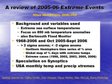
A review of 2005-06 Extreme Events
Klaus Weickmann, ESRL/PSD
- Background and variables used
- Extreme sea surface temperatures
- Focus on 850 mb temperature anomalies
- also Dartmouth Flood Monitor
- 1968-2006 and Oct 2005-Sept 2006
- gt 2 sigma anoms lt -2 sigma anoms
- Northern Hemisphere time series of area
- Global map of days with extreme temps
- Extreme cases (1998, 2002, 2003, 2005, 2006)
- Speculation on Synoptics
- USA monthly temp and precip xtremes
Special thanks to Cathy Smith, Don Hooper, Klaus
Wolter, Alex McColl, Barry McInnes
2
May-Sep 1998, 2002, 2003, 2005, 2006 composites
on right
SSTA
H
H
L
L
L
H
H
200uv
OLRA
3
Temperature 850 hPa
Annual mean standard deviation 1968-2006
Annual mean 1968-2006
Note full seasonal cycle of standard deviation
used in analysis that follows
4
98
850 temperature Oct 68 Sep 06 91-day running
mean
06
03
05
lt -2 s
02
gt 2 s
area 20-90N
Jan 77
Pinatubo
82-83
Mean 2.46 2.06
5
Oct 1968 to Sep 2006
days gt 2 s
Shading 2-4, 4-6, gt6
days lt -2 s
orography not blocked out
6
11 Sep
850 temperature Oct 05 Sep 06 daily plus
91-day running mean
15-16 Aug
lt -2 s
gt 2 s
21 Jul 8.7
area 20-90N
11 Jul 2
7
3.5C!
Oct 1968 to Sep 2006
850 mb temperature anomalies (degrees
C) Shading 0.5-1.0, 1.0-2.0, 2.0-3.0
850 mb temperature normalized anomalies Shading 0
.5-1.0, 1.0-1.5
8
Oct 2005 to Sep 2006
days gt 2 s
Shading 5-10, 10-15, gt15
days lt -2 s
orography not blocked out
9
98
850 temperature Oct 68 Sep 06 91-day running
mean
06
03
05
lt -2 s
02
gt 2 s
area 20-90N
Jan 77
Pinatubo
82-83
Mean 2.46 2.06
10
Percent of days out of 91 with 850 hPa
normalized temperature anomalies greater than 2
sigma Shading levels 8-16, 16-32, 32-48, gt48
Jun 13 Sep 11, 1998
May 20 Aug 18, 2002
Jul 14 Oct 3, 2005
Aug 3 Nov 3, 2003
Jul 12 Oct 10, 2006
11
Daily dates with maxima in area gt 2 sigma
during Jul 12 Oct 10 2006
USA west coast heat wave
12
(No Transcript)
13
(No Transcript)
14
(No Transcript)
15
(No Transcript)
16
Speculation on Synoptics Two areas of tropical
forcing due to extreme SSTs in warm pool
region MJO-like behavior faster time scale and
consolidation of anomalies, esp.
summer/fall? Leads to more transient
split flows with stronger westerly winds in
tropics subtropics Favors extreme ridging
events and subtropical jets spiraling into
mid-latitudes Reflecting increased heat
transport due warm tropical SSTs?
17
Summary and Conclusions
- Expanded gt 29C SSTs in warm pool region,
especially since July 2001 - 2005-06 continues recent string of extreme
temperatures during summer/fall, and more general
trend of increasing warm extremes - gt 2 sigma more often, over larger area and
especially at warm time of year - Synoptic discussion of Nov-Dec 2005 (USA west
coast precip), April 2006 (CA precip) and June
2006 (USA east coast precip) extreme events _at_
http//www.cdc.noaa.gov/MJO/Forecasts/climate_disc
ussions.html
18
(No Transcript)
19
Possible impact of assimilation model errors on
results?


