
GPS-Derived Orthometric Heights - PowerPoint PPT Presentation
Title:
GPS-Derived Orthometric Heights
Description:
GPSDerived Orthometric Heights – PowerPoint PPT presentation
Number of Views:105
Avg rating:3.0/5.0
Title: GPS-Derived Orthometric Heights
1
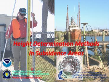
Height Determination Methods In Subsidence Areas
- NATIONAL OCEANIC AND ATMOSPHERIC ADMINISTRATION
- National Geodetic Survey
2
- Subsidence
- Areas
- Questionable
- Elevation Data
3
Hurricane Ike - 2008
4
No Reference Marks!
5
(No Transcript)
6
- DIFFERENCE OF 3.1 FEET !!
7
(No Transcript)
8
(No Transcript)
9
(No Transcript)
10
(No Transcript)
11
Difference of 0.9 meter (2.95 feet) !
12
DSWorld in Google Earth
13
GPS Derived Heights Planning And Evaluating a GPS
Vertical Survey
- NATIONAL OCEANIC AND ATMOSPHERIC ADMINISTRATION
- National Geodetic Survey
14
Topics To Be Discussed
- Review of heights and accuracies
- A Guide for Establishing GPS-derived Orthometric
Heights - Sample project following NGS guidelines
- Discussion on base line processing and analysis
of repeat base line results - Discussion of adjustment procedures and analysis
of results - NGS web site and services
15
Ellipsoid, Geoid, and Orthometric Heights
16
GPS - Derived Ellipsoid Heights
17
GEOID2009 (BETA)
GEOID2003
For the conterminous United States (CONUS),
GEOID2003 heights range from a low of -52
meters (magenta) in the Atlantic Ocean to a high
of -5 meters (red) in northwest Wyoming.
18
Expected Accuracies
- GPS-Derived Ellipsoid Heights
- 2 centimeters (following the guidelines)
- Geoid Heights (GEOID99)
- 2.5 cm correlated error (randomizing at 40 km)
- Relative differences typically less than 1 cm in
10 km - 4.6 cm RMS about the mean
- Leveling-Derived Heights
- Less than 1 cm in 10 km for third-order leveling
19
Recommendations to Guidelines Based on Tests and
Sample Projects
- Must repeat base lines
- Different days
- Different times of day
- Detect, remove, reduce effects due to multipath
and having almost the same satellite geometry - Must FIX integers
- Base lines must have low RMS values, i.e., lt 1.5
cm
20
Available On-Line at the NGS Web
Site www.ngs.noaa.gov
21
Table 1. -- Summary of Guidelines
22
Sample Project Showing Connections
CS2
CS1
LN4
LN3
LN1
LN2
PB2
PB1
SB2
LN5
SB1
LN7
LN6
SB3
SB5
SB4
PB4
PB3
CS3
CS4
23
A Guide for Establishing GPS-Derived
Orthometric Heights (Standards 2 cm and 5 cm)
24
A Guide for Establishing GPS-Derived Orthometric
Heights(Standards 2 cm and 5 cm)
3-4-5 System
- Three Basic Rules
- Four Basic Control Requirements
- Five Basic Procedures
25
Three Basic Rules
- Rule 1
- Follow NGS guidelines for establishing
GPS-derived ellipsoid heights (Standards 2 cm
and 5 cm) - Rule 2
- Use latest National Geoid Model, i.e., GEOID99
- Rule 3
- Use latest National Vertical Datum, i.e., NAVD 88
26
Four Basic Control Requirements
- BCR-1 Occupy stations with known NAVD 88
orthometric heights - Stations should be evenly distributed throughout
project - BCR-2 Project areas less than 20 km on a side,
surround project with NAVD 88 bench marks - i.e., minimum number of stations is four one in
each corner of project - BCR-3 Project areas greater than 20 km on a
side, keep distances between GPS-occupied NAVD 88
bench marks to less than 20 km - BCR-4 Projects located in mountainous regions,
occupy bench marks at base and summit of
mountains, even if distance is less than 20 km
27
BCR Example
BCR1 Sketch indicates that the 20 km rule was
met.
BCR2 This requirement is not applicable because
the project is greater than 20 km on a side.
BCR3 Circled bench marks are mandatory.
Analysis must indicate bench marks have
valid NAVD 88 heights. Other BMs can be
substituted but user must adhere to 20 km
requirement.
BCR4 This requirement is not applicable because
project is not in a mountainous region.
28
Five Basic Procedures
- BP-1 Perform 3-D minimum-constraint least
squares adjustment of GPS survey project - Constrain 1 latitude, 1 longitude, 1 orthometric
height - BP-2 Analyze adjustment results from BP-1
- Detect and remove all data outliers
29
BP2 After performing minimum constraint
adjustment, plot ellipsoid height residuals (or
dU residuals) and investigate all residuals
greater than 2 cm.
30
BP2 Station pairs with large residuals, i.e.,
greater than 2.5 cm, also have large repeat base
line differences. NGS guidelines for estimating
GPS-derived ellipsoid heights require user to
re-observe these base lines. Following NGS
guidelines provides enough redundancy for
adjustment process to detect outliers and apply
residual on appropriate observation, i.e., the
bad vector.
31
Five Basic Procedures(continued)
- BP-3 Compute differences between GPS-derived
orthometric heights from minimum-constraint
adjustment in BP-2 and published NAVD88 BMs
32
BP3 All height differences are under 5 cm and
most are less than 2 cm. Almost all relative
height differences between adjacent station pairs
are less than 2 cm. However, most of the height
differences appear to be positive relative to the
southwest corner of the project.
33
Five Basic Procedures(continued)
- BP-4 Determine which BMs have valid NAVD88
height values from results from BP-3 - Differences need to agree 2 cm for 2 cm survey
- Differences need to agree 5 cm for 5 cm survey
- May detect systematic tilt over large areas
- Solve for geoidal slope and scale
- BP-5 Perform constrained adjustment with results
from BP-4 - Constrain 1 latitude, 1 longitude, all valid
orthometric height values - Ensure final heights not distorted in adjustment
34
BP4 To detect and remove any systematic trend, a
tilted plane is best fit to the height
differences (Vincenty 1987, Zilkoski and Hothem
1989). After a trend has been removed, all the
differences are less than /- 2 cm except for one
and almost all relative differences between
adjacent station are less than 2 cm.
35
BP5 After rejecting the largest height
difference (-2.4 cm), of all the closely spaced
station pairs only 3 are greater than 2 cm, 1 is
greater than 2.5 cm and none are greater than 3
cm.
36
GPS-Derived Orthometric Heights
- Recent Articles in ACSM SALIS Vol. 58, No.1
(March 1998) and SALIS Vol. 58, No. 2 (June
1998) - Accuracy of GPS-derived Orthometric Heights in
San Diego County, California by Wesley Parks - An Evaluation of GPS-derived Orthometric Heights
for First-Order Horizontal Control Surveys by
Daniel J. Martin - Baltimore County, Maryland, NAVD 88 GPS-Derived
Orthometric Height Project by William E. Henning,
Edward E. Carlson, and David B. Zilkoski - NAVD88 GPS-derived Orthometric Heights, Parts 1
to 4 - by David B. Zilkoski, P.O.B. Magazine, Mar.
to Sept. 2001
37
- Data Processing and Analysis
- of Repeat Base Line Results
38
Vector Processing Controls
- Elevation Mask - 15 degrees
- Ephemeris - Precise
- Tropospheric Correction Model
- Iono Corrections - All baselines longer than 5
km. - Fix Integers
- Baselines less than 5 km L1 fixed solution
- Baselines greater than 5 km Iono free (L3)
solution - Looking for RMS - Less than 1.5 cm
39
Analysis of the Data Processing
- Fixed solutions / low RMS
- Repeatability of measurements
- Analysis of loop misclosures
- Be aware that repeatability and loop misclosures
do not disclose all problems
40
Repeat Vector Analysis
From To Session dh Diff
Dist RMS Solution
Station Station
Meters cm Meters Type BR13
BR14 0780-0780 45.974 1628
0.016 L1 float double
0770-0770 46.004 -3.0 0.017 L1
fixed double 0761-0762
46.009 -3.5 0.015 L1 fixed double
BR13 K251 0780-0780 -12.397
673 0.006 L1 fixed double
0770-0770 -12.400 0.3 0.006 L1
fixed double 0762-0761
-12.408 1.1 0.006 L1 fixed double
BR14 GR15 0780-0780 43.680
1133 0.022 L1 fixed double
0770-0770 43.654 2.6 0.024 L1
fixed double 0762-0765
43.607 7.3 0.020 L1 fixed double
BR19 CL20 0781-0781 54.703
365 0.047 L1 fixed double
0771-0771 55.031 -32.8 0.022 L1
fixed double 0762-0763
55.007 -30.4 0.019 L1 fixed double
BR20 BR30 0782-0782 28.939
9850 0.014 Iono free fixed
0772-0772 28.947 -0.8 0.014 Iono
free fixed 0760-0763 28.940
-0.1 0.020 Iono free fixed BR20
VINT HILL 0782-0782 33.045 11967
0.011 Iono free fixed
0772-0772 33.051 -0.6 0.009 Iono
free fixed 0760-0763 33.063
-1.8 0.013 Iono free fixed NOTE -
Reprocess all vectors which have difference
greater than 2 cm.
41
Repeat Vector Analysis After Re-Processing
From To Session dh Diff
Dist RMS Solution
Station Station
Meters cm Meters Type BR13
BR14 0761-0762 46.009 1628
0.015 L1 fixed double
0770-0770 46.004 0.5 0.017 L1
fixed double 0780-0780
46.007 0.2 0.015 L1 fixed double
BR13 K251 0770-0770 -12.400
673 0.006 L1 fixed double
0780-0780 -12.397 -0.3 0.006 L1
fixed double 0762-0761
-12.408 0.8 0.006 L1 fixed double
BR14 GR15 0780-0780 43.680
1133 0.022 L1 fixed double
0765-0762 43.658 2.2 0.020 L1
fixed double 0770-0770
43.654 2.6 0.024 L1 fixed double
BR19 CL20 0771-0771 55.031
365 0.022 L1 fixed double
0781-0781 55.027 0.4 0.023 L1
fixed double 0762-0763
55.019 1.2 0.018 L1 fixed double
BR20 BR30 0782-0782 28.939
9850 0.014 Iono free fixed
0772-0772 28.947 -0.8 0.014 Iono
free fixed 0760-0763 28.940
-0.1 0.020 Iono free fixed BR20
VINT HILL 0782-0782 33.045 11967
0.011 Iono free fixed
0760-0763 33.063 -1.8 0.013 Iono
free fixed 0772-0772 33.051
-0.6 0.009 Iono free fixed
42
- Adjustment Procedures to Obtain
- GPS-Derived NAVD88
- Orthometric Heights
43
Adjustment of Primary Base Stations
3820N
CORS HARN NAVD88 BM New Station
D191
10CC
19.0km
Primary Base Station
28.7km
25.7km
LATITUDE
38.3km
31.6km
38.7km
25.8km
LAKE
MART
29.6km
MOLA
3750N
12235W
12140W
LONGITUDE
44
Adjustment ProceduresControl and Primary Base
Stations
- Horizontal Adjustment
- (Latitude, Longitude, Ellipsoid Heights)
- Minimum Constrained One fixed station
- Fix latitude, longitude and ellipsoid height at
one station - Resolve all blunders and large residuals
- Determine which published coordinates should be
fixed - Partially Constrained All suitable stations
fixed - Fix latitude, longitude, and ellipsoid heights at
suitable stations - Make sure the constraints did not distort the
project - NOTE - Geoid model NOT applied
45
Adjustment of Local Network Stations
CORS HARN NAVD88 BM New Station Spacing Station
3816N
Primary Base Station
LATITUDE
8.2km
3755N
12140W
12220W
LONGITUDE
46
Adjustment ProceduresLocal Network Stations
- Horizontal Adjustment
- (Latitude, Longitude, Ellipsoid Heights)
- Minimum Constrained One fixed station
- Fix latitude, longitude and ellipsoid height at
one station - Resolve all blunders and large residuals
- Determine which control and primary base station
coordinates should be fixed - Partially Constrained All suitable stations
fixed - Fix latitude, longitude, and ellipsoid heights at
suitable stations - Make sure the constraints did not distort the
project - NOTE - Geoid model NOT applied
47
Adjustment ProceduresCombined Network Horizontal
Adjustment
- Perform combined adjustment
- Control and primary base network along with local
network - Latitude, longitude, and ellipsoid height
- Use GEOID model to obtain geoid heights
- Make sure combined adjustment did not distort the
project
48
Adjustment ProceduresCombined Network Vertical
Adjustment
- 3-D Vertical Adjustment
- (Orthometric Heights)
- Minimum Constrained One fixed station
- Fix latitude, longitude, and orthometric height
at one station - Resolve all blunders and large residuals
- Determine which NAVD 88 bench marks should be
fixed - Partially Constrained All suitable orthometric
heights fixed - Fix latitude, longitude at one station
- Fix orthometric heights at all suitable stations
- Make sure the constraints did not distort the
project
49
Real World
50
Mapping World
51
GPS Site Calibration
- Four parameter coordinate transformations
- Perform scaling, translation, and rotation of
coordinate axes - Transformation from one system to another
- x? s cos?x s sin?y tx
- y? s sin?x s cos?y ty
- Where s is scale factor
- x and y are coordinates from original system
- x? and y? are coordinates of point in transformed
system - ? is rotation angle from original to transformed
system - tx and ty are components of translation from
original to transformed system
52
GPS Site Calibration
- GPS leveling by the two-plane method
- Provides reasonable accuracy over limited areas
- Assumes the ellipsoid and geoid as plane surfaces
- Relation of geoid with respect to ellipsoid
- (Hi hi) ?E(Ni No) ?N(Ei Eo) tZ
- (Hi hi) is vertical shift form ellipsoid to
geoid at point i - ?E and ?N are rotations about north and east
axes, respectively, of the geoid plane with
respect to the ellipsoid plane - No and Eo are approximate coordinates of centroid
of project area - Ni and Ei are plane coordinates about point i
- tZ is vertical shift at centroid
53
GPS Site Calibration
- Surround project with at least four stations
- Each with known ellipsoid and orthometric
- Bound project area, ideally in corners
- Rough terrain may require additional control
- Initialize and calibrate GPS on known control
- Calibration requirements are equipment specific
- Compute best fit model for project area
54
Existing GPS-Usable Stations
GABB
HARN2
HARN1
CORS HARN NAVD88 BM
HARN3
55
GPS-Usable and New Stations
GABB
HARN2
HARN1
CORS HARN NAVD88 BM Project Control (new)
HARN3
56
Project Control (Base) Stations
Project Control
57
Rapid Static Survey
BASE2
BASE1
Project Control (base station)
Stop and Go Point
58
Calibrated Real Time Survey
BASE1
Project Control (base station)
Stop and Go Calibration Point
Stop and Go Point
Continuous Point
59
(No Transcript)
60
Tidal Datums
- Heights Measured Above Local Mean Sea Level
- National Tidal Datum epoch 19 year series
- Encompasses all significant tidal periods
including 18.6 year period for regression of
Moons nodes - Averages out nearly all meteorological,
hydrological, and oceanographic variability - Leveling is used to determine relationship
between bench marks and tidal gauges
61
- Importance of Shoreline
- AL, AK, CA, CT, FL, GA, LA, MD, MS, NJ, NY, NC,
OR, RI, SC, WA and TX (post-1836)
- Territorial Seas
- Privately Owned
- Uplands
- State Owned
- Tidelands
- Contiguous Zone
- Exclusive Economic Zone
- State Submerged Lands
- Federal Submerged Lands
- High Seas
- 3 n. mi.
- 12 n. mi.
- MHHW
- 200 n. mi.
- MHW
- MLLW
- Chart Datum
- Privately
- Owned
- State
- Owned
- Privately
- Owned
- State
- Owned
- TX pre--1836
- DE, MA, ME, NH, PA, VA
62
Precise Digital Leveling
National Oceanic and Atmospheric
Administration National Geodetic Survey
63
(No Transcript)
64
(No Transcript)
65
(No Transcript)
66
(No Transcript)
67
(No Transcript)
68
- Rigid Leg Tripod
- With Thermister
- Equipment
69
- Single-Piece, Bar-Coded Invar, Calibrated Rod
with Brace Poles
70
- Leveling rods must be one piece.
- According to at least one manufacturer's
specifications, the electronic digital leveling
instrument should not be exposed to direct
sunlight. The manufacturer recommends using an
umbrella in bright sunlight.
71
Leveling Tips
- Always practice SAFETY FIRST!!!!
- Apparent Heat Waves reduce sight lengths
- Wind effects block wind with body place a
light hand on tripod leg - reduce sight lengths - Difficult to obtain standard deviation reduce
SL - Carry instrument upright between setups
- Check rods and instruments circular levels once
a week to ensure theyre in adjustment - Transfer elevation to instrument when foresight
is ready minimize settlement - Do not leave the instrument setup unattended
- Do not let thermistors or level get wet
72
Leveling Tips (continued)
- Cross pavement (roadway) at right angles to
minimize uneven sight conditions - Clearly focus level instrument before measurement
- Stabilize both turning points and tripod every
setup - Never read below 0.5 meters on rod
- Ensure upper stadia crosshair is not above Invar
when reading near the top of the rod - Maintain tight setup imbalances
- Dont point the instrument into the sun
- Orchestrate setups so instrument is not pointing
into low sun angle
73
Leveling Tips (continued)
- DO NOT DROP RODS!!
- Keep one hand on rod at all times
- Keep rod faces clean do not touch Invar
- Always protect base of rod keep off ground
- Never setup rod or instrument on asphalt
- Turn rod to change shadows if measurement fails
- Rod person calls out BM designation for check
- Start and end with the same rod on mark
- Backsight rod person does not move until
foresight has been recorded and observer directs
74
Leveling Tips (continued)
- Make sure base of rod is directly on the turning
point or BM not on centering guide - Be aware of your surroundings carrying rod
- Spacer must have a backsight and a foresight
- Do not forget to retrieve spacer after setup
- Double run all sections
- Plan reverse leveling during a different time of
day from the first level run - Place visible mark on rod to indicate 0.5 m
75
- FGCS Specifications and Procedures to Incorporate
Electronic Digital/Bar-Code Leveling Systems
- NGS analysis of the data will be the final
determination if the data meet the desired FGCS
order and class standards
- http//www.ngs.noaa.gov/FGCS/tech_pub/Fgcsvert.v41
.specs.pdf
Recommended
CrystalGraphics Presentations


