Brownfields Mapping Application Overview - PowerPoint PPT Presentation
1 / 24
Title:
Brownfields Mapping Application Overview
Description:
Maps available to the public online. vary effective data sharing tool. easily learned ... Allows users to zoom in, out, pan, query, identify, print maps, etc. ... – PowerPoint PPT presentation
Number of Views:53
Avg rating:3.0/5.0
Title: Brownfields Mapping Application Overview
1
Brownfields Mapping ApplicationOverview
City of Atlanta Bureau of Planning Mactec
Engineering EPA US Army Corps of Engineers
Contact Michele McIntosh-Ross, Senior Urban
PlannerCity of Atlanta, Bureau of
Planning404-330-6786 mmcintosh_at_atlantaga.gov
2
Overview
- City of Atlanta Brownfield Program
- GIS mapping application for sharing brownfield
information - BeltLine
3
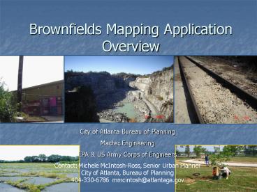
What is a Brownfield
- abandoned, idled and underutilized - usually
industrial and commercial facilities where their
reuse and/or redevelopment is burdened by real or
perceived environmental contamination. - Areas where there are brownfields pose a threat
to the community in terms of safety, health and
future prosperity. - These sites represent economically unproductive
real estate that produces negative returns since
the presence of these sites leads to
disinvestment throughout the community. - Brownfield sites are especially difficult to
redevelop into a productive use because of the
risk of environmental contamination, the extra
cost of corrective action (clean-up or caps) and
legal ramifications that can arise.
4
What is the City of Atlantas Brownfield Program?
- The City of Atlanta Sustainable Brownfields
Redevelopment Program is a program administered
through the Bureau of Planning Garnett Brown
and Michele McIntosh-Ross - Started in the 1990s and evolved
- Seeks grants from various funding sources
including EPA - The current project is an EPA funded project to
identify/assess and produce a geographic database
of brownfield sites citywide. - This will allow the city to leverage its efforts
by creating the incentive for future
redevelopment - The Program is ongoing we will continue to seek
funding for various initiatives with regards to
brownfield redevelopment within the City
5
A geographic database of brownfield sites
citywide.
- Geographic database (spatial datasets) list of
sites tied to location information which can be
presented on a map - GIS Geographic Information Systems is what is
used to create and present the geographic
database - A list of brownfield sites and their locations
that can be easily mapped is invaluable - Foundation for redevelopment programs
- Increased accessibility to potential developers
community residents - Community awareness
6
GIS Application Background
- Agencies such as USGS, ADEM, EPA, Regional
Planning of Greater Birmingham, and USACE worked
jointly to create a system that would organize
and distribute spatial datasets (geographic
database) related to the current Brownfields
project. - The model that was created (web-based GIS) and
successfully implemented in the greater
Birmingham as was tweeked and used for the City
of Atlanta - May, 2007 the USACE worked at City Hall with our
Planning/GIS and IT departments to implement the
system - Data entry and testing are ongoing
7
GIS Application Overview Web-Based Brownfields
GIS
- Maps available to the public online
- vary effective data sharing tool
- easily learned
- widely accessible
- can be used by all stakeholder groups to collect
and compare a wide range of data and
redevelopment options - Users can see the location of a brownfield on a
map alongside other data such as transportation
networks, central business districts, residential
developments, demographic and economic data
- Online Mapping Interface
- No Software Required! Just an Internet
Connection. - Allows users to zoom in, out, pan, query,
identify, print maps, etc. - The management of the project is also web-based
- Authorized users can edit records, upload new
sites online - Only one database exists. Data updates and
uploaded documents are in real-time making all
new entries immediately available to users.
8
How is this application used?
- Utilizes a range of spatial and attribute data,
both historic and current to display and show
comparisons - Sharing of data
- Tracking and inventorying Brownfields
- Promoting revitalized sites to potential
businesses - Mapping and site location
- Site review
- Environmental review
- To manage a multi-phased, multi-stakeholder
redevelopment project
9
Brownfields Demo
Online Application
10
Renew Atlanta Land Revitalization and Reuse
Database
11
Renew Atlanta Land Revitalization and Reuse
Database
12
(No Transcript)
13
Renew Atlanta Land Revitalization and Reuse
Database
14
Renew Atlanta Land Revitalization and Reuse
Database
Authorized users can supply the necessary
credentials to receive write access to the
database.
15
Printer Friendly results.
16
Renew Atlanta Land Revitalization and Reuse
Database
A Printer Friendly Page option provides the
record information in the same format as the EPA
Property Profile Form.
17
Renew Atlanta Land Revitalization and Reuse
Database
18
Renew Atlanta Land Revitalization and Reuse
Database
19
TheBeltLine
20
Land UseRedevelopmentRecommendations
21
Brownfields
Per Phase I Assessments
22
(No Transcript)
23
Atlanta Sustainable Brownfield Redevelopment
Project - database
- This database promotes the concept of a single
point of data entry and data access through a
centralized database - User-friendly interface empowers individuals to
populate and update the database - The mapping interface provides a spatial
references for property locations and analysis.
24
- City of Atlanta Brownfield web page
- http//www.atlantaga.gov/government/planning/brown
fields.aspx - Link to live map due fall 2007
- USACE map room website
- http//rsm.sam.usace.army.mil/maproom/index.asp?cu
stomerOPJ - Available now
Contact Garnett Brown 404-330-6724
gbrown_at_atlantaga.govMichele McIntosh-Ross
404-330-6786 mmcintosh_at_atlantaga.gov


