
GPS Global Positioning System - PowerPoint PPT Presentation
1 / 39
Title:
GPS Global Positioning System
Description:
Satellites use atomic clocks (0.000000003 seconds) Receiver's clock corrected by satellites ... Satellite Atomic Clock Errors (corrected periodically) ... – PowerPoint PPT presentation
Number of Views:234
Avg rating:3.0/5.0
Title: GPS Global Positioning System
1
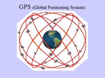
GPS (Global Positioning System)
2
Basic Concept
- 28 Satellites orbiting the earth /- 11,000
miles up - (6 Paths, sun-synchronous, each satellite
orbits earth 2x/day) - Receivers communicate with Satellites
- Communication (signal delay) determines
distance - Distance from multiple satellites determines
location
- Requires very precise clocks
- Satellites use atomic clocks (0.000000003
seconds) - Receivers clock corrected by satellites
- More satellites, widely spaced provides better
results - Longer duration of data capture provides better
results
3
Accuracy (Potential)
Horizontal location, in meters
/- RT-DGPS DGPS
Recreational/Pocket Unit 100-500 Mapping
Grade (GeoExp 3) 4,500Surveyor Grade
11-50,000 w/external add-on Radio Beacon
unit w/10 minutes of data Post-Processing 0.
3 with 30 minutes of data 0.1 with 45
minutes of data 0.01 (centimeter accuracy)
with 48 hours of data 0.001 (millimeter
accuracy?)
5-20 100-500
5-20
2-5 2-5 1 0.5
5-20
(Vertical Accuracy typically half as good as
horizontal)
5 m 11,000 miles 1 mm 2.2 miles (the
Empire State Building ¼ mile)
4
What you get for your
- waterproof - backlight display - battery life -
screen size - split screen zoom - more memory - storage of points, tracks, areas,
offsets - store/load maps/charts - streets, hydro
- accessories remote antenna options, RT-DGPS,
PALM and Laptop connection, Laser Range Finder - download data to PC
- ability to perform RT-DGPS
- ability to post process (DGPS)
- ability to enter attribute data (features), as
well as to append to existing data files - vehicle navigation
- electronic compass
- barometric altimeter (more accurate than GPS for
altitude, if calibrated) - WAAS compatible
- velocity
- vertical profiles of tracks
- alarms (anchor drift, arrival, off-course)
- fish locators, tide charts, calendars, celestial
information
5
Applications
- Military (DoD) civilian uses now exceed
military - Space Travel (NASA)
- Agriculture
- Resource and Asset Management
- Environmental Forestry
- Mining Engineering
- Oil Gas
- Construction
- Factory Automation
- Fishing (Recreational Commercial)
- Mapping GIS
- Survey
- Public Safety Emergency Management Crime
Prevention - Utilities
- Timing Synchronization (banking,
telecommunications) - LBS - Location Based Services (cell phones,
wireless web) - Transportation FAA (WAAS), Marine, Rail
- Vehicle Security (Fleet Management)
6
Other Applications
- Cell Phones (E911, October 2001)
- On Board Vehicle Navigation Systems
- Vehicle Tracking Systems (beyond fleet
management) - - Rental Car Companies
- - Family/Friends vehicle location
- - Crime Stolen cars Criminal tracking
- - Accident notification systems
- - GPS-measured Tolls variable taxation
based on congestion (UK) - Child/Senior/Pet Safety Tracking Systems
- - Teddy Bears, Backpacks, Wristwatches
- - Implants (health status w/location)
- Parole, Probation Tacking Systems
- Package/Assesst Tracking Systems
- Bridge stuctural monitoring
- Sports and Broadcasting (Skiers, NASCAR,
Sailboat races) - Golf Courses (distance to next hole)
- Geo-Caching (GPS scavenger/treasure hunts
global or local scale) - Beer Bottle GPS
- etc, etc,
7
Orbits
8
XYZT
9
2D-Satellites
X?
10
2D-3 Satellites
11
Poor GDOP
12
Good GDOP
13
Good-Bad GDOP
14
PDOP vs. GDOP
PDOP Position Dilution of Precision User
tolerance setting for acceptability of signal
quality (a PDOP mask) Typically set from
4 6 ( 8 poor)
GDOP Geometric Dilution of Precision Estimate
of satellite conditions for a given location
time Given in distance units (meters or feet)
PDOP GDOP Overall estimate of accuracy (PDOP
of 4) (GDOP of 30) (Accuracy of /- 120)
PDOP - GDOP often used interchangeably Also
HDOP, VDOP, TDOP, RDOP (horizontal,vertical,
time, relative) In all cases, smaller is better
15
GPS Masks PDOP, Elevation, SNR
Allow the user to control the quality of the data
accepted at the time of data collection
(unacceptable readings are filtered out)
PDOP Mask Allows the recording of positions only
when there is acceptable satellite geometry.
Typically considers both quantity and quality of
satellites (e.g., 4 satellites with good
precision, or 6 with reasonable precision, or 8
with average precision)
Elevation Mask Sets minimum elevation above
horizon for satellites to be used. The lower on
the horizon a satellite is the more atmosphere
the signal must pass through, thus the greater
the potential for signal diffraction
(inaccurate estimations of time/distance), as
well as greater chance of multi-path
errors. Also, with Differential Correction,
insures that all satellites used are visible to
base station as well as the field receiver.
SNR (Signal to Noise Ratio) Mask (higher is
better, stronger signal) Filters out signals
with excessive noise, using only those
satellites with low noise (more accurate). SNR
ranges from 0-35 10-15 is typical, less than 5
is generally considered unusable.
16
Sources of Error
Typical amount of Error (per Satellite)
Beyond quality of equipment/size of antennea, etc.
1.5 m 2.5 m 5.0 m 0.5 m 0.3 m 0.6 m
- Satellite Atomic Clock Errors
- (corrected periodically)
- Satellite Orbit (Position) Errors
- (corrected periodically)
- Earths ionosphere (charged particles)
- Earths troposphere (moisture)
- Receiver Noise (local conditions, radio
interference) - Multipath Errors (bounce off buildings, etc.)
- Local Weather (moisture in air, lightning)
- Poor Satellite Geometry (GDOP)
- Receiver Clock Errors (corrected by 4th
Satellites)
17
Selective Availability (SA)
Intentional degradation of signal quality by DoD
for security reasons. Spawned numerous
work-around technologies Turned off in May,
2001, recognizing civilian need for better
quality GPS signal (while reserving the option to
reinstate it should the need arise)
18
Differential Correction
Compare GPS data file from Rover file (handheld
unit) with a data file from a Base Station (at a
known coordinate) for the exact same time period.
Relies on the fact that receivers located
relatively close together, will record similar
errors from the same constellation of
satellites. Uses the apparent error of the base
station file to correct the corresponding error
of the Rover file.
19
Differential Correction 2
20
Differential Correction
- Can improve accuracy by up to 20 m. (50-90)
- Requires local Base Station (w/in 100 miles)
- Requires post-processing (back in the lab)
OR can be done on-the-fly using
Real-Time DGPS
- Need better data longer recording period,
better GDOP
- More Base Stations near coasts (navigation)
- No effect on multi-path and/or receiver errors
But were not going to do that
21
Data Dictionaries
Created with Pathfinder Office (in the lab) and
transferred to the GeoExplorer 3 before using in
the field. Allows creation of custom fields
(attributes) and field values (defined lists of
possible attribute values) for feature collection.
So, for a database of TREES, you might create a
data dictionary with Species List (fir, pine,
alder, etc) Type List (Either Deciduous or
Conifer) DBH Number field (Enter size in
inches) Date Auto-generated date field
(day-month-year)
Or, for a database of STREETS, you might create a
data dictionary with Name Text field (Enter
Street Name) Type List (Ave, St., Way, Place,
Circle, etc) Type List (Arterial, Residential,
Highway, Private Surface List (Paved, Gravel,
Dirt) Lanes Number field (Enter number of
Lanes) Bike Yes/No (as to existence of Bike
Lanes)
But were not going to do that either
22
Other Navigation Systems
GLONASS (GLObal NAvigation Satellite System)
Russian 10 satellites
Galileo (European Union GPS) Civilian based
initiative (2006? 2008?)
WAAS (Wide Area Augmentation System) FAA
(2003?) 3 m., North America, near airports
NDGPS (Nationwide Differential GPS) DOT,
Railroad (2002?)
Loran-C (LOng RAnge Navigation) - Coast Guard,
Radio navigation, 50 m, North America Russia,
Europe
Etc.
Many now used in combination w/GPS (augmented
systems)
Auto Navigation GPS GIS Inertial Sensors
(Dead Reckoning)
23
The Future
Augmented systems (using WAAS, Galileo, etc)
Incorporation with other technologies (Cell
phones, PDAs, Cars) Components the size of a
credit card, available for under 10.00
Dual (or Tri) Frequency GPS receivers Track L1
and L2 ( L5?) satellite signals for greater
accuracy. (GeoExplorer 3 is single frequency)
Enhanced GPS Ability to use low-quality
satellite data (typically filtered out by
masks) for estimating positions under canopy,
inside buildings/cars, etc.
LBS (Location Based Services) advertising, via
cell phone, mobile ads (busses, taxis), service
location/lookup, etc.
Transponders tracking and finding your
pet/child/car/package.
Additional Satellites, Ground support
(augmentation)
24
(end of show)
fini
25
GeoExplorer 3
26
Sys-Data-Nav Buttons
TAB
Function
- View information about the satellites that the
GeoExplorer 3 is tracking and their relative
positions in the sky. See your current position. - View information about the GeoExplorer 3
hardware, accessories and external connections. - Create and edit data dictionaries and feature
settings. Edit configuration. Reset factory
defaults.
GPS
Status
SYS
Setup
File
- Create a new data file or open an existing one.
- Collect new features and attributes.
- Update features and attributes
- View features and select them for update.
New Update Map
Data
Road
- Navigate to features and waypoints using the
Road. - Navigate to features and waypoints using the
Compass. - Navigate to features and waypoints using the
Chart.
Nav
Compass
Chart
27
Sys Button Screens
28
Sys-GPS (Skyplot) Screen
29
Sys-Status Screen
30
Sys-Setup Screen
31
Data-File Screen
32
Data-File Screen
33
Data-Map Screen
34
The Keyboard
35
GeoExplorer 3 Notes
Rover Files Contain Feature(s) collected in the
field Automatically generated R101810A.ssf R
10 18 15 A . ssf Rover, October 18th, 10
am, A file Greenwich Mean Time (note that GMT
is 7 or 8 hours later than the west coast of the
USA depending on Daylight Savings 7 in the
summer, 8 in the winter) A First rover file
for that hour (B 2nd rover file, etc) .ssf
Trimble Rover file extension
Features Points Lines Areas (polygons) Can
have multiple features (points, lines or areas)
within a single Rover file. Can be paused while
recording positions. Can be updated at later.
36
(end of show2)
fini
37
GeoExplorer 3
10 hours of battery life 10 MB of data storage
38
GPS Ellipsoid - Datum
GPS uses the WGS84 (World Geodetic System of
1984) as mathematical surface (model) of the earth
WGS84 is for all practical purposes the same as
the Geodetic Reference System of 1980 (GRS80)
that was used for the North American Datum of
1983 (NAD83) horizontal datum.
Elevations are referenced to Height Above
Ellipsoid (HAE)
39
Code vs. Carrier Phase
Standard GPS uses Code phase comparing
pseudo-random code to determine distance
(amount of time out of sync between satellites
code and receivers code distance satellites
code had to travel)
Carrier phase uses the Code phase to get close,
then uses the actual carrier frequency wave
pattern (that which carries the pseudo-random
code) to increase the precision.
For post-processing (Differential Correction), we
want to use Carrier phase recordings to get the
best results. Carrier phase also stores
information from each satellite individually,
allowing later comparison of the base stations
readings (error estimation) for each separate
satellite recorded. Consequently, Carrier phase
recordings use far more memory for storage than
Code phase does.
Recommended
CrystalGraphics Presentations


