
The Global Positioning System - PowerPoint PPT Presentation
1 / 26
Title:
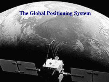
The Global Positioning System
Description:
Differential GPS ... on SLR, VLBI and GPS. Allows for plate tectonics ... Invert GPS offsets (using Volterra's formula) to get fault parameters, geometry ... – PowerPoint PPT presentation
Number of Views:188
Avg rating:3.0/5.0
Title: The Global Positioning System
1
The Global Positioning System
2
Introduction
- GPS constellation
- GPS signal
- Basic position calculations
- Sources of error
- GPS Processing
- Applications
3
The GPS Satellite Constellation
- 24 satellites
- 11 hour, 58 min orbital period
- 20,000 km (12,000 miles) altitude
4
The GPS Signal
Navigation Message
- Broadcast ephemeris
- Clock corrections
- Satellite health
- Almanac data
- Ionospheric Information
5
The GPS Signal, continued ...
Pseudorandom Code
- XOR binary function
- C/A code repeats every 1ms, chip length 293m
- P code repeats every 267 days, chip length 29.3m
6
Measuring Position
Need 4 measurements x, y, z, receiver clock
offset
7
The GPS Signal, continued ...
- Carrier wave
- L1 154x10.23MHz (wavelength 19.0cm)
- L2 120x10.23MHZ (wavelength 24.4cm)
8
GPS Error
9
GPS Error
- Atmospheric Noise
- Ionosphere important for single frequency
receivers delay of 0.1m at night, 100m during
the day. - Troposphere dry delay is 1.9 to 2.3m at
zenith, wet delay is 0 to 20cm. Total effect
can reach 20m at horizon.
10
GPS Error, continued
Orbit Error
11
GPS Error, continued
Multipath
- Similar at same time every day.
- Reduce effects with a specially designed antenna
12
GPS Error, continued
Periodic Signals
- Precession and nutation
- Length of day
- Polar motion
- Solid earth tides
- Atmospheric pressure
- Oceanic pressure
- Monument instability
- Isostacy
- Plate tectonics
13
Differential GPS
Single difference reduce satellite clock errors
(and also orbit errors, local atmospheric errors,
periodic signals).
14
Differential GPS, continued
Double difference reduce satellite clock, orbit,
local atmospheric, periodic signal and receiver
clock errors.
15
Precise Point Positioning
- Use precise orbits and clock estimates in least
squares adjustment for position, instead of
treating them as nuisance parameters to be
removed. - Reduce CPU time.
- Can analyze stations individually.
- International GPS Service for Geodynamics
- Precise orbits (fiducial/non-fiducial)
- Precise clock corrections
- Monitors ITRF stations.
- The International Terrestrial Reference Frame
- Based on SLR, VLBI and GPS
- Allows for plate tectonics (aligned to NUVEL-1A)
16
GPS Processing
- GPSurvey (Trimble)
- Double differencing
- Windows
- GAMIT (MIT, Scripps, Harvard)
- Double differencing
- UNIX
- GIPSY-OASIS II (JPL)
- Precise Point Positioning
- Estimates clocks no double differencing
- Simultaneously processes pseudorange and carrier
phase. - UNIX
17
Accuracy and precision.
- DOP use to adjust error estimates according to
geometry of satellites used. - RMS square all the values, take the mean of the
squares, square root the mean of the squares. - Standard deviation rms of differences between
all the measurements - Standard Error / Formal Error rms of
differences between the possible values of a
measurement and its expected value - Repeatability / Precision - weighted (uses SE for
each value) rms scatter about the mean of daily
estimates or about a best fit line - Confidence levels 681s, 952s, 99.73s
(normal dist)
18
Volcano Deformation
- Remote, rapid, safe
- Combination with InSAR
Glacial Isostacy and Sea Level Change
- Measure vertical movement of tide gauges.
- Measure ice mass changes.
- Measure uplift in areas of postglacial rebound.
19
Coseismic Deformation
- Invert GPS offsets (using Volterras formula) to
get fault parameters, geometry of earthquake
rupture. - Using calculated fault geometry, invert for slip
distribution. - Combine GPS and InSAR
Postseismic Deformation
- Decaying transient times
- Mantle viscosity
20
Interseismic Deformation
PANGA BARD BARGEN SCIGN EBRY
21
Interseismic Deformation, continued
From Western US Cordillera project
22
Plate Motions
23
References http//www.scign.org/ http//www.gpswo
rld.com/ http//www.colorado.edu/geography/gcraft/
notes/gps/gps_f.html http//www.trimble.com/gps/ h
ttp//cfa-www.harvard.edu/space_geodesy/WUSC/ Teun
issen, P.J.G and Kleusberg, A. (1998) GPS for
Geodesy
24
(No Transcript)
25
GPS Processing, continued
- Retrive GPS data (RINEX file) and precise
ephemerides. - Clean data for cycle slips and outliers.
- Model physical effects (e.g. earthtides,
satellite clocks, atmosphere) and form
ionosphere-free data. - Compute observation equations.
- Solve for station coordinates, using non-fiducial
orbits. - Transform station coordinates to ITRF.
- Repeat every day for several years.
- Plot station coordinates as a graph with respect
to time. - Estimate velocity of each station.
- Calculate baseline velocities relative to
stable stations.
26
GPS Receivers
Single Handheld pseudorange approx 10m
Differential pseudorange 0.5m to 5m
Differential carrier phase
Continuous carrier phase
Recommended
CrystalGraphics Presentations


