Forest Inventory Sampling Grids - PowerPoint PPT Presentation
1 / 14
Title:
Forest Inventory Sampling Grids
Description:
Mouse over Sampling Tools from the Hawth's Tools drop-down menu ... Open DNR Garmin Software. Select: GPS Set Port Port 5 (Port 1 when not using USB adaptor) ... – PowerPoint PPT presentation
Number of Views:192
Avg rating:3.0/5.0
Title: Forest Inventory Sampling Grids
1
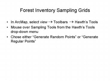
Forest Inventory Sampling Grids
- In ArcMap, select view Toolbars
Hawths Tools - Mouse over Sampling Tools from the Hawths Tools
drop-down menu - Chose either Generate Random Points or
Generate Regular Points
2
Generating Random Points
- Select a layer from the dropdown menu
- A polygon layer such as a tract or property
boundary that you wish to sample - Check Prevent points from occurring in the
polygons of this layer and select layers from
the drop down menu if neccessary
3
Generating Random Points
- If desired, check Enforce minimum distance
between points and enter desired distance - Distance is in same units as the selected layers
projection - Ex. State Plane Coordinate System, NAD83,
Kentucky Single Zone (U.S. Survey Foot)
projection distance is in feet
4
Generating Random Points
- Select type of sampling design and enter the
number of random points desired - For Stratified sampling designs you must select
a Polygon unique ID field - Not necessary for Unstratified sampling design
- Select the folder icon to name and save the
shapefile in your desired location. - Press OK
5
Generating Random Points
6
Generating Regular Points
- Select Extent Same as this layer and select the
desired layer from the pull down menu - Enter the desired Point spacing
- Spacing is in the same units as the layer
projection - Select Alignment of alternating rows using the
toggle buttons - Name and save the new Shapefile using folder icon
- Press OK
7
Generating Regular Points
8
Clipping Points to a Layer
- Select the red toolbox icon to open the
ArcToolbox window - Select Analysis Tools Extract Clip
- Select the points layer you wish to clip from the
Input Features drop down menu - Select the boundary layer from the Clip
Features drop down menu - Enter name and save location under Output
Feature Class - Press OK
9
Clipping Points to a Layer
10
Uploading Points to GPS Unit
- Plug sync cable into computer and then into GPS
unit - GPS unit must be turned on
- Open DNR Garmin Software
- Select GPS Set Port Port 5 (Port 1
when not using USB adaptor)
11
Uploading Points to GPS Unit
- Select File Load From File
- Select Shapefile and choose Open
- Change Identity or Comment fields as desired and
choose OK - Choose OK in pop-up window, points should appear
in DNR data table - Select Waypoint Upload
12
Exporting Points from GPS Unit
- Plug sync cable into computer and then into GPS
unit - GPS unit must be turned on
- Open DNR Garmin Software
- Select GPS Set Port Port 5 (Port 1
when not using USB adaptor
13
Exporting Points from GPS Unit
- Select GPS Open Port
- Select GPS Units Feet
- Select File Set Projection Select
ESRI Datums/Projections
NAD_1983_StatePlane_Kentucky_FIPS_1600_Feet - Press OK
14
Exporting Points from GPS Unit
- Select Waypoint or Track Download
- Highlight points or tracks you want to download
- Select File Save to Select Save as
type ArcView Shapefile (Projected) (.shp)
Enter File Name Press Save


