
Geographic Information Systems GIS - PowerPoint PPT Presentation
1 / 9
Title:
Geographic Information Systems GIS
Description:
'Geographic information systems are tools that allow for the ... A data storage and retrieval system - A data manipulation and ... Symbology and Thematic ... – PowerPoint PPT presentation
Number of Views:106
Avg rating:3.0/5.0
Title: Geographic Information Systems GIS
1
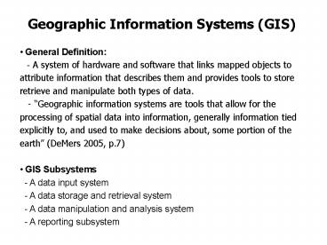
Geographic Information Systems (GIS)
- General Definition
- - A system of hardware and software that links
mapped objects to attribute information that
describes them and provides tools to store
retrieve and manipulate both types of data. - - Geographic information systems are tools
that allow for the processing of spatial data
into information, generally information tied
explicitly to, and used to make decisions about,
some portion of the earth (DeMers 2005, p.7) - GIS Subsystems
- - A data input system
- - A data storage and retrieval system
- - A data manipulation and analysis system
- - A reporting subsystem
2
Projection and Coordinate Systems
- Projection Process
- - A mathematical transformation that allows a
spherical surface to be represented in
two-dimensional space. - - All projections create some distortion of
angles, conformality, areas, distances or
directions No projections can be both conformal
and area-preserving - - Some projections minimize distortions in
some of these properties at the expense of others
3
Projection and Coordinate Systems
- Projection Family
- - Cylindrical projection Tropical zones
- - Conical projection Temperate zones
- - Azimuthal projection Polar zones
4
UTM Coordinate System
5
UTM Coordinate System
6
State Plane Coordinate (SPC) System
- State Plane Coordinate System
- - A coordinate system for mapping the United
States - - Three projection methods Lambert Conformal
Conic (longer states in the east-west direction),
Transverse Mercator Projection (longer states in
the north-south direction), and Oblique Mercator
Sourcehttp//www.warnercnr.colostate.edu/class_in
fo/nr502/lg3/datums_coordinates/spcs.html
7
Symbology and Thematic Mapping (Example)
8
INTERNET GIS DATA SOURCES
1. ESRI ArcData Online Website (Census 2000
TIGER/Line Data) http//www.esri.com/data/down
load/census2000_tigerline/ . 2. ESRI Virtual
GIS Training Courses http//campus.esri.com/
3. Geographynetwork GIS Data
http//www.geographynetwork.com/data/downloadable.
html 4. GIS Data Depot, GeoCommunity
http//www.geocomm.com/ 5. GIS Data
Clearinghouse http//www.dnr.state.oh.us/gims/
http//www.dnr.state.oh.us/gims/counti
es.htm http//gis.state.ga.us/ (Georgia GIS
Clearinghouse) http//seamless.usgs.gov
(Satellite Imagery Server)
9
INTERNET GIS DATA SOURCES
6. Other Useful GIS Websites (Ohio)
http//oit.ohio.gov/sdd/ess/ogrip/index.aspx
(Ohio Geographic Information System Service
Center) http//metadataexplorer.gis.state.oh.u
s/metadataexplorer/explorer.jsp (Ohio Metadata
Sever) http//dmc.ohiolink.edu/GEO/LS7/
(Ohiolink's Landsat 7) http//www.ohioview.org
(OhioView, Satellite Imagery Server)
http//glovis.usgs.gov/ (Global Satellite
Imagery) http//neocando.case.edu/cando/index.
jsp (Center on Urban Poverty and Social Change,
Northeast Ohio Community and Neighborhood
Data) http//gis.mahoningcountyoh.gov/
ftp//gis.mahoningcountyoh.gov/ (Mahoning County
GIS Division, Ohio) http//downloads.ddti.net/
MadisonOH/ (Madison County GIS, Ohio)
http//downloads.ddti.net/ClarkOH/ (Clark County
GIS, Ohio) http//www.auditor.co.geauga.oh.us/
gis/downloads/index.asp (Geauga County GIS,
Ohio) http//www.dublin.oh.us/business/gis/int
ro/index.html (City of Dublin, Ohio)
http//www.athensgis.com/ (Athens County GIS,
Ohio)
Recommended
CrystalGraphics Presentations


