
Seamount PowerPoint PPT Presentations
All Time
Recommended

Seamount Communities and Pelagic Interfaces: A Tale of Two Seamounts
| PowerPoint PPT presentation | free to download

Genin et al. (1986) - Black coral Stichopathes sp. on Jasper Seamount ... Removal of coral reefs reduces habitat heterogeneity ...
| PowerPoint PPT presentation | free to view

'Attractors' for mobile mammals, tuna, turtles, seabirds. Differences in abundances of zooplankton, nekton. TOPP Program. Long Lived species ...
| PowerPoint PPT presentation | free to view

the Magellan Seamount Trail
| PowerPoint PPT presentation | free to download

the Magellan Seamount Trail
| PowerPoint PPT presentation | free to view

just because organisms are present doesn't necessarily mean they are active ... Craig Moyer (WWU) Spatial and temporal variability in microbial mat ...
| PowerPoint PPT presentation | free to view

Serpentinite Seamount Processes in the IBM system
| PowerPoint PPT presentation | free to download

the Magellan Seamount Trail
| PowerPoint PPT presentation | free to view
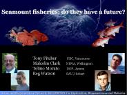
Seamount fisheries: do they have a future
| PowerPoint PPT presentation | free to download

Acoustic rays 'skip' over seamount peak and form convergence ... Random data dropouts. Random start time error. Sensor position. Towed Hydrophone Array - Issues ...
| PowerPoint PPT presentation | free to view

Seamount research involves many science disciplines that have much to gain from ... of the seamount interface between the hydrosphere, lithosphere and biosphere. ...
| PowerPoint PPT presentation | free to view

Scientific research and conservation of seamounts in the Azores and the NorthEast Atlantic region
| PowerPoint PPT presentation | free to download

Case Study: Submarine Crashes into Uncharted Seamount Relevant GISCI Rule of Conduct Section I, Number 5: We shall not knowingly perpetuate bad or outdated data.
| PowerPoint PPT presentation | free to download

x:xmpmeta xmlns:x='adobe:ns:meta/' x:xmptk='Adobe XMP Core 4.1-c036 46.277092, ... rdf:RDF xmlns:rdf='http://www.w3.org/1999/02/22-rdf-syntax-ns#' rdf: ...
| PowerPoint PPT presentation | free to download

The long journey towards a detailed picture ... Vertical heat and salt flux ... important factor for shaping seamount communities (and controlling bio-communication? ...
| PowerPoint PPT presentation | free to view

Institute of Zoology, London (~4 mio. USD) & SIODFA. FAO EAF ... No comprehensive conservation and management framework for the high seas of the Indian Ocean ...
| PowerPoint PPT presentation | free to download

For spectrograms of these sequences, see the GALLERY to the far right. ... The high-frequency component peaks at 90 Hz and shows little harmonic structure. ...
| PowerPoint PPT presentation | free to download

Smaller volcanoes are called sea knolls, and flat-topped seamounts are called guyots. ... The seamount becomes submerged to form a Guyot. Ocean Trench ...
| PowerPoint PPT presentation | free to view
High-order advection schemes ... Advection Schemes in ROMS (Seamount Case) V ... Evaluation of time-stepping, advection, and pressure gradient algorithms ...
| PowerPoint PPT presentation | free to download

Abyssal Plains. Mid-Ocean Ridge. Seamounts. Trenches. Continental Shelf ... Abyssal Plains. Flat seafloor area at the bottom of the continental slope. 4000-6000km deep ...
| PowerPoint PPT presentation | free to download

Mafic: Hawaiian Islands and Emperor Seamounts. Hotspot under moving oceanic crust ... On ocean floor or oceanic islands. Made from mafic lava ...
| PowerPoint PPT presentation | free to view

Deep Ocean Basins. Oceanic ridges. Hydrothermal vents. Abyssal Plains and Abyssal Hills. Seamounts and Guyots. Trenches and Island Arcs ...
| PowerPoint PPT presentation | free to download

Determine the age of the islands and seamounts in Samoa based on the Pacific plate velocity that you calculated using the Hawaiian data. ...
| PowerPoint PPT presentation | free to download

Rising Limb of a Convection Current Mid-Ocean Ridge System Mid Ocean Ridge System Mid-Ocean Ridge and Transform Faults Seamount former Volcano A Guyot flat ...
| PowerPoint PPT presentation | free to view

Seamounts, Guyots, and. Aseismic Ridges. Reefs - Atolls. Transform Faults - Fracture Zones ... Guyot Formation. Aseismic Ridges - Hotspot Tracks. absolute plate motion ...
| PowerPoint PPT presentation | free to view

Define what you think a 'seamount' is. Rank the following pictures from ... The approximate age of something determined by comparing ... Fuji, Japan ...
| PowerPoint PPT presentation | free to view

Mariana Trench, 36,200 ft deep. shrinking. as earth plates are pushed together ... TABLEMOUNTS GUYOT. SUBMERGED BROAD FLAT SEAMOUNT. REMAINS OF OLD VOLCANOES THAT ...
| PowerPoint PPT presentation | free to view

Anthozoan Life Cycle. Brusca and Brusca 2003. Seamounts are sites of endemism. ... Enhanced food supply causes high benthic biomass ...
| PowerPoint PPT presentation | free to download

Increasing pressure raises the melting point of a material. ... mountainous to flat plains: Abyssal plains, Abyssal hills, Seamounts, and Deep sea trenches ...
| PowerPoint PPT presentation | free to view

... Bathymetric System) uses lasers from the air to take pictures of the ocean floor ... Continental Rises. Abyssal Plains & Abyssal Hill. Seamounts. Guyots ...
| PowerPoint PPT presentation | free to view

Looking at Hawai'i, and volcanic seamounts nearby (underwater volcanic islands) Current Hawaiian. Islands. What is a hot spot? ...
| PowerPoint PPT presentation | free to view
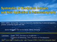
EESC G9802, Spring 2006: Toward an improved understanding of paleoceanographic ... Solitary coral Desmophyllum Dianthus from the New England seamounts. Case Studies ...
| PowerPoint PPT presentation | free to download

Probably 50,000 seamounts 1 km tall remain undetected. ... Raney et al. will demonstrate improved H and reduced sensitivity to SWH over ocean surface. ...
| PowerPoint PPT presentation | free to download

How do scientists determine the depth of the ocean? Q 3 p 476 ... Q 5 p 478. How does a seamount form? BONUS p 481. What is a nodule? TRADE ...
| PowerPoint PPT presentation | free to view

Abyssal plains are the pieces of oceanic crust between a spreading mid-ocean ... Abyssal plains can be. covered in 1 km of sediments. Seamounts are old ...
| PowerPoint PPT presentation | free to view

Title: 1 Author: sanchu Last modified by: sanchu Created Date: 10/28/2005 10:08:32 AM Document presentation format: (4:3)
| PowerPoint PPT presentation | free to download


Mountains in the sea
| PowerPoint PPT presentation | free to view

Back to Map Compare continental and oceanic landforms Continental landform Canyon Valley Volcanic mountain Mountain Range Low hills or plains Oceanic landform ...
| PowerPoint PPT presentation | free to view

The Geochronology of Hotspot Trails in the Pacific and the Timing of the Hawaii-Emperor Bend ... Predictions of the 'Fixed Hotspot' Hypothesis Related to Geochronology ...
| PowerPoint PPT presentation | free to download

Benthos refers to animals living in this zone (both on and near the sea floor). Come with us now and let's explore the Antarctic benthos... Welcome to the benthic zone ...
| PowerPoint PPT presentation | free to view

A better approximation is the geoid (height) which measures the variation of ... On land the geoid is the height the water in a canal would have if it were ...
| PowerPoint PPT presentation | free to view

Continental Margin: the portion of the seafloor adjacent to the continents; it may include the continental shelf, continental slope, and continental rise.
| PowerPoint PPT presentation | free to download

To Instructor: Students should be able to Explain what is required for a planet s magnetic field to be generated by a dynamo. Describe the evidence that plates ...
| PowerPoint PPT presentation | free to download

Volcanoes are also prodigious land builders as they have created the Hawaiian Island chain. Kilauea and Mauna Loa, two of the world's most active volcanoes, are still ...
| PowerPoint PPT presentation | free to download

The valley ranges from 15 to 30 miles in width and contains an active seismic ... to fill depressions of the rocky ocean floor remains of marine life ...
| PowerPoint PPT presentation | free to view

Deep Ocean Technology & The Ocean Floor IMPORTANT VOCAB Continental margin Continental shelf Continental slope Continental rise Deep ocean basin Abyssal plain ...
| PowerPoint PPT presentation | free to view

Is the boundary between the ocean floor and the continents. Continental Shelf ... A new suit that lets divers diver deeper, faster and stay longer. Sonar ...
| PowerPoint PPT presentation | free to view

Features of the Ocean Floor Essential Question What does the Ocean Floor Look Like Sketch a picture of your hypothesis. Features of the Ocean Floor Continental shelf ...
| PowerPoint PPT presentation | free to view

Exploring the Ocean Floor By: Laura Barrios, Uriel Flores, Edgar Gonzalez, Emmanuel Solis.
| PowerPoint PPT presentation | free to download

Ocean Topography What is Ocean Topography? The shapes, patterns and physical configuration of the ocean surface. Side-scan sonar is used to create an image of large ...
| PowerPoint PPT presentation | free to view

... The remotely operated vehicle (ROV) is controlled by the surface by a ... The untethered ROV, more generally called an autonomous underwater vehicle (AUV) ...
| PowerPoint PPT presentation | free to download

The largest ocean is the Pacific, and the smallest is the Artic. Ocean Climates & Depth ... Abyssal Plain. Flat plains. Formed by dead organisms. Food Chain. The End! ...
| PowerPoint PPT presentation | free to view

Warm Up 12-5-14 1. What are the four minerals that compose salt water? 2. What are the three reasons the ocean is salty? 3. What percentage of a drop of water ...
| PowerPoint PPT presentation | free to download

Ocean Floor Features We re diving in Ocean Floor Ready? Continental Shelf The edges of the continents slope down from the shore into the ocean.
| PowerPoint PPT presentation | free to download

Chapter 16: The Marine Environment 10. Estuaries are important because they allow many types of shellfish and other marine life to mature in that habitat.
| PowerPoint PPT presentation | free to view