
Offshore Surveyors PowerPoint PPT Presentations
All Time
Recommended
Marine and offshore surveyors inspect a boat, yacht or an offshore platform. They also survey small commercial ships, tugs, trawlers, dredgers, ex-barges and narrow boats of varying types and sizes. The job of a marine surveyor is to ascertain whether the vessel is in a suitable and sea, or river worthy condition. This is the basic task of a marine and offshore surveyor. Marine surveyors are also called to investigate the causes of an accident, because they can provide expert advice on a ship or a boat. Marine surveyors are either find employment in large insurance companies or can specialize in inspecting small vessels that are used for pleasure boating. Contact yellowpages-uae.com to Contact Marine & Offshore Surveyors Companies in Dubai i.e. at http://www.yellowpages-uae.com/uae/dubai/marine-and-offshore-surveyors
| PowerPoint PPT presentation | free to download

Constellation Marine services’s Highly Qualified Team has unrivaled experience of marine construction and navigation.This Depth of knowledge and talent enables the company to offer an array of specialist risk management and marine support services. The Constellation Marine services Engineering department has extensive offshore project experience and offers a wide range of competencies.These Engineering services are complemented by in-depth knowledge of offshore construction and operations, HSE Requirements and industry best practice.Constellation Offshore Marine services professionals have detailed knowledge of marine legislation and best practice guidelines. We provide Inspection and Monitoring services before a vessel enters dry dock to identify,plan and prioritize machinery and ship repair Wor
| PowerPoint PPT presentation | free to download

Institute of Mine Surveyors of South Africa. NEW TECHNOLOGY IN MINE SURVEYING AND ITS IMPACT ON SAFETY IN THE UNDERGROUND WORKINGS OF A MINE
| PowerPoint PPT presentation | free to view

Analysis of emerging experience. Quantification of uncertainty ... architects, consulting engineers, designers, surveyors, contractors, developers ...
| PowerPoint PPT presentation | free to view
We are the best hydraulic survey company that estimates the water depth of the onshore or offshore marine environments that include waterway planning, dredging analysis, and wreck location.
| PowerPoint PPT presentation | free to download

Quarters. Platform. Platform 2. Flare. Wellhead. Platform 1. BSP1. BSP2 ... every six months and typically are 2-4 days in length, performed by 2 surveyors. ...
| PowerPoint PPT presentation | free to view

Aerial mapping drones have a variety of applications in the mapping and land surveying industries. They are used to assist surveyors in quickly, easily, and affordably mapping big areas. The purpose of deploying drones is to improve processes and minimize time-consuming manual mapping and surveying. For more information about our Aerial mapping services please visit: https://www.falcon3dme.com/drone-inspection-services.html
| PowerPoint PPT presentation | free to download
Naval architecture is a field of engineering involving the designing, contraction and repair of boats, ships and other marine vehicles. The design of sea vessels is reliant on similar engineering expertise and technologies that are used offshore; except that a sea focus is necessary to ensure safety and effectiveness for sea operation.
| PowerPoint PPT presentation | free to download

... increase of CO2 in the atmosphere from about 280 ppm in the pre-industrial era ... and deposited just offshore in a fashion that restores the shape of the beach ...
| PowerPoint PPT presentation | free to view
Hazard detection is crucial in developing an understanding of the threat contributors to the particular system that can allow help to identify the safeguards or threat reducing measures presently in place, and to make recommendations for fresh safeguards to further reduce threat.
| PowerPoint PPT presentation | free to download

Terrestrial surveying is one of the most commonly used service that includes terrestrial scanning in which tripod-mounted or ground-based light radar is used to create a high-resolution 3D image of objects and surfaces.
| PowerPoint PPT presentation | free to download

Terrestrial surveying is one of the most commonly used service that includes terrestrial scanning in which tripod-mounted or ground-based light radar is used to create a high-resolution 3D image of objects and surfaces.
| PowerPoint PPT presentation | free to download

Bunker Quantity Survey
| PowerPoint PPT presentation | free to download
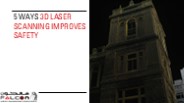
We'll look at how 3D laser scanning enhances safety in high-risk projects by lowering accidents, minimizing on-site exposure, and improving project management overall.
| PowerPoint PPT presentation | free to download

we'll dive into the world of hydrographic survey services, shedding light on what they are, why they are important, and how they work. So, let's set sail on this informative journey to uncover the secrets of hydrographic surveying in a simple and engaging way. Know More: https://www.falconsurveyme.com/our-services/bathymetric-survey/hydrographic-survey-2/
| PowerPoint PPT presentation | free to download

Careers In Ocean Engineering
| PowerPoint PPT presentation | free to download

Bathymetric surveys are an essential part of many marine construction projects. These surveys provide detailed information about the depth and topography of the seafloor, which is crucial for planning and executing various marine engineering projects.
| PowerPoint PPT presentation | free to download

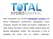
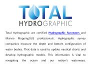
Total Hydrographic is one of best hydrographic survey companies that provide high quality surveys in all over Australia. We provide all method of hydrographic surveys like measure underwater surfaces, structure of the ocean floor and showing the depth and shape of ocean.
| PowerPoint PPT presentation | free to download

TWO PRESENTATIONSCOMBINED: RISK ASSESSMENT AND ECONOMIC ISSUES: 1' WHEN PAINTING BALLAST TANKS 2' WH
| PowerPoint PPT presentation | free to view


Title: PRESENTATION ON AFRICAN MARITIME TRANSPORT CHARTER Last modified by: User Document presentation format: On-screen Show Other titles: Times Arial Times New ...
| PowerPoint PPT presentation | free to view

J. Anthony Cavell, PLS, CFedS Louisiana State University, C4G Currently GNSS's are GPS and GLONASS, Galileo is planned They supplant earlier systems Transit, STARFIX ...
| PowerPoint PPT presentation | free to download

BIM Engineering U.S. L.L.C - Offers the best Point Cloud Scanning Services and 3D Laser Scanning Services for various projects & jobs | 3D Laser Scanning Services | Point Cloud Modeling|Point Cloud Services in the US.
| PowerPoint PPT presentation | free to view

BIM Engineering U.S. L.L.C - Offers the best Point Cloud Scanning Services and 3D Laser Scanning Services for various projects & jobs | 3D Laser Scanning Services | Point Cloud Modeling|Point Cloud Services in the US.
| PowerPoint PPT presentation | free to download

Louisiana. State. University 'Building a ... 2 cm Vert. Users can obtain elevations in any datum or realization. ... 2cm Vert., EVERYWHERE! GULFNet. RTN ...
| PowerPoint PPT presentation | free to view

WAVESPEC Limited Marine Engineering and Naval Architecture Consultants WAVESPEC Limited, Fullbridge Mill, Fullbridge, Maldon, Essex CM9 4LE 01621 840447
| PowerPoint PPT presentation | free to view


'Bulgarian National Association of Shipbuilding and Shiprepair' (BULNAS) was ... activities as a subcontractor to respectable shipbuilding. yards. ...
| PowerPoint PPT presentation | free to view

The Industry's focal point for skills, learning & workforce ... Geese fade through. Random Activity. Focussed Activity. Providing the focus. Potential Talent ...
| PowerPoint PPT presentation | free to view

To order poster prints visit us at www.genigraphics.com ... AND EARTHQUAKE SOURCES IN THE PACIFIC NORTHWEST INSERT YOUR ORGANIZATION S
| PowerPoint PPT presentation | free to download

HYSYS.PROCESS C. O Process Design / Sizing PEL. PEL. PEL. PEL. PEL. PEL. PEL. PEL EQLIST. VSP-V. VSP-H. FLARESIZ. REL_BLD. LINLIST. PUMPSIZ. LIQ-H-UP O. O. O. O. O. O ...
| PowerPoint PPT presentation | free to download

See to the training and certification of seamen as per international ... Intelligence gathering on the activities of small crafts and canoes to be intensified. ...
| PowerPoint PPT presentation | free to view

Sea Levels around the Caribbean
| PowerPoint PPT presentation | free to view

Hexajobs is a direct platform between the applicants and Employers. Find a suitable job,job vacancies,job recruitment ,jobs search through India,Singapore,Malaysia,Macau,China,Hong-kong,Canada,Australia,USA,Saudi Arabia,New Zealand and other countries.
| PowerPoint PPT presentation | free to download

Manufacturing: clothing, chemicals and plastic, automotives and metals ... Talent Manager / Org Designer. Ensuring today's and tomorrow's talent. Developing talent ...
| PowerPoint PPT presentation | free to view

... routine tanker operations and the discharge of oily wastes from machinery spaces. ... provision of facilities for the reception of oily water and residues. ...
| PowerPoint PPT presentation | free to view

Exchange box' used to match other system data fields to Metacor and vice versa. ... Trained in Piping, Structural and static equipment coatings and corrosion surveys. ...
| PowerPoint PPT presentation | free to view

International Convention on the Control of Harmful Systems on Ships AFS Convention Current Status Adopted in 5 October 2001 Met the conditions for entry into force of ...
| PowerPoint PPT presentation | free to view

... position and detonate explosives to break or dislodge rock and soil. ... Electrical Fitter Electrical Mechanic Fitter Instrument Fitter Lift Mechanic ...
| PowerPoint PPT presentation | free to view

Isle of Man is within EU for VAT purposes (essentially part of UK) and has a ... Penalties for belated notification up to 15% of net VAT. Output Tax ...
| PowerPoint PPT presentation | free to view

Wind- Green but high cost power alternative ... ( EVA model of single NM-82 turbine) ... ( EVA model assumptions) Energy Ventures Analysis Inc. Single Wind ...
| PowerPoint PPT presentation | free to download

YET OUR COUNTRYSIDE IS BEING DESTROYED AS A POLITICAL GESTURE. Questions & discussion on Part 1 ... are seen as the observer moves through the countryside ...
| PowerPoint PPT presentation | free to view
Building Capacity
| PowerPoint PPT presentation | free to download

Geoid Equipotential surface. based on ... It happens to fit the geoid in their area particularly well. ... direction of gravity from vertical datum at geoid. ...
| PowerPoint PPT presentation | free to view

Finding HMAS Sydney
| PowerPoint PPT presentation | free to view

Space Weather Effects on Products and Services Supporting Surface Transportation
| PowerPoint PPT presentation | free to view

Title: PowerPoint Presentation Author: Hilde De Wachter Last modified by: van Created Date: 9/30/2002 12:50:22 PM Document presentation format: On-screen Show
| PowerPoint PPT presentation | free to download

... Oil Pollution Prevention, Response & Cooperation [OPRC 1991] and over 100 Codes and Protocols International Safety Management Code [ISM 1993] ...
| PowerPoint PPT presentation | free to download

J = Number of journalists present. Cf = Country factor ... Singapore, Yokohama, Piraeus, Rotterdam, London, Miami and Korea. First Green Passport for ...
| PowerPoint PPT presentation | free to view

Infrared (IR) active gases, principally water vapor (H2O), carbon dioxide (CO2) ... No direct relationship between the two as they did not exist at the same time. ...
| PowerPoint PPT presentation | free to view
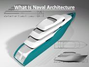
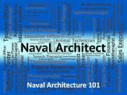
Naval technology has been making strides over the past century and this has led to several advancements in shipbuilding and marine navigation. These steps have further led to the development of specific areas of study, and naval architecture happens to be one of those areas.
| PowerPoint PPT presentation | free to download

Find the Best Marine & Hydrographic Survey Equipment Suppliers in Dubai UAE? Contact Mer-subsea.com we provides the Best Environmental Equipment Suppliers, ROV tooling Suppliers, Marine Solutions, Seismic Solutions, Designed Solutions & Geotechnical Equipment Suppliers in Dubai UAE
| PowerPoint PPT presentation | free to download

* Enforcement of the Inactive Well Plugging Extension (HB 3134) ... T State Funded Operations Holds Well Level: X, V H15 issues (delinquency, ...
| PowerPoint PPT presentation | free to view
construction technology & maintenance cem 417 sources from : mohd amizan mohamd mohd fadzil arshad siti rashidah mohd nasir fka, uitm shah alam.
| PowerPoint PPT presentation | free to download

... and the insurer have a common interest in minimising time 'off ... available yards in the FE for final repairs. ... Common repairs for Owners class / safety ...
| PowerPoint PPT presentation | free to view