
Mapping Camera PowerPoint PPT Presentations
All Time
Recommended

Enter underwater drone mapping surveys, a revolutionary instrument that allows us to record and analyze underwater habitats in unprecedented depth.
| PowerPoint PPT presentation | free to download

Drone mapping services have transformed the landscape of surveying and mapping, offering unparalleled precision, efficiency, and cost-effectiveness. As these technologies continue to advance, we can expect even more accurate data collection, faster processing times, and expanded applications.
| PowerPoint PPT presentation | free to download

Mapping the Security Cameras on Arizona State University Main Campus. By. Micah J. Morino ... has an unknown number of cameras on its campus, operated by over ...
| PowerPoint PPT presentation | free to view

... cameras and camera phones Has led to many amateur photographers having their photos published Consumer-generated media ... defamation of character by making ... law -enforcement tool ...
| PowerPoint PPT presentation | free to download

Best backpack for curring your DSLR camera, its a common choice to travell lovers as well as who likes to go out for any other need.

Title: Nevada Test Site Calibration Range and Geometric Calibration of Digital Cameras Author: bkletzli Last modified by: bkletzli Created Date
| PowerPoint PPT presentation | free to download

Dash camera is first-of-its-kind car security camera that captures everything that is happening inside and outside the car, which can be viewed from any part of the world. It also helps in locating the car on real time basis with the in-built GPS tracker system

Looking for a quality stereo camera module? We offer a high-resolution stereo camera module to be imaged and captured images for daytime use, and it is perfect for 3D mapping, USB interface, etc. Order your camera module today and call us at +86 136 9976 9387.
| PowerPoint PPT presentation | free to download
Caused by imperfect lenses ... what kind of camera? external or extrinsic (pose) parameters including ... All specifics of the camera summarized in one matrix ...
| PowerPoint PPT presentation | free to download

The global security cameras market size was USD 6.40 Billion in 2021 and is expected to register a revenue CAGR of 18.7% during the forecast period, according to latest analysis by Emergen Research.
| PowerPoint PPT presentation | free to download
If you want drone mapping services, rely on Agri Drone Specialists! We also offer drone seeding services to help farmers or landowners with precision agricultural solutions. Contact us at 027 323 8155 or visit https://www.agridronespecialists.co.nz/
| PowerPoint PPT presentation | free to download

Gremsy Pixy U comes with multi-camera support. A comprehensive solution for the purpose of aerial surveying, inspection, mapping and many other applications for drone applications!
| PowerPoint PPT presentation | free to download

Lens distortion. Row and Column Pixels Scaling. Camera pixels are not necessarily squares ... Place a camera in front of the target and we can locate the ...
| PowerPoint PPT presentation | free to view
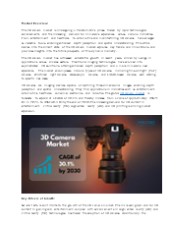
Technological advancements propel the 3D camera market to unprecedented heights. The integration of high-resolution sensors, improved image processing algorithms, and enhanced depth mapping capabilities catapults 3D camera performance to new levels. Applications in augmented reality (AR), virtual reality (VR), autonomous vehicles, and industrial automation fuel market growth. As consumer demand for immersive experiences grows, 3D cameras become indispensable across diverse industries. This surge in demand underscores the market's potential and underscores the pivotal role of technology in shaping its trajectory.
| PowerPoint PPT presentation | free to download

Are you looking for the Best Security Camera Installation in MacAlister Range? Then contact Tropical Energy. They specialize in many types of electrical work, meaning they can be your one-stop shop for all things electrical. They keep up to date with the latest technology and as well as general e; electrician work, they also offer EV charging, Security Camera Installations.
| PowerPoint PPT presentation | free to download


This new technology is changing the way construction businesses approach surveying, site analysis, and project management. aerial drone mapping Know More: https://www.falconsurveyme.com/our-services/aerial-mapping/
| PowerPoint PPT presentation | free to download

Camera Parameters CS485/685 Computer Vision Prof. George Bebis * * * * * * * * * * * * * * * * * * * * * * * * * * * * * * * * * * * * Types of parameters (cont d ...
| PowerPoint PPT presentation | free to download

Future Market Insights has recently published a market research report on Global Smart Camera market. The study presents a detailed analysis on the historical data, current and future market scenario for the Smart Camera market.
| PowerPoint PPT presentation | free to download
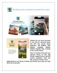
GPS Map Camera App with Location Latitude Longitude Address & DateTime Stamp
| PowerPoint PPT presentation | free to download
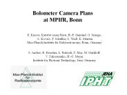
Bolometer Camera Plans at MPIfR, Bonn E. Kreysa, Kaustuv moni Basu, H.-P. Gem nd, G. Siringo, A. Kovacs, F. Schuller, A. Wei , K. Menten Max-Planck-Institute for ...
| PowerPoint PPT presentation | free to download

Security Cameras should be weather resistant. These cameras must have night vision, heat and motion-sensing technology, and modern-security cameras.
| PowerPoint PPT presentation | free to download

High Angle. In this shot the camera looks down on the subject, decreasing its importance. ... One of the most commonly used shots is the eye-level shot. ...
| PowerPoint PPT presentation | free to view

Mapping the Heavens:
| PowerPoint PPT presentation | free to view

Digital Camera s and WebCams Technology Advancement Group (TAG) Doug Baleshta May 10, 2004 Sign of the Times A Short Course on Using Digital Cameras and Web ...
| PowerPoint PPT presentation | free to view

Are you seeking specialised camera control devices for UAVs? Air-Supply’s precision camera trigger device of Seagull UAV helps with accurate surveillance, mapping, and navigational controls. More details please visit https://articles.abilogic.com/476153/looking-camera-trigger-device-drones.html
| PowerPoint PPT presentation | free to download
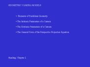
The Extrinsic Parameters of a Camera. The General Form of the Perspective Projection Equation ... Parameters of a Camera. Normalized Image. Coordinates ...
| PowerPoint PPT presentation | free to download

List of CCTV Cameras Systems Dealers, Suppliers, Service Providers for Homes & Offices in Jaipur, with provides Addresses, Contacts Details, Location Maps . Call now 950 950 2100 for more info.
| PowerPoint PPT presentation | free to download

List of CCTV Cameras Systems Dealers, Suppliers, Service Providers for Homes & Offices in Jaipur, with provides Addresses, Contacts Details, Location Maps . Call now 950 950 2100 for more info.
| PowerPoint PPT presentation | free to download

Oman being one of the leading countries in GCC is advancing in technology at a quick pace and to be a part of this technology improvement, R&D at Customized Drones™ is contributing in the advancement of the technology and will be launching mapping drones in Oman soon.
| PowerPoint PPT presentation | free to download
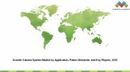
Crawler Camera System Market by Component (Hardware, Software, Service), Application (Drain Inspection; Pipeline Inspection; Tank, Void, and Cavity/Conduit Inspection), Vertical (Residential, Municipal, Industrial), and Region
| PowerPoint PPT presentation | free to download

Camera Notes. Xian-Sheng Hua, Shipeng Li and Hong-Jiang Zhang. Microsoft Research Asia. ICME 2005 Amsterdam Netherlands July 7 2005. Motivation ...
| PowerPoint PPT presentation | free to view

Affordable Dash camera is first-of-its-kind car security camera that captures everything that is happening inside and outside the car, which can be viewed from any part of the world. It also helps in locating the car on real time basis with the in-built GPS tracker system
| PowerPoint PPT presentation | free to download

In the realm of agriculture, large-scale farming poses unique challenges. Managing extensive tracts of land, monitoring crops, and optimizing resources is no small feat. Enter drone mapping services—a groundbreaking technology reshaping large-scale farming. Here’s how drones are revolutionising the industry. Read more :-https://www.agridronespecialists.co.nz/drone-mapping/
| PowerPoint PPT presentation | free to download

Cass Everitt, 'Projective Texture Mapping' NVIDIA SDK White Paper. ... Image Source: Cass Everitt et al., 'Hardware Shadow Mapping' NVIDIA SDK White Paper ...
| PowerPoint PPT presentation | free to download

Gremsy Pixy U and gremsy Pixy F are new age camera gimbals for aerial videography, mapping accuracy; and offer longer flight times for drone and UAVs during aerial photography. Just visit the link: https://bit.ly/2Zfg0Ud
| PowerPoint PPT presentation | free to download

Value Stream Mapping Leads us to next question what activities are waste? Quick run through this each one is detailed after this.
| PowerPoint PPT presentation | free to view

8 1 8 7 6 5 4 3 2 What a fun place to play and explore! ... This picture map shows real colors of a part of our Earth as seen from outer space. Where is this?
| PowerPoint PPT presentation | free to download

Surging demand of 3D enrich content from entertainment industry and enhancement in 3D scanning technology are proliferating the demand of 3d camera in the market.
| PowerPoint PPT presentation | free to download

Mapping Drones have become more and more common for those working in archeology and architecture professions, as it is a great source of efficiency for topographic survey. The topographic survey includes accurately mapping with the help of a drone/UAV the natural and man-made features of a particular piece of land. The goal is to represent the three-dimensional features of the terrain in a two-dimensional format, typically in the form of a topographic map.
| PowerPoint PPT presentation | free to download
Future Market Insights (FMI) has published a new market research report on social employee recognition systems. The report has been titled, Global Rugged Thermal Camera Market: Global Industry Analysis,Forecast. Long-term contracts with large enterprises and private companies are likely to aid the expansion of business revenues, and innovation in the industry will enable social employee recognition system vendors to reach out to new potential customers in emerging markets. These factors are expected to help the global market for social employee recognition systems observe stellar growth in next few years.
| PowerPoint PPT presentation | free to download

The final product of drone mapping or aerial surveying in construction is a map. The two most prevalent ways of mapping with drones are photogrammetry and laser ranging (LiDAR). Using either way, you'll get a different kind of map and you'll need specialised tools to analyse the data.
| PowerPoint PPT presentation | free to download

Deficient weather information in Alaska contributes to a ... Cameras are installed with fixed direction (pan, tilt, zoom is fixed) Site requirements include: ...
| PowerPoint PPT presentation | free to view

Lighting and Cameras
| PowerPoint PPT presentation | free to view
Focusing on the Small Details, Seeing the Large Picture
| PowerPoint PPT presentation | free to download

Sample Preparation and Mapping Steps Cleaning and drying of bulk samples Initial Preparation. Cutting, impregnation, cast-making, fusing Mounting.
| PowerPoint PPT presentation | free to download
Saudi Arabia is a country having vast and diverse landscapes, with this environmental situation, the Customized Drones™ team in Dubai, which is a leading drone manufacturer in Dubai, introduces their advanced mapping drone with high-end customized features that give many benefits for many industries in Saudi Arabia.
| PowerPoint PPT presentation | free to download

Lock Lenses at Infinity Before Calibration. Lab Radiometric Calibration ... Terrestrial Camera Stations. PECTRUM. MAPPING, LLC. Bundle Result 1. PECTRUM. MAPPING, LLC ...
| PowerPoint PPT presentation | free to view

Camera and Lighting for Animation
| PowerPoint PPT presentation | free to download
Mapping drones in Saudi Arabia are becoming increasingly popular in the region, as they offer a number of advantages over traditional surveying methods. Drones can collect data quickly and efficiently, and they can access areas that would be difficult or dangerous for humans to reach. This makes them ideal for a variety of applications.
| PowerPoint PPT presentation | free to download

Network Camera Solutions HDG-M220F Ultra High Resolution : Advanced Full HD Network Camera ABF (Auto Back Focus) Zoom Ratio : Total 36x (Optical 3x, Digital ...
| PowerPoint PPT presentation | free to view

Used when the tex coords are too cumbersome to specify, or will be changed with time. ... There are a few glaring limitations to spherical mapping. ...
| PowerPoint PPT presentation | free to view

Acoustic Camera Market
| PowerPoint PPT presentation | free to download

ASPRS Photogrammetry - Part2 ... should continue to calibrate film mapping cameras using the present calibrator and the Simultaneous Multiframe Analytical ...
| PowerPoint PPT presentation | free to download