
Landuse PowerPoint PPT Presentations
All Time
Recommended
Landuse Planning
| PowerPoint PPT presentation | free to download
... for deciding the best present and future use of each parcel of land in an area ... Zoning - process in which various parcels of land are designated for a ...
| PowerPoint PPT presentation | free to download

Landuse Planning - a process for deciding the best present and future use of ... Conservation Easement - tax breaks to landowners who agree to use land only for ...
| PowerPoint PPT presentation | free to view

Land's 'surface' is typically considered to be a ... Multiple Land Use Concept ... Less convenient than cars. Very expensive. Can be crowded and uncomfortable ...
| PowerPoint PPT presentation | free to view

USE Clothes shop Womens. FUNCTION retail. FIRST FLOOR. NAME Houses Galore. USE house rentals ... specialist-florist,bike. A STUDY OF CHANGE -Do survey to show ...
| PowerPoint PPT presentation | free to view

Concerns by municipalities and industries ... residences industries agriculture. Effect on resources. No scientifically accurate forecasting method. Background ...
| PowerPoint PPT presentation | free to view

NASA Earth Systems Science Fellowships (2) ... to develop detailed understanding and explanations of causes and consequences of ...
| PowerPoint PPT presentation | free to view

hydrology of Mae Chaem river basin. ???? ?????????? (presenter) ... Distributed Hydrology Soil-Vegetation Model. ?????? GIS ?????????? ...
| PowerPoint PPT presentation | free to view

Establish lot area requirements. Number of ... Legality. Value. Building Codes. Minimum acceptable materials and construction standards needed to protect public ...
| PowerPoint PPT presentation | free to view

41 - Deciduous Forest. 42 - Evergreen Forest. 43 - Mixed Forest. 51 - Dwarf Scrub. 52 - Shrub/Scrub ... 3 - deciduous needleleaf forest. 4 - deciduous broadleaf ...
| PowerPoint PPT presentation | free to download

Hypoxia, Water Quality, and LandUse in the Mississippi River Watershed
| PowerPoint PPT presentation | free to view

Find optimum scenario assignment for each district from ... c) gene-wise mutation. d) maturation (elitism) 343 District Genes. A2. C4. A3. F. 260 Street Genes ...
| PowerPoint PPT presentation | free to view

Albertas Landuses, Population, and Residential Patterns Challenges and Opportunities for Albertas Re
| PowerPoint PPT presentation | free to view

Car pooling. Safe driving. Environmental campaign. Hazard map. 4 September 2006 ... Sustainability and A Compact City. Population. Environment. Social. Economic ...
| PowerPoint PPT presentation | free to view

... (fallow, open and under-forest) and semi-natural vegetal covers interspersed with hills of varying vegetal covers (cultivated in the western part and mostly ...
| PowerPoint PPT presentation | free to download

... WW W W W W W W W W W W W W W W W W W W W W W W W W W W W W W W ... 456789:CDEFGHIJSTUVWXYZcdefghijstuvwxyz GpSs tFTO ...
| PowerPoint PPT presentation | free to view

Steve Morse, Senior Fellow, Minnesota Institute for Sustainable Agriculture ... migratory waterfowl and neo-tropical songbird populations at the watershed level ...
| PowerPoint PPT presentation | free to view

Kingdom of Morocco. Ministry of Land-Use Management, ... The First Carbon Exhibition. in North Africa and Middle East Region. Djerba, ... exothermic process ...
| PowerPoint PPT presentation | free to view

Global observation of forest cover and land-use dynamics (GOFC/GOLD) in Africa ... and research institutions in DRC, Malawi, Mozambique, Tanzania, Zambia and Zimbabwe. ...
| PowerPoint PPT presentation | free to view

... WWWWWWWWWWWWWWWWWWWWWWWWWWWWaW WGWpWSWsW WtWFWTWOWdWWfWeWWW WWWWW WW WW WW F* ' ... 456789:CDEFGHIJSTUVWXYZcdefghijstuvwxyz GpSs tFTO ...
| PowerPoint PPT presentation | free to view

Using the Spatial Analyst Model Builder to support Citizen-Based Landuse Planning ... UW-Madison LICGF, 550 Babcock Drive Rm B102, Madison WI. ???:???. Introduction ...
| PowerPoint PPT presentation | free to view

... of total evaporation between the bare soil surface and canopy ... Bare Soil had the largest change in sensible heat flux ( 100 w/m2) over control. ...
| PowerPoint PPT presentation | free to view

MANNING'S N VALUES ASSICITED WITH LANDUSE LAYER AND FLOODPLAIN INUNDATION MODELING USING ArcGIS ... Gage datum 280.16 feet above sea level NGVD29. h = 33.38 ft. ...
| PowerPoint PPT presentation | free to view

Fei Chen1, Yubao Liu1, Hiroyuki Kusaka1 4, Mukul Tewari1, Jian-Wen ... Low surface albedo. radiation trapping. Large thermal capacity and thermal conductivity ...
| PowerPoint PPT presentation | free to view

One Tree Hill. Three Kings. Mt. Albert. Mt. Roskill. Mt. St. John. Te ... One Tree Hill erupted about 20,000 years. ago. It stands 183 meters high. Red arrows ...
| PowerPoint PPT presentation | free to view

maintain the vitality of the many small production, distribution and ... of Los Angeles 'Bright Lights Safe Nights' (http://www.lacity.org/BSL/index.htm) ...
| PowerPoint PPT presentation | free to view

Environmental programs that seek changes in private land management. Australia: ... command and control, taxes, permits, offsets. extension, education, suasion ...
| PowerPoint PPT presentation | free to view

Using a regional climate model to study land-use land-cover changes impacts on ... on the type of conversion and phenology of the land-cover involved in the changes. ...
| PowerPoint PPT presentation | free to view

Hypoxia, Water Quality, and LandUse in the Mississippi River Watershed
| PowerPoint PPT presentation | free to view

Clermont County- Ohio. Year 2003-2004. Science Teacher: Mr. Jon Souder ... Sampling points (I have a picture with the map). Your video. Preliminary Results ...
| PowerPoint PPT presentation | free to view

These results could be related to a trend to the observed increase in precipitation. Land cover type (MODIS) and estimated trend from NCEP and ERA reanalyses (Lim, ...
| PowerPoint PPT presentation | free to view

For interior-forest birds, habitat fragmentation is a central factor, ... Brood parasites include the brown-headed cowbird from agricultural lands. ...
| PowerPoint PPT presentation | free to view

Case study: SEA for land-use plan amendments of Krasna Hora municipality. Background info: ... Aim is to 'examine and modify current functions of certain ...
| PowerPoint PPT presentation | free to view

For City of Cleveland. by Statistical Planning Area ... Study Area Map: UST 642 Introduction to G.I.S. Michael Hoag. City of Cleveland - Planning Commission ...
| PowerPoint PPT presentation | free to view

University of Maryland and Florida State University. Mario Nunez and C. Ciappesoni, Argentina ... Results from China (Zhou, Dickinson, et al, PNAS, 2004) ...
| PowerPoint PPT presentation | free to view

Impact of Land-Use Changes on Future Monsoon Climates ... causing deforestation in tropical Africa as assessed by Geist and Lambin (2001) ...
| PowerPoint PPT presentation | free to view

Exploring impacts of landuse change and residential landmanagement behavior on water quality in the
| PowerPoint PPT presentation | free to view

1. The European Working Group on Land-Use Planning and the Guidelines for LUP in ... developments (transport links, locations frequented by the public, residential ...
| PowerPoint PPT presentation | free to view

( i.e. political, physical, climatic, land-use resource, contour, elevation, topographic. ... the surface of the earth in great detail are called physical map. ...
| PowerPoint PPT presentation | free to download

10 Parties and the European Community. Received 4 presentations ... Existing data sets on forest inventory, maps, remote sensing allows simple extrapolation ...
| PowerPoint PPT presentation | free to download

Its properties vary with depth and are determined by climate, parent material, ... use urban forest as a recreational resource for bike riding and other activities. ...
| PowerPoint PPT presentation | free to view

This experiment was designed to test the correlation between phosphate levels in ... One soil core consisted of up to 1 meter of soil which compacted as 40 cm or less. ...
| PowerPoint PPT presentation | free to view

Using a regional climate model to study land-use land-cover ... Adriana Beltr n-Przekurat and Roger ... Global Environment (SAGE), University of Wisconsin ...
| PowerPoint PPT presentation | free to view

Land-Use Change in Temperate East Asia: Land Cover Changes Impacts on Carbon ... to 2003 to characterize vegetation phenology, seasonal dynamics and inter-annual ...
| PowerPoint PPT presentation | free to view

Landuse-plan, Landvalue-plan ... Physical Planning &Design (a)Landuse-plan distribution of development area in different functions/effective &non-effective area. (b) ...
| PowerPoint PPT presentation | free to view

GIS & Planning, Looking Back and Looking ... Commission Approval Many Rural Subdivisions being created ... Office created Landuse layer ...
| PowerPoint PPT presentation | free to download

Soil Point Information & Landuse ... consideration is data quality Data lifecycle Planning & Definition Collection Storage Access & Use Archive & Disposal ...
| PowerPoint PPT presentation | free to view

Railroad. Terrain area with specific landuse. Building ... Cables underground. RegistrationalArea province, municipality boundary ...
| PowerPoint PPT presentation | free to download

The Application of GIS Tools to Inform Rural Telecom ... in the policy development and planning ... of residential subscribers Landuse patterns and business ...
| PowerPoint PPT presentation | free to view
Assessing Economic and Ecological Tradeoffs from Tradable Landuse Rights: Application to Canada s Boreal Mixedwood Forest Marian L. Weber Alberta Research Council
| PowerPoint PPT presentation | free to download
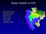
GIS models are commonly used for site selection, landuse planning and habitat modeling. These applications are all based on multi-layer selection in GIS.
| PowerPoint PPT presentation | free to download

Scope study area down to portion of watershed in Franklin County Planned Methodology Apply landuse estimate method described in Impervious Cover and Land Use in the ...
| PowerPoint PPT presentation | free to view

GIS + Crop model User Interface Climate database GIS layers (Soils, Landuse, ) Promise grid for each cell of the grid, the GIS tool will extract the input ...
| PowerPoint PPT presentation | free to download

Throwing garbage in a blender? Underestimation of non-CO2 / landuse reduction potentials? ... Throwing garbage in a blender? Or blending everything into garbage? ...
| PowerPoint PPT presentation | free to download

Identify contrasts in impacts on different types of communities i.e. urban/rural ... Coastal zone management and landuse planning Provision of emergency ...
| PowerPoint PPT presentation | free to download

Soil. Landuse (vegetation) Climate (rainfall, temperature, humidity, ... Uses SWAT (Soil and Water Assessment Tool) http://www.brc.tamus.edu/swat ...
| PowerPoint PPT presentation | free to view