Landsat PowerPoint PPT Presentations
All Time
Recommended
U.S. Department of the Interior. U.S. Geological Survey. Landsat Project Status ... Stand down all recipes, options, priorities, etc - DELAYED. 17 ...
| PowerPoint PPT presentation | free to view
Landsat Calibration Scientist, NASA/GSFC Landsat Project ... New processing logic was added to detect and correct the step offsets in the quaternion data ...
| PowerPoint PPT presentation | free to view
Landsat 7 and its Enhanced Thematic Mapper-Plus (ETM ) sensor reach the end of ... SS Survivability Sensor. ALT Radar Altimeter. TSIS Total Solar Irradiance Sensor ...
| PowerPoint PPT presentation | free to view
Landsat A key climate sensor. Absolutely crucial land climate sensors: Landsat 1972 now. AVHRR-MODIS-VIIRS continuum 1981 -- now. Lidar for the 3rd Dimension ...
| PowerPoint PPT presentation | free to download
LANDSAT AND QUICKBIRD SATELLITE
| PowerPoint PPT presentation | free to download
Landsat 7 Mission. By: Ro'Derrick Brown. Earth System Science. Ms. Jakubowyc. Novermber 28, 2006 ... Land sat 7 Data have been used to monitor agricultural ...
| PowerPoint PPT presentation | free to view
Serie Landsat ... Landsat TM. Bandas de TM. Aplicaciones de bandas en. TM y ETM. Bandas TM y ... Resumen Landsat. Resumen Landsat (Spot) Escena de MSS. Escena de TM. Escena de ...
| PowerPoint PPT presentation | free to view
Landsat Data Gap Study Activities Remote Sensing Technologies Project http://calval.cr.usgs.gov/ Greg Stensaas, USGS Gyanesh Chander, Jon B. Christopherson SAIC
| PowerPoint PPT presentation | free to download
Land Cover Mapping Using Landsat 8 Imagery
| PowerPoint PPT presentation | free to download
... the post-fire rapid assessment process led by the Burn Area Emergency Response (BAER) Team. ... cover and surface properties. Landsat. Mesoscale. Models ...
| PowerPoint PPT presentation | free to view
Landsat Change Detection of Forests with a Modified Enhancement Classification Methodology
| PowerPoint PPT presentation | free to view
New Landsat 7 Gapfilled Products
| PowerPoint PPT presentation | free to view
ground resolution, five-year design life: microbolometer technology ... records' Allen, R.G. 'The Need to Continue High Resolution Thermal Imagery ...
| PowerPoint PPT presentation | free to view
History and Features of Landsat 7 By: Andy Vogelsberg Photo of Landsat 7 taken from http://teacherlink.ed.usu.edu/tlnasa/pictures/litho/landsat/land.jpg
| PowerPoint PPT presentation | free to view
R. Bindschadler and P. Vornberger (SAIC), NASA Goddard Space Flight Center ... 50m location accuracy with ephemeris data) stacking order and cutlines ...
| PowerPoint PPT presentation | free to view
... (ANFIS) Matlab Matlab Each band pixel into the FIS results in a grid pixel out that is classified. This could be seen as a local function. ...
| PowerPoint PPT presentation | free to view
Landsat Global Land Surveys: Status Update
| PowerPoint PPT presentation | free to view
Title: PowerPoint Presentation Last modified by: John Dwyer Created Date: 1/1/1601 12:00:00 AM Document presentation format: On-screen Show Other titles
| PowerPoint PPT presentation | free to view
... Secure existing Landsat holdings from IGS (consolidate at EDC) (first) Achieve sustained consistent Landsat-class observations (second) ...
| PowerPoint PPT presentation | free to download
Landsat Data Gap Studies: Potential Data Gap Sources
| PowerPoint PPT presentation | free to view
EROS Data Center. Landsat Program. USGS Landsat Goals ... EROS Data Center. Landsat Program. Landsat 7 ETM SLC-Off New Product Development Status (Phase 1) ...
| PowerPoint PPT presentation | free to view
Exploring 30 Years of Land Use Change: Landsat Time Series Images and Simple Image Classification Techniques Paul Cote Lecturer in Landscape Architecture / Urban Planning
| PowerPoint PPT presentation | free to download
LandTrendr and TimeSync: Leveraging the Landsat archive to monitor landscape dynamics
| PowerPoint PPT presentation | free to view
The extremely high spatial resolution missions should be left to the private ... Spatial/geographic properties. Expanded swaths. Improved resolution. Geometric quality ...
| PowerPoint PPT presentation | free to view
Atmospheric Correction of Landsat Sea Surface Temperature by Using Terra MODIS Junsoo Kim, Hyangsun Han and Hoonyol Lee Department of Geophysics, Kangwon National ...
| PowerPoint PPT presentation | free to download
Mozambique Flooding. Landsat 7, Path 167, Row 77. Image Location. Image Location. Mozambique. Path 167, Row 77. 22 August 1999. Mozambique. Path 167, Row 77. 01 ...
| PowerPoint PPT presentation | free to view
Landsat Science Team Meeting, USGS EROS, Sioux Falls, SD. Page 1 ... Land Remote Sensing Data Archive (NSLRSDA) at USGS EROS, Sioux Falls, SD ...
| PowerPoint PPT presentation | free to view
RBV (return beam vidicon) cameras projected to be the primary sensor (TV cameras) ... Archiving data lacks the glamour' of a launch...
| PowerPoint PPT presentation | free to view
Action: Map forest disturbance (harvest, insect damage, storm damage, fire, etc) across a Landsat frame (timing, intensity, location) for 1984-2005
| PowerPoint PPT presentation | free to view
Old Black Spruce (SSA G6K8S) Sept. 18, 1994. MMR vs. Landsat Reflectance. Reflectance * 100 ... Old Jack Pine (NSA T7Q8T) June 9, 1994. 11. r swir. NDVI. Young ...
| PowerPoint PPT presentation | free to view
Wildfire is one of the most significant forms of natural disturbance impacting a ... a site has been altered by fire (National Wildfire Coordinating Group, 1996) ...
| PowerPoint PPT presentation | free to download
Statistical Atmospheric Correction of Lake Surface Temperature from Landsat Thermal Images Hyangsun Han and Hoonyol Lee Department of Geophysics, Kangwon National ...
| PowerPoint PPT presentation | free to download
Inter-Sensor Validation of NDVI time series from AVHRR, SPOT-Vegetation, SeaWIFS, MODIS, and LandSAT ETM+ Molly E. Brown + Jorge E. Pinzon+ Jeffery T. Morisettex
| PowerPoint PPT presentation | free to download
The second version was posted in April, 01 and reviewed at the Second LDCM ... A band center at 1375 nm (120 m GSD) for cirrus cloud detection and correction ...
| PowerPoint PPT presentation | free to view
Fourth generation gain change approach. Change solar zenith angle threshold to 75 from ... July 14. July 30. Cloud Contamination (L7 16-Day Temporal Repeat ...
| PowerPoint PPT presentation | free to view
Wildfire Risk Mapping for the Insurance Industry Susanne Haas, University of Cologne Ulrich Ebel, Swiss Re ( Reuters/ Mike Stone) Content I Monetary losses caused by ...
| PowerPoint PPT presentation | free to download
Calibration Status for Current Instruments and Plans for Future Instruments: ... Research Scanning Polarimeter, POLDER, MODIS, Sun Photometer network [EOSP] ...
| PowerPoint PPT presentation | free to download
Plataforma: Landsat 5. Sensor: TM. Sector 226-79. Fecha:03 /03 / 1987. Proyecci n: UTM21 ... El verde es sensible a la cantidad de materia no fotosint tica de ...
| PowerPoint PPT presentation | free to view
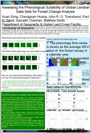
Multitemporal Analysis of Landsat Data to Determine Forest Age Classes for the Mississippi Statewide
| PowerPoint PPT presentation | free to view
Satella: Tool for Peer to Peer Landsat Data Sharing. Bruno Margerin (SSAI) ... Bruno Margerin: bruno@turbodog.gsfc.nasa.gov. John Owens: jowens@umd.edu ...
| PowerPoint PPT presentation | free to view
Improvements in Landsat Pathfinder Methods for Monitoring Tropical Deforestation and Their Extension
| PowerPoint PPT presentation | free to view
Curtis Woodcock. Geography, Boston University. Definitions. Landsat-Class 100m, multispectral, global systematic coverage. VHS (very high spatial) - Class ...
| PowerPoint PPT presentation | free to download
Continuity processing seeks to meld diverse remote sensing sources into a ... and carbon science communities to tailor processing to meet science needs ...
| PowerPoint PPT presentation | free to view
... ha) is defined in the study as a biomass of growing stock trees greater than 2.5 ... Topography: flat to rolling (elevation from 232 to 459 m) ...
| PowerPoint PPT presentation | free to download
How can scientists share data easily ? we need a way let data users know - who has ... Success of Napster/Gnutella music file sharing networks illustrate people ...
| PowerPoint PPT presentation | free to view
One Tree Hill. Three Kings. Mt. Albert. Mt. Roskill. Mt. St. John. Te ... One Tree Hill erupted about 20,000 years. ago. It stands 183 meters high. Red arrows ...
| PowerPoint PPT presentation | free to view
Automatic spectral rulebased preliminary mapping of calibrated Landsat TM and ETM images
| PowerPoint PPT presentation | free to view
One 15m-resolution panchromatic band. Band 8 ( = 0.52-0.90 m) 13, ... Band 8 (High-Resolution Panchromatic Band) Written to up to three segment files due to size ...
| PowerPoint PPT presentation | free to download
Vegetation phenology is a major consideration in acquiring satellite ... This makes the GeoCover imagery set ideal for land cover mapping and change detection. Hanoi ...
| PowerPoint PPT presentation | free to download
Assessing Land Cover Status and Change using Historical Landsat Data
| PowerPoint PPT presentation | free to view
Long Term Radiometric Calibration: Can We Extend Consistent Calibration ... reference points (Highway intersection, runway edges, buildings, etc) on each ...
| PowerPoint PPT presentation | free to view
... for burned areas detection on Paran Medio Flooding Valley in Argentina. ... on the islands belonging to the Paran River Flooding Valley to obtain soft ...
| PowerPoint PPT presentation | free to view
Provides more flexibility to offerors and the USGS/EDC in negotiating for the ... Description Document for MIT/LL Services replaces the LDCM Catalog ...
| PowerPoint PPT presentation | free to view
In these works, locust monitoring was conducted through its habitat' ... supervised classification for grasshopper habitat on TM image was ... Habitat element ...
| PowerPoint PPT presentation | free to view
Improving Automated Detection of Forest Cover Change for Large Areas using Landsat Data
| PowerPoint PPT presentation | free to view
Landsat bands 5, 4, 3 (R, G, B) for part of St. John, USVI ... St. Thomas (Mg/ha) Biomass on largely protected St. John (Mg/ha) Forest type ...
| PowerPoint PPT presentation | free to view


