Landforms PowerPoint PPT Presentations
All Time
Recommended
Landforms Around the World
| PowerPoint PPT presentation | free to view
Landforms Types of Landforms 1. Mountain 6. Lake 2. Valley 7. Ocean 3. Plain 8. Coast 4. Plateau 9. Desert 5. Island 10.
| PowerPoint PPT presentation | free to view
LANDFORMS Terms and Picture package Social Studies 8 Landform Dictionary Activity Using the provided worksheet and terms, you are going to create your very own ...
| PowerPoint PPT presentation | free to view
landforms of our world
| PowerPoint PPT presentation | free to download
Landforms Natural Features on ... A river is a stream of water that flows across the land. ... or as small as a pond. Geologists study how landforms are created, ...
| PowerPoint PPT presentation | free to view
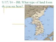
... Notes about Earth Layers and Axis 9/15 : BR, Notes about Earth Crust and Continental Drift 9/16: (today) BR, Landform Notes Landforms Project ...
| PowerPoint PPT presentation | free to download
Landforms Landforms Archipelago Ex. Islands of Japan Bay Ex: San Francisco Bay or Cape Town, South Africa Butte Ex. Merrick Butte in Monument Valley, Arizona Canyon ...
| PowerPoint PPT presentation | free to view
Landforms What are landforms? are natural physical features of the earth s surface. 2 Types of forces act on the earth to create landforms: Erosional Elements ...
| PowerPoint PPT presentation | free to download
Title: No Slide Title Author: Grant County High School Last modified by: tvaughn Created Date: 8/19/1998 5:45:48 PM Document presentation format: On-screen Show
| PowerPoint PPT presentation | free to download
Landforms 3.7B; 4.7B; 5.7B Deposition Rock particles that are picked up and transported during erosion will ultimately be deposited somewhere else.
| PowerPoint PPT presentation | free to view
Landforms and Climate Zones Mountains Hills Plains Plateaus Polar Temperate Tropical Landforms and Climate Zones Mountains Hills Plains Plateaus Polar Temperate ...
| PowerPoint PPT presentation | free to download
... erosion - ocean. Canyons formed by water erosion river. OR by wind erosion ... formed by wind erosion ... Wind and water erosion. Weathering. Ice and ...
| PowerPoint PPT presentation | free to download
Definition: body of salt water larger than a sea The Earth contains 5 oceans: the Arctic, Atlantic, Indian, Pacific, and Southern. The ocean s water covers over 70% ...
| PowerPoint PPT presentation | free to view
Lake. A body of water surrounded by land. Most lakes have fresh water. Lake Lanier ... of land that was once mostly level. Many plateaus are cut deeply by ...
| PowerPoint PPT presentation | free to download
The Nile River which is in Africa is the longest river in the world. ... What is the largest island? There are five main kinds of islands and ...
| PowerPoint PPT presentation | free to view
Title: Slide 1 Author: Connie Campbell Last modified by: Troup County School System Created Date: 2/23/2004 6:46:03 PM Document presentation format
| PowerPoint PPT presentation | free to download
Mountains. Canyons. Glaciers. Glaciers ... Young mountains can have steep sides and pointed peaks. Quiz. Deserts ... Valleys are often located between two mountains. ...
| PowerPoint PPT presentation | free to download
Desert Mountains A ... Low in elevation Example: The Great Plains of central USA Plateau A plateau has 2 ... Atlantic Pacific Arctic Indian Oceans Rivers A river has ...
| PowerPoint PPT presentation | free to view
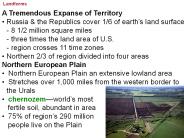
... French leader Napoleon Bonaparte conquers Europe Bonaparte invades Russia from Poland in ... Siberia is like U.S. Wild West - travel is dangerous, ...
| PowerPoint PPT presentation | free to download
LANDFORMS AND OCEANS Science Standard 5-3 The student will demonstrate an understanding of features, processes, and changes in Earth's land and oceans.
| PowerPoint PPT presentation | free to view
Volcanic Landforms Processes and Hazards
| PowerPoint PPT presentation | free to view
Geographic Landforms basin Area of land drained by a given river and its branches; area of land surrounded by lands of higher elevation. bay Part of a large body of ...
| PowerPoint PPT presentation | free to view
Tennessee Landforms There are many landforms in Tennessee. Landforms can affect the way we live and play. Let s take a tour of Tennessee Landforms
| PowerPoint PPT presentation | free to download
An area of land completely. surrounded by water. Archipelago. a group of many islands. Peninsula ... piece of land that extends into a body of water and is ...
| PowerPoint PPT presentation | free to view
Volcanic Landforms Landforms From Lava and Ash Rock and other materials formed from lava create a variety of landforms including shield volcanoes, composite volcanoes ...
| PowerPoint PPT presentation | free to download
Landforms. Mountains. Hills. Plains. Valleys. Plateaus. High, rocky land. 2. Steep sides ... Mountains. Rocky Mountains. http://www.nps.gov/romo ...
| PowerPoint PPT presentation | free to view
Landforms 5.3-1 Explain how natural processes (including weathering, erosion, deposition, lands, volcanic eruptions, earthquakes, and floods) affect Earth s ...
| PowerPoint PPT presentation | free to view
Title: PowerPoint Presentation Author: Melvin Chng Last modified by: Melvin Chng Created Date: 7/26/2002 5:41:16 AM Document presentation format: On-screen Show
| PowerPoint PPT presentation | free to download
Periglacial landforms You should be able to describe and explain the formation of various periglacial landforms including Tors Blockfields Pingos Ice wedges Patterned ...
| PowerPoint PPT presentation | free to download
A good example of a peninsula is FLORIDA. REVIEW OF LANDFORMS ... Florida Picture: http://fcit.usf.edu/florida/maps/clipart/colorpic/48.htm. CREATIVE ACTIVITY ...
| PowerPoint PPT presentation | free to view
Like it is here in Death Valley California. There can be deep canyons like this. This Badwater alluvial fan in ... This is a worn down mesa called a butte. ...
| PowerPoint PPT presentation | free to view
Landforming Processes: Diastrophism The Relationship Between Folding and Faulting Consider also that ductile rocks may eventually fracture under high stress.
| PowerPoint PPT presentation | free to download
Volcano ... A place where you can find one is in Alaska. Hills ... Our favorite landform is a volcano. ...
| PowerPoint PPT presentation | free to view
Depositional Landforms Braided Streams A braided stream has islands/eyots of deposited material within the channel. The deposited material causes small channels that ...
| PowerPoint PPT presentation | free to download
Glaciers * * * * * * * * * * * * * * * * * * * * * * * * * * Eolian Erosional Landforms Abrasion wind blows sand along a surface to polish & abrade it Ventifacts ...
| PowerPoint PPT presentation | free to download
Two classes of igneous rocks. intrusive: formed inside the Earth ... Grand Tetons, WY. Basin and Range. Horst and graben ('hill' and 'grave' ...
| PowerPoint PPT presentation | free to view
Constructive and Destructive Forces that effect Earth s Landforms Weathering Weathering is the process that breaks down rocks at or near the surface of the earth.
| PowerPoint PPT presentation | free to download
Insert at LEAST TWO more s (click on Insert New Slide) ... What is the definition of your landform? Where is the landform located. Give an example. ...
| PowerPoint PPT presentation | free to view
Title: PowerPoint Presentation Author: Jefferson County Schools Last modified by: mfninob Created Date: 6/3/2004 2:58:32 PM Document presentation format
| PowerPoint PPT presentation | free to download
Landforms and Weathering Grade 5 Goal 2 EOG Tested Varves Alternating thin layers of light-colored and dark colored finer grained sediment are called varves, this is ...
| PowerPoint PPT presentation | free to download
Title: PowerPoint Presentation Author: megan rucker Last modified by: HRW Created Date: 5/16/2002 4:45:22 PM Document presentation format: On-screen Show
| PowerPoint PPT presentation | free to download
Eighty percent of crop yield loss within a field and within years can often be attributed to variable moisture availability, both too little and too much. Excess moisture also plays havoc with machinery operations and farm efficiency. By improving surface drainage and promoting more uniform infiltration, Optimum Surface Landforming has shown to provide a range of profit boosting benefits at a relatively low cost per hectare resulting in a high Return On Investment (ROI).
| PowerPoint PPT presentation | free to download
Title: Volcanoes and Volcanic Landforms Author: Mark Reinhold Last modified by: ksu Created Date: 7/15/2002 3:53:29 PM Document presentation format
| PowerPoint PPT presentation | free to download
http://www.nps.gov/romo/downloads_photos/photos.html. Grand Tetons. Raised part of the earth's surface. Sloping sides. 3. Lower than a mountain ...
| PowerPoint PPT presentation | free to view
They are in Queensland, Adriatic Sea, and Tonga. ... Are made up of brackish water. Where the river meets the sea. By: Tate Davenport. Did you guess? ...
| PowerPoint PPT presentation | free to view
Title: Slide 1 Author: Lawrence McGlinn Last modified by: COAS Created Date: 12/28/2006 2:09:16 AM Document presentation format: On-screen Show (4:3)
| PowerPoint PPT presentation | free to download
Coastal Landforms Erosional and depositional landforms Defining the Coastal Area / Zone The coastline is the line where the land and sea meet. The coast is a zone or ...
| PowerPoint PPT presentation | free to view
GLACIAL LANDFORMS SHAPE MOUNTAINS Ice Plumbing Erosional Depositional GLACIAL LANDFORMS SHAPE MOUNTAINS Ice Plumbing Erosional Depositional MORAINES: OVERVIEW Medial ...
| PowerPoint PPT presentation | free to view
Volcanoes: eruptive style and associated landforms Volcanic Explosivity Index Volume of material How high the eruption column reached How long the main eruption ...
| PowerPoint PPT presentation | free to download
Volcanic Landforms Types of Volcanoes Cinder Cone Shield Composite Cinder Cone Volcanoes Mainly explosive eruptions Produced from ash, cinders and bombs (pyroclastic ...
| PowerPoint PPT presentation | free to view
Choose a category. You will be given the answer. You must give the correct question. Click to begin. $100 The shape of a canyon formed by a glacier. $100 What is U ...
| PowerPoint PPT presentation | free to download
Title: General Author: GIS Last modified by: Joe Created Date: 6/2/1995 10:19:30 PM Document presentation format: Overhead Other titles: Times New Roman Arial Arial ...
| PowerPoint PPT presentation | free to download
Glaciers and Glacial Landforms Alpine Glaciers - developed on mountain peaks and valleys. Cirque glacier - small glacier occupying valley head.
| PowerPoint PPT presentation | free to download
Waterfalls. Small, high waterfalls are common features of alpine mountains carved by glacial ... However, large waterfalls on major rivers are comparatively rare. ...
| PowerPoint PPT presentation | free to download
LANDFORMS AND OCEANS Science Standard 5-3 The student will demonstrate an understanding of features, processes, and changes in Earth's land and oceans.
| PowerPoint PPT presentation | free to view
That one is called Death Valley. Volcano. A large mountain that sprays out a hot liquid. ... of ice that moves very slowly down a mountain or threw a valley. ...
| PowerPoint PPT presentation | free to view


