Geoid PowerPoint PPT Presentations
All Time
Recommended
Geocentric (ITRF96/GRS-80) New for G99SSS (vs. G96SSS) KMS98 altimetry ... Non-geocentric: NAD 83 -- NAVD 88. PICTURE OF 6169 GPSBMS. PICTURE OF GEOID99 ...
| PowerPoint PPT presentation | free to view
Convert height anomalies to geoid heights if needed N2ZETA. ... Table 1. The free-air gravity anomalies are shown in http://cct.gfy.ku.dk/geoidschool/nmfa.pdf ...
| PowerPoint PPT presentation | free to view
Gravity, Geoid and Heights
| PowerPoint PPT presentation | free to download
Data fusion for geoid computation numerical tests in Texas area (preliminary results) Yan Ming Wang & Xiaopeng Li National Geodetic Survey, NOAA, USA
| PowerPoint PPT presentation | free to download
Height from the geoid to the Earth's surface ... NESDIS : ORA : ORAD -- Satellite altimetry and oceanic gravity. November 13, 2000 ...
| PowerPoint PPT presentation | free to download
Gravity and the Geoid at NGS Dru A. Smith National Geodetic Survey Presented at the 2000 Geodetic Advisor Convocation Silver Spring, MD April 11, 2000
| PowerPoint PPT presentation | free to download
... Ellipsoidal height (24-48 hours GPS obs. time), OPUS project used for data ... Validation of marine geoid models in the North Aegean Sea using satellite ...
| PowerPoint PPT presentation | free to download
Geoid Modeling, GRAV-D and Height Mod ...
| PowerPoint PPT presentation | free to download
Composite Geoids. Gravimetric Geoid systematic misfit with benchmarks ... A, B, and 1st order GPS only. ABCRMH criteria for 1st, 2nd, and 3rd order leveling ...
| PowerPoint PPT presentation | free to download
Geoid (meters), from GRACE satellite data ... Free-Air Anomalies from ocean surface topography ... Is this gravity, free-air anomaly, or Bouger anomaly? ...
| PowerPoint PPT presentation | free to download
Applications of computational methods in spatial analysis ... research award winner, was investigating topological approaches to risk analysis ...
| PowerPoint PPT presentation | free to view
Gravity Field and the Geoid
| PowerPoint PPT presentation | free to view
Title: PowerPoint Presentation Author: GPO User Last modified by: Yan.Wang Created Date: 6/2/2005 1:13:57 PM Document presentation format: On-screen Show
| PowerPoint PPT presentation | free to download
Improved Covariance Modeling of Gravimetric, GPS, ... Research Geodesist. Abstract. Hybrid geoids are created from gravimetric geoids and GPS-derived ellipsoidal ...
| PowerPoint PPT presentation | free to view
Title: No Slide Title Author: rtravis Last modified by: Daniel Winester Created Date: 8/23/2000 6:41:53 PM Document presentation format: On-screen Show (4:3)
| PowerPoint PPT presentation | free to download
... D. Roman. National Geodetic Survey. NOAA. Montreal, Canada, May 17-21, 2004. Recent geoid ... in Banff, Alberta, Canada from July 31 - August ...
| PowerPoint PPT presentation | free to view
Gravity, Geoids, and Other Vertical Datums in the Puerto Rico/Virgin Islands Region ... From the National Geospatial-Intelligence Agency Website at: ...
| PowerPoint PPT presentation | free to download
Numerical aspects of the omission errors due to limited grid size in geoid computations Yan Ming Wang National Geodetic Survey, USA VII Hotine-Marussi Symposium
| PowerPoint PPT presentation | free to download
Geodetic Advisor Convocation. Silver Spring, MD. April 11, 2000. Topics of Discussion ... GTOPO30 (30 arc second) for Canada. NGSDEM99 (1 arc second) for PNW ...
| PowerPoint PPT presentation | free to view
GRACE provides monthly coefficients to degree and order 60 ... Could GRACE see it? Yellowstone National Park. From Christine Puskas and Wu-Lung Chang at U Utah ...
| PowerPoint PPT presentation | free to download
Physical geodesy: gravity, geoid '' with basics of airborne gravity
| PowerPoint PPT presentation | free to view
9/2/09. Recent Geoid Research at NGS. Dru A. Smith. 9/2/09. Status ... Combination of GPS/geoid/leveling. 9/2/09. Overall Status. Spherical DEM, Outer Zone: 95 ...
| PowerPoint PPT presentation | free to view
ELLIPSOIDAL CORRECTIONS TO GRAVIMETRIC GEOID COMPUTATIONS ... Spherical harmonic synthesis and analysis ... application of the coefficients even more so no ...
| PowerPoint PPT presentation | free to view
Q: So what's a 'geoid height' model? A: A model of the separation between a geoid or vertical datum ... maybe a brief GEOID 101 tutorial to cover the basics ...
| PowerPoint PPT presentation | free to download
all rely on approximations to the order of the square of the ... many can not be applied if the Stokes kernel is modified ... RECAPITULATION. Formulation (3/3) ...
| PowerPoint PPT presentation | free to view
... Models (e.g., USGG2009) and Conversion Surfaces using GPS on BM ... Conversion Surface model of systematic misfit derived from BM's in IDB ... 'Time ...
| PowerPoint PPT presentation | free to view
Improving data management is among the highest priority challenges facing NOAA ... Vision NOAA's GEO-IDE is envisioned as a 'system of systems' a framework ...
| PowerPoint PPT presentation | free to view
Airborne gravity '' A new data source for geoids
| PowerPoint PPT presentation | free to view
Reduce Loss of Life and Property from Disasters. Protect and Monitor our Ocean Resources ... XML Schemas, Spatial Databases (SQL), data formats (WMO, NetCDF, HDF, etc. ...
| PowerPoint PPT presentation | free to view
Improve weather forecasting. Reduce Loss of Life and Property from Disasters ... Grids, time-series, moving-sensor multi-dimensional, profiles, trajectories, ...
| PowerPoint PPT presentation | free to view
'NGS will publish all coordinates of defining points of the NSRS with an epoch ... Geodetic latitude, longitude and height. Scale, gravity, and orientation ...
| PowerPoint PPT presentation | free to view
Improving data management is among the highest priority challenges ... The fabric of the SOA is built upon standards for: discovery (e.g. CF, FGDC, ISO, SQL) ...
| PowerPoint PPT presentation | free to view
OCTAS primary study area, Fram Strait between Greenland and Svalbard ... MSS in the Fram Strait, retracking. Geoid computation. Gravity compiling, error screening ...
| PowerPoint PPT presentation | free to view
... Regional Geoid by optimal Combination of GRACE Gravity Model and Surface Gravity Data ... Remove-restore (R-R) Surface gravity data used in the local integral ...
| PowerPoint PPT presentation | free to download
... the Earth which best fits to global mean sea level in a least squares sense. ... Define the vertical datum reference surface as being the geoid ...
| PowerPoint PPT presentation | free to view
CALIBRATION OF GEOID MODELS IN COLLI ALBANI AREA (ROME, ITALY) ... Geoid models used to estimate orthometric heights of points of known ellipsoidal ...
| PowerPoint PPT presentation | free to view
Issue: GEO-IDE (from DAARWG, 12/2006) ... Undersecretary for Oceans and Atmosphere. DMIT. Data Management Integration Team. NOSC ...
| PowerPoint PPT presentation | free to view
... satellite altimetry, global tracking networks, GNSS, dedicated gravity satellite ... The new Height Reference System in Canada will be based on a geoid model, like ...
| PowerPoint PPT presentation | free to view
The European Geoid (Denker and Torge, 1998): the European Gravimetric Geoid 1997 (EGG97) ... The European Gravimetric Quasigeoid EGG97. ...
| PowerPoint PPT presentation | free to view
Application of World Geoid Model. Fly Levelling Survey by Optical Level. Development of Local Geoid Model. Temporary Control Point (Northing, Easting, RL) ...
| PowerPoint PPT presentation | free to view
Geoid Equipotential surface. based on ... It happens to fit the geoid in their area particularly well. ... direction of gravity from vertical datum at geoid. ...
| PowerPoint PPT presentation | free to view
Map Projections 3D-2D Transformation Process Geoid Earth as Sphere Most commonly used in cartography Primarily for small-scale maps Earth as Sphere Size 3D-2D ...
| PowerPoint PPT presentation | free to download
where NP equals the geoid height of P. H. H = Orthometric Height (NAVD ... Uncertainty Due to the Geoid Model. For GEOID03, sNp 2.4 cm. For GEOID09, sNp 1.5 cm ...
| PowerPoint PPT presentation | free to view
Geoid. Gravimetric. Gravity anomaly: ?g = gobs-?. Mean Sea Level. Models of the Earth ... Geoid height, N = distance along ellipsoid normal (Q to P0) ...
| PowerPoint PPT presentation | free to download
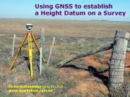
Using GNSS to establish a Height Datum on a Survey Richard Stanaway QUICKCLOSE www.quickclose.com.au Overview of GNSS Heighting Height systems and Geoid models AHD ...
| PowerPoint PPT presentation | free to download
Non-hydrostatic geoid anomalies ... Dynamic Model Geoid. Deflection of density discontinuities. Correct Sign! Post-glacial rebound ...
| PowerPoint PPT presentation | free to view
Least Squares Collocation. The optimum estimate using geoid height or geoid slopes is: ... 2D FFT Interpolation using collocation. ...
| PowerPoint PPT presentation | free to view
NAD 83(2011) epoch 2010.00 USGG12 (gravimetric geoid ... NGS will develop standards and specifications on how to best blend the controlled leveling survey with the ...
| PowerPoint PPT presentation | free to download
Geoid Models ... Geoid models attempt to represent the surface of the entire earth over both land ... The WGS-84 Geoid defines geoid heights for the entire earth. ...
| PowerPoint PPT presentation | free to view
Geoid. Ellipsoid. Map ... Geoid. Ellipsoid. Enlarged Local Ellipsoid Surface. Local Map ... (land and water datums, geoid models, ellipsoids, etc) ...
| PowerPoint PPT presentation | free to view
geoid. MSSH. dyn. topog. oceanography. by taking advantage of. signal ... geoid = MSSH - dyn topo. blue error spectrum. Joint solution of. GSTM / SPP 1257 ...
| PowerPoint PPT presentation | free to view
GEOID. Heterogeny distribution of the masses in the upper layers of the Earth. Geoid. Gravity corrected by the theorical one. Gravity anomaly - External measurement ...
| PowerPoint PPT presentation | free to download
Gravity, Geoid and Space Missions GGSM2004, Porto, Portugal, ... Gravity, Geoid, and Ocean Circulation as Inferred from Altimetry, Mar del Plata, Argentina. ...
| PowerPoint PPT presentation | free to view
Geoid is a surface of constant gravity. Topographic surface. Ellipsoid. Sea surface ... Elevation is measured from the Geoid. Standard Vertical Geodetic Datum ...
| PowerPoint PPT presentation | free to view
... an oblate ellipsoid or geoid (which simply means 'earth ... This shape is known as an ellipsoid or more properly, geoid (earth-like). From Matt Rosenberg ...
| PowerPoint PPT presentation | free to view
A better approximation is the geoid (height) which measures the variation of ... On land the geoid is the height the water in a canal would have if it were ...
| PowerPoint PPT presentation | free to view


