
Digital Elevation Models PowerPoint PPT Presentations
All Time
Recommended

Anaglyph - Malaspina. DEM products. Elevation 0- ? 16 bit (signed) Shaded relief 0-255 ... Visual: Anaglyphs and 3D perspectives. DEM quality and errors ...
| PowerPoint PPT presentation | free to view

Gale Creek Watershed in Washington County, Oregon Prepared by: Pamela Monnette ES 492: GIS Applications in Earth Science Hydrologic Summary The watershed has 10 ...
| PowerPoint PPT presentation | free to download

stereo photos - contour lines - digitised lines - convert ... Tanaka relief contours not a common software option. Slope and aspect layers (GIS analysis) ...
| PowerPoint PPT presentation | free to view
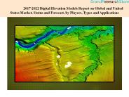
This report studies the Digital Elevation Models market status and outlook of global and United States, from angles of players, regions, product types and end industries; this report analyzes the top players in global and United States market, and splits the Digital Elevation Models market by product type and applications/end industries. VISIT HERE @ https://www.grandresearchstore.com/ict-and-media/2017-2022-digital-elevation-models-report-on-global-and-united-states-market-status-and-forecast-by-players-types-and-applications0D
| PowerPoint PPT presentation | free to download

Terrain Synthesis by Digital Elevation Models
| PowerPoint PPT presentation | free to download

GIS- Geographic Information System (????? ???? ????????)- ????? ??????? ??????, ... The three values of each vertex are not shown. ???? ?????-Hierarchical models ...
| PowerPoint PPT presentation | free to view
Raster calculation of wetness index. Raster calculation of TOPMODEL runoff ... Relative wetness at a point and depth to water table is determined by comparing ...
| PowerPoint PPT presentation | free to download

... random sample of points is taken from the large scale map (one point ... from the USGS Middle East Oil Resources Survey geologic map of the Arabian Pennisula. ...
| PowerPoint PPT presentation | free to view

TINs and Surface Analysis. Interpolation of z values ... What TINs are Really Good At. Tins are really good at 3D display of real world surfaces ...
| PowerPoint PPT presentation | free to view

Validate image quality & overlap by inspection. Found good pairs for 4 sites ... Limited to single horizontal baseline at a time. Fourier transform techniques ...
| PowerPoint PPT presentation | free to view

... park based on detailed morphologic features, and indicating that the nearby ... active fault in northern Taiwan using airborne LiDAR data: detailed geomorphic ...
| PowerPoint PPT presentation | free to view

Digital services and solutions play a pivotal role in the era of digital transformation, enabling businesses to evolve and thrive in an increasingly digital world.
| PowerPoint PPT presentation | free to download

A Digital Elevation Model is a bare-earth raster grid referenced to a vertical datum. The DEM can even be obtained from stereo digital aerial imagery at various resolutions, depending on the quality and scale of the imagery.
| PowerPoint PPT presentation | free to download

Digital Pundit is one of the best digital marketing course in Ahmedabad, our digital marketing program structured comes with a 25 modules in a way that will cover SEM Course, SEO course, Email Marketing, Affiliate marketing, Social media marketing and all digital medium marketing techniques through online marketing.
| PowerPoint PPT presentation | free to download

In today's rapidly evolving digital landscape, businesses are constantly seeking innovative strategies to thrive and stay ahead of the competition. Leveraging the expertise of a reputable digital marketing agency like DignitySoft is essential for achieving sustainable growth and success. With a focus on cutting-edge digital business strategies, DignitySoft empowers businesses to navigate the complexities of the online world and maximize their digital presence.
| PowerPoint PPT presentation | free to download

Digital Elevation Model Based Watershed and Stream Network Delineation
| PowerPoint PPT presentation | free to download

... Priority, and the USGS-USFS-BLM Management Oversight Committee, among others. ... NDEP Steering Committee and the Project Coordination Subcommittee held at BLM on ...
| PowerPoint PPT presentation | free to view

Digital Elevation Model Based Watershed and Stream Network Delineation
| PowerPoint PPT presentation | free to download

A Digital Elevation Model (DEM) is a representation of the bare ground topographic surface of the Earth. excluding trees, buildings, and other surface objects. It is a 3D computer graphics representation of elevated data to represent terrain. DEMs are often used in geographic information systems and are the basis for digitally-produced relief maps.
| PowerPoint PPT presentation | free to download

MNDEM: Digital Data for a Digital Age.
| PowerPoint PPT presentation | free to view

The global digital elevation model market was valued at ~US$ 942 Mn in 2018 and will exhibit a CAGR of ~16% during the forecast period of 2019-2029.
| PowerPoint PPT presentation | free to download

Digital Terrain Modeling, Mapping and Distribution of Geospatial Data in USA
| PowerPoint PPT presentation | free to view

Continuous fields in GIS only spatially discretized (TIN, raster) ... Types of raster maps. Nominal data like land use (forest, grassland, farmland, ...
| PowerPoint PPT presentation | free to view

Digital Terrain Analysis and Simulation Modeling to Assess Spatial ... J.C. Gallant ... Gallant, J.C. 1999. TERRAE: A new element network tool for ...
| PowerPoint PPT presentation | free to download

J Ram n Arrowsmith Department of Geological Sciences, Arizona State University, ... to user and communicates with the Manager program, relaying relevant information ...
| PowerPoint PPT presentation | free to download

Improvement of Digital Elevation Model of Greenland Ice Sheet by Using ICESat Satellite Laser Altimetry Data Bea Csatho, Taehun Yoon and Yushin Ahn
| PowerPoint PPT presentation | free to download

System architecture when hard-limiter replaced with a sigmoid nonlinearity: As the q0 of sigmoid function. approaches zero; the soft-limiter. approaches the hard ...
| PowerPoint PPT presentation | free to view

Search interpolation method to construct the digital model, based on a regular mesh. ... ZI = GRIDDATA(X,Y,Z,XI,YI,METHOD) where METHOD is one of: ...
| PowerPoint PPT presentation | free to download

The Modular Modeling System (MMS): A Toolbox for Water- and Environmental-Resources Modeling and Management G.H. Leavesley, S.L. Markstrom, R.J. Viger, and L.E. Hay
| PowerPoint PPT presentation | free to view

Games are dominated by the ultimate goal of win-lose or other similar binary ... three peculiar symbols randomly provided by the machine in the way he thinks fit; ...
| PowerPoint PPT presentation | free to view

Comparison of grain size data against the SedFlux prediction the uppermost two bins (0 20 cm) ... SedFlux predicts the grain size well within the range of the ...
| PowerPoint PPT presentation | free to view

Introduction to GIS Modeling Week 7 GIS Modeling Examples GEOG 3110 University of Denver Winter, 200
| PowerPoint PPT presentation | free to view

Digital elevation model overlay of the Columbia Icefield. The Athabasca Glacier is located by the red arrow. 1920 1924 1935 1938 & 1974 (Stereo images) 1949 1974 Wide ...
| PowerPoint PPT presentation | free to view

... were created by scanning and digitalizing the existing ... 3D image for Motorway on the Corridor VC with the Ortho Photo and the Digital Topographic DATA ...
| PowerPoint PPT presentation | free to view

... Based Method for Removing 'Cornrow' Artifacts from Digital Elevation Map Data ... reduce the cornrows more noticeably, but is still only of marginal value. ...
| PowerPoint PPT presentation | free to view

LO1: Understand concept of data models. What is a data model? Why ... LO1: Understand concept of data models. LO2 : Understand the models of spatial information ...
| PowerPoint PPT presentation | free to download

Chapter 2: Spatial Concepts and Data Models 2.1 Introduction 2.2 Models of Spatial Information 2.3 Three-Step Database Design 2.4 Extending ER with Spatial Concepts
| PowerPoint PPT presentation | free to download

Launch of 5G module, economic construction of infrastructure, and expansion of the telecommunication industry will be crucial in shaping the digital elevation model market through 2029. The global digital elevation model market is anticipated to reach over US$ 1 Bn in 2019, as indicated by FMI’s report. The growth of digital elevation model market will be spectacular, at a CAGR of 16%, during 2019 – 2029. In this report, the global digital elevation model market is tracked in terms of value, and is calibrated to obtain remarkable market share.

Digital Terrain Model (DTM) is a bare earth model that is generated using stereo pair of imageries. Such models become an integral part of topographic surveys. These models are also used to generate contour maps. Such models are the best depiction of slopes and aspects.
| PowerPoint PPT presentation | free to download
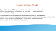
Digital Surface Model (DSM) represents the elevations of the reflective surfaces of trees, buildings, and other features elevated above the “Bare Earth”. It represents the earth’s surface and includes all objects on it.
| PowerPoint PPT presentation | free to download
Discover the Top Digital Marketing Companies that drive growth and engagement. Leverage expert strategies to enhance your online presence and boost ROI today
| PowerPoint PPT presentation | free to download

DCMS Network is a reliable and experienced provider of as-built services for residential, commercial, and industrial properties. Our team utilizes 3D scanning technology to create accurate floor plans, building surveys, site plans, BIM models, architectural models, construction models, and interior/ exterior elevation plans. We understand the importance of efficient service from the start, so our solutions are tailored to meet all materials and labor costs without sacrificing quality or detail.
| PowerPoint PPT presentation | free to download

Explore effective strategies and innovative approaches for mastering various restaurant business models. From traditional to digital, learn how to maximize your restaurant's potential and thrive in today's competitive market. Dive into our expert insights and elevate your restaurant business to new heights
| PowerPoint PPT presentation | free to download

Representations / Models
| PowerPoint PPT presentation | free to view

Corusview IT Services is a premier web development company renowned for delivering high-quality, reliable web, software, and mobile application development services. We cater to clients worldwide, ensuring they receive value for their investment through our unique service models tailored to the nature of their projects and individual preferences.
| PowerPoint PPT presentation | free to download

The JISC defines them as: By digital literacy we mean those capabilities which fit an individual for living, learning and working in a digital society: for example ...
| PowerPoint PPT presentation | free to download

Digital sataware technology byteahead has become web development company a part app developers near me of everything hire flutter developer we ios app devs do as a software developers human software company near me beings, software developers near me.
| PowerPoint PPT presentation | free to download

GIS Modeling Venkatesh Merwade, University of Texas at Austin Interdisciplinary aquatic modeling workshop, July 21, 2005 Overview GIS and data representation ...
| PowerPoint PPT presentation | free to view
Which of majority, centroid, or weighted are most similar to the others? ... Download, unzip, import, and display a quad that you are familiar with ...
| PowerPoint PPT presentation | free to download
Explore the transformative power of generative AI in our latest E42 Blog post, diving deep into its capabilities for enterprise-level process automation. From explaining the core principles of generative AI, to uncovering insights into the crucial role played by on-premises Large Language Models (LLMs) in facilitating secure and compliant digital transformations across industry verticals—the article also provides a glimpse into the future of AI, where multimodal enhancements and breakthroughs in bias mitigation promise to reshape the landscape of process automation.
| PowerPoint PPT presentation | free to download

SWReGAP Habitat Modeling
| PowerPoint PPT presentation | free to view

Topography & Hydrography. Digital Elevation Model (DEM) 30 m. USGS National Elevation Dataset ... National Hydrography Dataset. http://nhd.usgs.gov/data.html ...
| PowerPoint PPT presentation | free to view

Modeling Flood Hazards
| PowerPoint PPT presentation | free to view

Title: GIS Data Models Author: Preferred Customer Last modified by: BUU Created Date: 12/25/2003 6:54:27 PM Document presentation format: On-screen Show (4:3)
| PowerPoint PPT presentation | free to view

Still foggy about some aspects or have an immediate need for expert help? Don't wait- get in touch with our data management experts today! Let's unlock the power of models for your business together.
| PowerPoint PPT presentation | free to download