
Blueskyrains PowerPoint PPT Presentations
All Time
Recommended

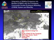
Migration of BlueSkyRAINS. to the Southeast. PNW Group: USFS: Sue Ferguson, Susan O'Neill ... with available emissions data from prescribed and agricultural burns. ...
| PowerPoint PPT presentation | free to view

ARIA (University of Arizona) University of Alabama in Huntsville (ITSC) ... Giovanni (GSFC Kempler) DECISIONS (Friedl) 4D AQS (Hoffman) RS for BlueskyRAINS ...
| PowerPoint PPT presentation | free to view

This illustrates how the linkage of a surface hydrology model to a biogeochemistry model can be used to predict the filtering action of soils & vegetation as ...
| PowerPoint PPT presentation | free to download

southern fire issues
| PowerPoint PPT presentation | free to download

FS Coarse Spatial Data. NEI Fire Emissions. BLM Fire History. Wildland Fire ... 2. Promote efficient flow of Earth science data from collection to end-use. ...
| PowerPoint PPT presentation | free to view
Calculate Fuel Consumption (CONSUME) ... Time, location, & size of fires determined from National Fire Occurrence ... Area of Burnsite [acre] 500 500. 0 - 0.25 ...
| PowerPoint PPT presentation | free to download

... kZZ1)) cRRZJJ )!!RBB kRRB11 {ZZ 9)) ccR99{{1!!{RR ... Z t{ t t t tt t ss{kks{{ RRZBBJ kckt ... cmPPJCmp0712*Hsb ...
| PowerPoint PPT presentation | free to download

Ponderosa Pine and Dry Douglas Fir Habitat Type. FR II. 0 to 35 years. mixed severity ... Ponderosa Pine AZ CC2. Southern Rough FR1CC3. Swamp Riparian FR1CC3 ...
| PowerPoint PPT presentation | free to view

to provide more effective execution of each agency's fire management program. ... Forest Fire Management Group. Paul de Mar. DHS. IRM Program Mgmt Office Judy Crosby ...
| PowerPoint PPT presentation | free to download

Recommend and demonstrate to the CEC approaches for the ... Color= Maroon. Size=2. Name. Settings. North American Commission. for Environmental Cooperation ...
| PowerPoint PPT presentation | free to view

Continuity and standards for training equipment, ... Photo Gallery. www.fs.fed.us. Photo and Video Gallery. www.firewise.org. Enhanced Media, Photos ...
| PowerPoint PPT presentation | free to view

Gary L. Achtemeier, Scott Goodrick. Yongqiang Liu. USDA Forest Service. Athens, GA. Thomas Mote. University of Georgia. Products. Class 1. ...
| PowerPoint PPT presentation | free to view