The Basics - PowerPoint PPT Presentation
1 / 1
Title: The Basics
1
A Probabilistic Nighttime Fog/Low Stratus
Detection Algorithm Corey G Calvert and Michael J
Pavolonis Cooperative Institute for
Meteorological Satellite Studies, Madison,
Wisconsin NOAA/NESDIS/Center for Satellite
Applications and Research Advanced Satellite
Product Branch, Madison Wisconsin
Fog Detection Approach
Reducing Noise from the Final Product
Small-Scale Detection Capabilities
- The Basics
- The aviation-based level of cloud ceiling under
which pilots must fly using instrument flight
rules (IFR) is approximately 300m. Therefore, the
goal for the GOES-R fog detection algorithm is to
create a fog mask to detect liquid stratus clouds
with bases lower than 300m. - The GOES-R fog detection algorithm builds off the
widely-used 3.9, 11?m channel combination for
nighttime detection of fog. - Strategy
- Nighttime fog is typically characterized by the
following traits - Cloud top is close to ground so the difference
between cloud temperature and surface temperature
is typically small - Relatively high spectral emissivity signal
(3.9,11?m) at night - Fog detection is based on finding small
differences between the radiometrically-derived
and NWP surface temperature along with strong
signals from the 3.9?m pseudo-emissivity. - Rather than using specific thresholds, training
data were used to create look-up tables (LUTs)
that assign a probability a pixel returning
certain spectral information is fog. - Cloud objects are created to group neighboring
pixels with similar radiometric signals. This
allows pixels within an object that have a
stronger signal (usually at the center) to
represent the entire object, which is useful for
small-scale fog events (see far right). - Algorithm
- The GOES-R fog detection algorithm can be broken
down into the following four steps
- Due to the spatial resolution (4km) of current
GOES satellites, detecting small-scale fog events
(e.g., within river valleys) is difficult. - The use of cloud objects can enhance the
detection ability by allowing pixels with a
stronger radiometric signal to represent pixels
within the object that may not have otherwise
been classified as fog. - This helps areas such as fog edges where the
signal may not be strong enough by itself to be
classified as fog, but has pixels in the same
object with a stronger signal that is more
representative. - Using the cloud objects can help to restore
detail that may be missed without increasing the
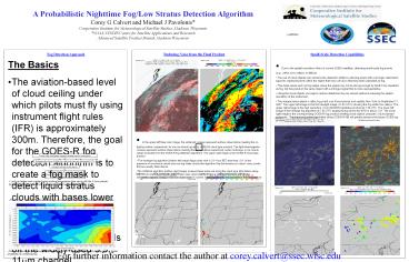
spatial resolution of the instrument. - The images below depict a valley fog event over
Pennsylvania and upstate New York on September
17, 2007. The upper left image is the first
daylight image (1145 UTC) showing the fog within
the valleys. The upper right image is the high
resolution (1 km) MODIS fog/stratus product at
738 UTC. The lower left image is the heritage
fog algorithm at 745 UTC displaying fog where
the BTD is below -2 K. The lower right image is
the corresponding GOES-R fog product creating
cloud objects using the 3.9?m pseudo-emissivity.
The improved spatial resolution of the GOES-R ABI
will greatly enhance the future GOES fog product.
MODIS Fog/Stratus Product
- In the upper left false color image, the
white/red crosses represent surface observations
meeting the no fog/fog criteria, respectively,
for non ice clouds (given by GOES-R cloud type
product). The light blue/magenta crosses
represent surface observations meeting the same
criteria respectively under multi-layer or ice
clouds (areas excluded from the GOES-R fog
detection algorithm). The upper right image is
the GOES-R cloud type product. - The heritage fog algorithm (bottom left image)
flags pixels with a 3.9-11?m BTD less than -2 K.
In the presence of convective clouds and non-fog
water clouds this algorithm has the tendency to
return noisy pixels that are usually false
alarms. - The GOES-R algorithm (bottom right image) screens
these areas out using the cloud type information
along with 3.9 ?m pseudo-emissivity data. It also
uses cloud objects to group neighboring pixels
with similar radiometric signals. Using a minimum
object size of 3 pixels, it can significantly
reduce noise in the final product.
- Look-up tables were created using surface
temperature bias along with the 3.9?m
pseudo-emissivity as predictors. Truth was
gleaned from surface observations. - The 3.9 ?m clear-sky surface emissivity was also
used to separate pixels with different surface
types (e.g., desert and forest) which might lead
to unrepresentative fog probability calculations. - Below is the fog LUT for the 3.9?m
pseudo-emissivity and surface temperature bias
for pixels with a clear-sky surface emissivity
between 0.90 and 0.95.
- Pixels with small surface temperature biases and
low 3.9 ?m pseudo-emissivity will be given a
higher probability of containing fog.
For further information contact the author at
corey.calvert_at_ssec.wisc.edu

