
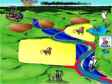
Geomorphic Analysis of the Yalobusha River System - PowerPoint PPT Presentation
Title:
Geomorphic Analysis of the Yalobusha River System
Description:
SNTEMP stream network water temperature. SIDO sediment intrusion & dissolved oxygen for redds. ... Salmonid Total Life Stages spawning-to-return spawners. – PowerPoint PPT presentation
Number of Views:311
Avg rating:3.0/5.0
Title: Geomorphic Analysis of the Yalobusha River System
1
Climate
Watershed Considerations
Farming Operations
Livestock
Hunting
Fishing
Family Recreation
Riparian Wetlands
Lakes Reservoirs
Gully Streambank Erosion
2
Where do the Pollutants Come From ?
3
AGNPS 2001 Watershed Evaluation Tool
GEM
WEATHER
4
AGNPS 2001
A partnering effort between the
Agricultural Research Service
and
Natural Resource Conservation Service
5
AGNPS 2001
- Input/Output?GIS support, TOPAZ, Visual Basic
Editor. - Climate? synthetic weather generator (GEM)
- AnnAGNPS?pollutant loadings (sediment
chemicals). - CONCEPTS?instream hydrodynamic processes.
- SNTEMP?stream network water temperature.
- SIDO?sediment intrusion dissolved oxygen for
redds. - Fry Emergence?mortality of salmonid fry.
- Salmonid Total Life Stages?spawning-to-return
spawners. - Salmonid Economics?net economic value of
salmonids in Pacific Northwest.
6
AnnAGNPS
- Annualized Agricultural Non-Point Source
Pollution computer model. - Continuous simulation, surface runoff pollutant
loading (PL) computer model. - Replacement for single-event AGNPS 5.0.
- Written in standard ANSI Fortran 95?no memory
limits.
7
AnnAGNPS operational modes
8
AnnAGNPS Uses NRCS Standards
Processes
Databases
- Weather Generation - GEM
- Runoff SCS Curve Number
- Peak Runoff TR-55
- Erosion - RUSLE
- Sediment Delivery - HUSLE
- Soils - NASIS
- Crops and Operations Set by NRCS State
Agronomists - HUWQ Databases Fertilizer, Pesticides, Animal
Wastes, etc.
9
AnnAGNPS the pollutant loading model
- Loadings by kind of pollutant
- Water?rainfall, snowmelt, irrigation, point
sources. - Sediment by particle size-class
- clay
- silt
- sand
- small aggregate and
- large aggregate.
- Chemicals (adsorbates solutes)
- nutrients?nitrogen, phosphorous, organic
carbon and - pesticides?any number, any kind.
10
AnnAGNPS the pollutant loading model
- Loadings by source of pollutant
- Cells (land areas)?water, sediment,
chemicals. - Feedlots?soluble nutrients.
- Gullies?sediment and chemicals.
- Point Sources?water and chemicals.
- Reaches?sediment yield chemical transport.
- Impoundments?sediment deposition.
11
AnnAGNPS major processes
gully
reach 1
reach 3
reach 2
feedlot
impoundment
reach 4
point source
watershed outlet
12
AnnAGNPS source accounting
10 of outlet sediment from gully
80 of outlet pest X from cell C
gully
reach 1
feedlot
Reach 3
reach 2
25 of outlet nitrogen from feedlot
impoundment
reach 4
point source
watershed outlet
13
AGNPS 2001 WATERSHED DESCRIPTION
14
Tucannon River cropland after thunderstorm
showing severe erosion
15
AnnAGNPS cell processes
- Weather?varies air temperatures, relative
humidity allows for variable rainfall between
cells. - Precipitation?rainfall, snowmelt, irrigation
runoff. - Soil moisture?precipitation, infiltration,
percolation, evapotranspiration. - Management operations?crops, rotation,
fertilizer, etc. - Irrigation?determines amount if automatic.
- Winter routines?snowpack, melt, frozen ground.
- Curve number?antecedent moisture condition
(current soil moisture). - Sediment yield?RUSLE or USLE.
16
AnnAGNPS cell processes (continued)
- Pesticides?application decay adsorbates
solutes. - Nutrients? application decay adsorbates
solutes. - Adds cell data to reach routing processes?if
runoff event occurs. - Adds cell data to simulation totals?if source
accounting requested. - Writes to a detailed stream network file?if this
output is requested.
17
AnnAGNPS cell processes (continued)
- Cells
- Foliage?relative growth, nutrients,
pesticides - Soil surface?residue, nutrients, pesticides
- Soil profile?moisture, frozen layers, residue,
nutrients, pesticides and - Operations?next operation rotation year.
- Feedlots
- Manure pack nutrients?soluble only
- Date of new operation?calendar date
- Amount left over from previous operation?non-dimen
sional ratio - Initial manure amount?mass and
- Daily change in manure production rate?mass per
unit time.
18
AnnAGNPS reach processes
- Water?rainfall, snowmelt, irrigation, point
sources. - Sediment Yield?by particle size-class source.
- Chemicals?nutrients, pesticides, organic
carbon. - Impoundments?sediment deposition.
19
USDA-ARS-NSL - CONCEPTS
- CONSERVATIONAL
- CHANNEL
- EROSION
- POLLUTANT
- TRANSPORT
- SYSTEM
20
USDA-ARS-NSL - CONCEPTS
- Integrates the impact on instream water quality
from upland and channel processes to provide a
comprehensive stream corridor evaluation tool.
21
USDA-ARS-NSL - CONCEPTS Impact of Channel
Incision
- A common and destructive mode of channel erosion
- Bed lowering causes banks to become unstable and
widening proceeds at a very rapid pace - Destabilizes the landscape and leads to severe
downstream impacts
22
USDA-ARS-NSL - CONCEPTS Characterization of
Streambank Erosion
- Bank-toe erosion
- Integration of hydraulic, sedimentologic, and
geo-technical processes influencing bank failure - Frequency of bank failure
- Incipient motion criteria for removal of failed
material
23
USDA-ARS-NSL - CONCEPTS Effect of riparian
vegetation on river restoration
- Flexible vegetation exert major influences on
flow resistance - Areas of enhanced deposition and erosion affect
channel geometry - Plant roots affect stream bank stability
- Woody debris influence flow channel hydraulics
and morphology
24
Upper middle Tucannon River showing loss of
riparian vegetation
25
Lower end Tucannon River showing lack of
riparian vegetation stream instability
26
Integration of Riparian Zones Within AGNPS 2001
27
Integration of Riparian Zones Within AGNPS 2001
28
Integration of Riparian Zones Within AGNPS 2001
29
Integration of Riparian Zones Within AGNPS 2001
30
Integration of Riparian Zones Within AGNPS 2001
31
Integration of Riparian Zones Within AGNPS 2001
32
(No Transcript)
33
AGNPS 2001 Web Site
- What is available at the web site
- web site instructions
- model(s) overviews
- technical feature abstracts
- reference input databases
- documentation
- executable files
- sample data sets
- profiles of management personnel, sponsors,
technical team, cooperating users - direct link to technical support and
- AGNPS version 5.0 (single-event) archives.
34
AGNPS 2001 Web Site (continued)
- Distribution via web site
- go to http//www.sedlab.olemiss.edu and
- then click on AGNPS 2001 Project or
- go directly to http//www.sedlab.olemiss.edu/A
GNPS.html
35
AGNPS 2001 Registered Users
Federal Government ARSEPANIHNRCS USCOEWORLDBAN
K USGS
Universities ClemsonColorado StateIowa
StateKansas StateMichigan StateOregon
StatePenn StateVirginia State Univ. of
FloridaUniv. of GeorgiaUniv. of KansasUniv. of
MassachusettsUniv. of MississippiUniv. of
MontanaUniv. of NebraskaUniv. of New
MexicoUniv. of North DakotaUniv. of North
TexasUniv. of TexasUniv. of Wisconsin
All 50 States
36
AGNPS 2001 Registered Users (cont.)
Foreign Countries (over 40) ArgentinaAustraliaAu
striaBelizeBoliviaBrazilCanadaChileChinaCol
umbia Czechoslovakia Ecuador EgyptFinland France
GermanyHungary
IndonesiaItalyJapanJordan KoreaLithuaniaMalay
sia Mexico New Zealand Netherlands
Philippines Poland Singapore Slovia South
Korea Spain Sweden
SwitzerlandSyriaTaiwan TanzaniaThailand Turkey
Venezuela Vietnam
37
AGNPS 2001 Interface Components
- What the User sees.
- Tools to automatically determine model parameters.
- Tools to modify and add parameters.
- Tools to visualize the watershed.
38
AGNPS 2001
39
Key Parameters Coordinates of Watershed
Outlet, Size of DEM
Outlet Location
Area shown ? 4 x 6 miles
40
Outlet Location
41
(No Transcript)
42
STREAM NETWORK ASSOCIATED SUBWATERSHEDS
43
DIGITIZED vs. GENERATED STREAM NETWORK
GENERATED STREAM NETWORK ASSOCIATED WITH 47
SUBWATERSHEDS
DIGITIZED STREAM NETWORK ASSOCIATED WITH BLUE
LINES ON 7.5 MINUTE USGS QUADS
44
1987 ACCUMULATED RUNOFF by CELL GOODWIN CREEK
0
22.48 in
45
1987 ACCUMULATED SEDIMENT by CELL GOODWIN CREEK
19.94 t/ac
46
1991 ACCUMULATED SEDIMENT by CELL GOODWIN CREEK
147.91 t/ac
47
(No Transcript)
48
(No Transcript)
49
(No Transcript)
50
(No Transcript)
51
(No Transcript)
52
(No Transcript)
53
(No Transcript)
54
(No Transcript)
55
(No Transcript)
56
(No Transcript)
57
(No Transcript)
58
FEBRUARY 18, 1991 SEDIMENT by CELL GOODWIN CREEK
- 9 inches of Rainfall
23.75 t/ac
59
NOVEMBER 30, 1991 RUNOFF by CELL GOODWIN CREEK -
10.4 inches of Rainfall
11.19 in
60
NOVEMBER 30, 1991 SEDIMENT by CELL GOODWIN CREEK
- 10.4 inches of Rainfall
Produces 5.5 of SY _at_ outlet
48.26 t/ac
61
(No Transcript)
62
(No Transcript)
63
(No Transcript)
64
(No Transcript)
65
(No Transcript)
66
(No Transcript)
67
(No Transcript)
Recommended
CrystalGraphics Presentations


![Global In-Car Entertainment (Infotainment) [ICE] System Market worth $14.4 Billion by 2016 PowerPoint PPT Presentation](https://s3.amazonaws.com/images.powershow.com/6264549.th0.jpg?_=20190305095)


