CASA POster Template - PowerPoint PPT Presentation
1 / 1
Title:
CASA POster Template
Description:
On the afternoon of May 29th, 2004, a long-lived supercell formed in Western ... Shortly after that time, an anticyclonic tornado formed north of Calumet, OK. F2. F2 ... – PowerPoint PPT presentation
Number of Views:27
Avg rating:3.0/5.0
Title: CASA POster Template
1
Detection of Hazardous Weather Phenomena Using
Data Assimilation Techniques
Robert Fritchie, Kelvin Droegemeier, Ming Xue,
Mingjing Tong, Elaine Godfrey School of
Meteorology and Center for Analysis and
Prediction of Storms University of Oklahoma,
Norman OK 73019
- Methodology
- Compare detections produced by automated
algorithms to features in assimilated analyses
that are generated using ensemble Kalman
filtering for an observed tornadic storm that
occurred on 29 May 2004 and that was observed at
reasonably close range by NEXRAD radar. - Examine sensitivities to a variety of variable
factors including, in WDSS-II, adaptable
parameters and in ensemble Kalman filtering, grid
spacing, data frequency, ensemble size, and
quantities assimilated. - Comparison between detected features, both
through WDSS-II and Data Assimilation, and
surveyed ground truth data will allow for a good
assessment of relative skill of hazardous weather
phenomena detection.
Overview Currently, the most widely used
paradigm for automated detection of tornadoes and
other hazardous weather events involves using
algorithms to identify patterns in Doppler radar
reflectivity and velocity data. One such radar
data-based system is the NSSL Warning Decision
Support System Integrated Information
(WDSS-II) One limitation is that new detection
algorithms must be created, or existing ones
adapted, each time a new observation system is
deployed. A tornado/parent mesocyclone will look
very different when viewed by a WSR-88D with a
gate size of 1km, as supposed to a mobile doppler
radar with a gate size of 50m. Another
limitation is that such algorithms operate
principally on data directly measured by the
sensor (radial velocity and reflectivity) and
thus do not make use of fine-scale fields that
are potentially available to them (e.g., pressure
deviations and temperature fields within storms).
An alternative approach involves using advanced
data assimilation and retrieval techniques,
applied to all available observations
especially those collected at fine scales by
Doppler radar to generate dynamically
consistent, 3D gridded analyses of all key
observed and unobserved meteorological quantities
to which detection tools can be applied. The
potential advantages include the ability to
interrogate quantities not available from radar
data alone and the use of geometrically simple 3D
grids. The most important advantage, however, is
that the detection tools developed for these
gridded analyses do not depend upon the observing
platforms characteristics, and thus do not have
to be changed when new data sources are added
(e.g., new types of radars).
Results
- 40-member ensemble of a square-root Kalman
filter - The filter uses observations from the KTLX radar
of the May 29th case - Assimilation was performed every 5 minutes (each
volume scan) for a 1 hour period - Built the storm to a physically consistent
gridded set that closely resembles the actual
storm itself - The analysis grid, depicted in figure 1, is a
180km x 120km x 16km block, with horizontal grid
spacing of 1 kilometer and stretched vertical
grid spacing with a minimum of 100 meters. - The analysis ends at 0100UTC, or 8pm CDT.
Shortly after that time, an anticyclonic tornado
formed north of Calumet, OK.
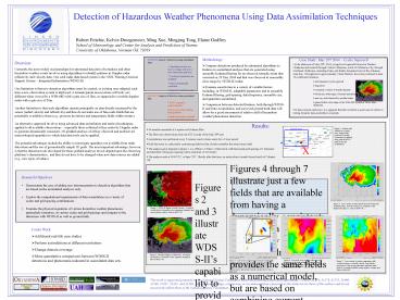
- Figures 4 through 7 illustrate just a few fields
that are available from having a dynamically
consistent gridded data set produced by a Kalman
filter. A Kalman filter provides the same fields
as a numerical model, but are based on combining
current observations from the radar with model
physics in an optimal fashion. Highlighted
results - Reflectivity derived from the assimilation
closely resembles that displayed in WDSS-II. - Several areas of intense vorticity maxima and
minima exist, but only one is associated with a
strong updraft. - A relative minimum in pressure also indicates a
rotating updraft. - Baroclinic zones, associated with mini-fronts
generated by the storm, also help to identify the
greatest risk of high winds and tornadoes at
their intersection.
Figures 2 and 3 illustrate WDSS-IIs capability
to provide forecasters with information that
supports the warning process. However, there are
no dynamics keeping observations physically
consistent and filling in the areas between radar
scans. Additionally, multiple tornadic vortex
signatures are detected, and additional retrieved
fields would help to narrow down which are true
concerns.
Figure 4 Cross-section of radar reflectivity
derived from the assimilated data. Note the
structure as compared to that displayed in figure
3. Time is 0100 UTC.
Figure 2 WDSS-II display of radial velocity.
Overlayed are detections of tornadic vortex
signatures (triangles) and mesocyclones
(circles). Time is 0102 UTC.
- Future Work
- Additional real-life case studies
- Perform assimilations at different resolutions
- Change domain coverage
- More quantitative comparisons between WDSS-II
detections and phenomena indicated in assimilated
data sets.
Figure 3 WDSS-II display of reflectivity.
Overlayed are detections of tornadic vortex
signatures (triangles). Time is 0102 UTC.
Figure 6 Low-level cross-section of pressure
with. Placement of the local minimum in pressure
is in agreement with placement of the main
anticyclonic updraft. Time is 0100 UTC.
Figure 5 Low-level cross-section of vertical
vorticity with overlaid contours of strong
positive vertical velocities (updrafts). Note the
strong updraft is associated with negative
vorticity, indicating a anti-cyclone. Several
minutes later a anticyclonic tornado touched
down. Time is 0100 UTC.
Figure 7 Cross-section of surface temperature
with overlaid contours of vertical vorticity.
Note that the intersection of the strong
temperature gradients (mini-fronts) is associated
with the strong negative vorticity area. Time is
0100 UTC.
This work is supported primarily by the National
Science Foundation under the following
cooperative agreements ATM03-31574, 31578,
31579, 31480, 31586, 31587, 31591, and 31594. Any
opinions, findings, conclusions, or
recommendations expressed in this material are
those of the authors and do not necessarily
reflect those of the National Science Foundation.


