Using Caris Notebook to Streamlining NOAAs Hydrographic Survey Processing - PowerPoint PPT Presentation
1 / 20
Title: Using Caris Notebook to Streamlining NOAAs Hydrographic Survey Processing
1
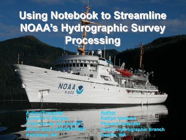
Using Notebook to Streamline NOAAs Hydrographic
Survey Processing
Author/Presenter Lynnette V. Morgan Chief Survey
Technician NOAA Ship FAIRWEATHER Ketchikan, AK
Author Kaitlyn VanSant Physical
Scientist Pacific Hydrographic Branch Seattle,
WA
2
Streamlining the Process
- NOAA Hydrographers are required to verify and
revise the depiction of shoreline portrayed on
nautical charts - H-Cell implemented by processing branches to
expedite the application of new survey data to
the ENC - Retaining the positional integrity of the data
collected in the field and producing the end
product early in the process to obtain as much
S-57 attribution while viewing the features in
the field
3
Initial Goals of the Project
- Reduce ping-to-chart time
- Deliver a field product to the Office of Coast
Survey which most easily enables the revision of
ENC feature object information - Display both acquired and reference data in an
editable form in Notebook, with full S-57
attribution - Minimize data conversions
4
(No Transcript)
5
Pre-Acquisition
- Mapinfo
- Numerous source files of various formats reviewed
compiled for field verification - GeoTiff image (TIF/TFW) produced from source data
- GPS PathFinder
- (for use in Trimble TerraSync software)
- Configuration parameters setup in a config file
- Data Dictionary produced
- Trimble TerraSync
- GeoTiff image imported into software for display
6
Acquisition
- Trimble TerraSync
- Data collection
- User defined data dictionary
- Can be programmed to attribute in S-57
- Allows for in-Field S-57 attribution
- Challenges
- Does not display .000
- Only one background file can be viewed at time
7
Acquisition TerraSync Display
8
Acquisition
9
Acquisition TerraSync In field S57
Attribution
Acquisition Processing Transition
- TerraSync produces a .ssf file
- GPS Pathfinder processes the .ssf file to
create shape files separated by S-57 object type - Pydro generic data parser used to import shape
files
10
Processing Pydro
- Tide Correction via
CARIS HIPS - - Pydro creates PVDL in HDCS_Data
- S-57 attribution capability, (object type can
be changed) - Feature Management
- Automatic report functions
- Export of XML to CARIS
Notebook - Pydro is a NOAA in house software program
11
Processing CARIS HIPS Tide Correction
12
Processing CARIS Notebook
- Import of tide corrected managed features
from Pydro XML files - Import of source data via OIU
- Creation of line/area features
- Modification of source data, attribution and
geographic extents - Review of multibeam BASE surfaces shoreline
features simultaneously - Deliverables produced - .hob format containing
S-57 attributed features for H-cell production
13
CARIS Notebook Object Import Utility
- Import
- Text Files
- Shape Files
- Database
- Mapping of fields
- retain/assign S-57 attribution
14
Processing Notebook Display
15
Processing Notebook - Editing
- Necessary Editing functions are
- changing of S-57 object type
- multiple node deletion
- splitting lines, node deletion/cutting
from middle of line
16
GOALS - Revisited
- Deliver field product to Coast Survey which
streamlines ENC update - ACCOMPLISHED
- Display both acquired and reference data in an
editable form in Notebook, with full S-57
attribution - ACCOMPLISHED
- Reduce ping-to-chart time
- PARTIALLY ACCOMPLISHED
- Minimize data conversions
- NOT ACCOMPLISHED
17
Future Streamlining
Pre-Acquisition eliminate use of Mapinfo,
duplicate work Acquisition .000 files viewed
directly in acquisition software,
both shoreline (TerraSync) and multibeam
(Isis) Batch processing of acquired
files or multiple files into one spreadsheet
for importation Processing Tide correction
alternatives Editing capabilities
18
The on going success of this project is
attributed to the hard work of the survey
personnel aboard the NOAA Ship FAIRWEATHER,
Physical Scientists Kaitlyn VanSant Megan
Palmer from the Pacific Hydrographic Branch, the
Pydro team at NOAAs HSTP division-especially
Jack Riley, and the CARIS Notebook team.
19
For Questions/Comments/Further information or
documentation, contact lynnette.v.morgan_at_noaa.gov
20
(No Transcript)


