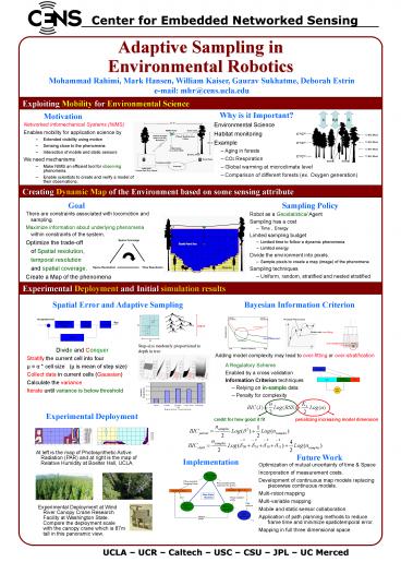
Adaptive Sampling in Environmental Robotics
1 / 1
Title:
Adaptive Sampling in Environmental Robotics
Description:
Environmental Robotics ... Exploiting Mobility for Environmental Science ... Environmental Science. Habitat monitoring. Example. Aging in forests. CO2 Respiration ... –
Number of Views:31
Avg rating:3.0/5.0
Title: Adaptive Sampling in Environmental Robotics
1
Adaptive Sampling in Environmental Robotics
Center for Embedded Networked Sensing
Mohammad Rahimi, Mark Hansen, William Kaiser,
Gaurav Sukhatme, Deborah Estrin e-mail
mhr_at_cens.ucla.edu
Exploiting Mobility for Environmental Science
Why is it Important?
Motivation
- Networked Infomechanical Systems (NIMS)
- Enables mobility for application science by
- Extended visibility using motion
- Sensing close to the phenomena
- Interaction of mobile and static sensors
- We need mechanisms
- Make NIMS an efficient tool for observing
phenomena. - Enable scientists to create and verify a model of
their observations.
- Environmental Science
- Habitat monitoring
- Example
- Aging in forests
- CO2 Respiration
- Global warming at microclimate level
- Comparison of different forests (ex. Oxygen
generation)
Creating Dynamic Map of the Environment based on
some sensing attribute
Goal
Sampling Policy
- There are constraints associated with locomotion
and sampling. - Maximize information about underlying phenomena
within constraints of the system. - Optimize the trade-off
- of Spatial resolution,
- temporal resolution
- and spatial coverage.
- Create a Map of the phenomena
- Robot as a Geostatistical Agent
- Sampling has a cost
- Time , Energy
- Limited sampling budget
- Limited time to follow a dynamic phenomena
- Limited energy
- Divide the environment into pixels.
- Sample pixels to create a map (image) of the
phenomena - Sampling techniques
- Uniform, random, stratified and nested stratified
Experimental Deployment and Initial simulation
results
Bayesian Information Criterion
Spatial Error and Adaptive Sampling
- Step-size randomly proportional to depth in tree
- Divide and Conquer
- Stratify the current cell into four
- µ a cell size (µ is mean of step size)
- Collect data in current cells (Gaussian)
- Calculate the variance
- Iterate until variance is below threshold
Adding model complexity may lead to over-fitting
or over-stratification
- A Regulatory Scheme
- Enabled by a cross validation
- Information Criterion techniques
- Relying on in-sample data
- Penalty for complexity
Experimental Deployment
credit for how good it fit
penalizing increasing model dimension
- At left is the map of Photosynthetic Active
Radiation (PAR) and at right is the map of
Relative Humidity at Boelter Hall, UCLA.
Future Work
Implementation
- Optimization of mutual uncertainty of time
Space - Incorporation of measurement costs.
- Development of continuous map models replacing
piecewise continuous models. - Multi-robot mapping
- Multi-variable mapping
- Mobile and static sensor collaboration
- Application of path planning methods to reduce
frame time and minimize spatiotemporal error. - Mapping in full three dimensional space
- Experimental Deployment at Wind River Canopy
Crane Research Facility at Washington State.
Compare the deployment scale with the canopy
crane which is 87m tall in this panoramic view.
UCLA UCR Caltech USC CSU JPL UC
Merced


