WV Statewide Coverage - PowerPoint PPT Presentation
1 / 44
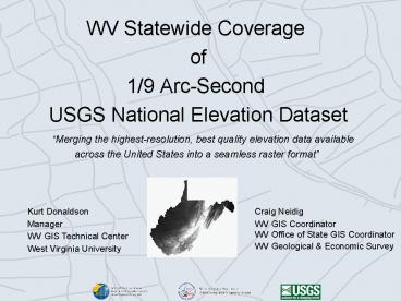
Title: WV Statewide Coverage
1
- WV Statewide Coverage
- of
- 1/9 Arc-Second
- USGS National Elevation Dataset
- Merging the highest-resolution, best quality
elevation data available - across the United States into a seamless raster
format
Kurt Donaldson Manager WV GIS Technical
Center West Virginia University
Craig Neidig WV GIS Coordinator WV Office of
State GIS Coordinator WV Geological Economic
Survey
2
Elevation Conversion Project
- Input Data Photogrammetric-derived mass points
and break lines - Output Data Hydrologically enhanced,
high-resolution grid incorporated into National
Elevation Dataset (1/9th arc second / 3-meter
resolution )
Elevation Mass Points and Breaklines
3-meter DEM
3
Partners
Statewide Addressing and Management Board
WV Department of Transportation
WV GIS Technical Center, West Virginia University
4
Private Sector Partners
Verizon Funded mapping
BAE Systems Mapping Contractor (Bob Hickey,
Clark Selby, Sandy Howery)
Baker Project Manager (Joe Seppi)
5
Public Sector Partners
USGS Funding, technical expertise, steward and
distributor of USGS National Elevation
Dataset (Bruce Bauch and Steve Rich)
Statewide Addressing and Management Board Source
data and support (Craig Neidig)
WV Dept. of Transportation Funded enhanced
elevation
WV GIS Technical Center Contractor for raster
conversion and distributor of USGS National
Elevation Dataset
6
Project Highlights
- COLLECTION DATE Spring 2003
- DATA SOURCE Statewide Addressing and Mapping
Board - ACCURACY Supports nominal vertical accuracy /-
10 feet - NATIONAL PRODUCT STANDARD National Elevation
Dataset - DATA DISTRIBUTION National and State Data
Clearinghouses - FILE SIZE ( 7.5-Minute Quad) 105 MB
uncompressed - COMPLETION TIME Data Collected 3 years
Raster Conversion 19 months - PARTNERS 3 private sector, 4 public sector
- DATA VALUE 2 million dollars
7
Methodology
- Pre-Process Vector Source Files
- Elevation mass points and breaklines
- Hydrography drainage edits
- Create Terrain Surfaces
- Create TIN
- Convert to 3-meter Raster
- Drainage Enhancement
- Quality Control Checks
8
Processing Unit 7.5 USGS Quad
- AREA
- Ranked 41st in Nation
- Total 24,244 sq mi
- Width 130 miles (210 km)
- Length 240 miles (385 km)
- 495 USGS 7.5' Quads
9
Source Data Vector Format
Elevation Mass Points and Breaklines
Hydrography
10
Terrain Surface Models
Grid Surface
TIN Surface
11
Drainage Enhancement
12
30-Meter Digital Elevation Model
13
10-Meter Digital Elevation Model
14
3-Meter Digital Elevation Model High Resolution
15
Elevation Data Sets for West Virginia
5 m
16
USGS Seamless Data Distribution System
17
Geoprocessing (Automated)
- Automation Program scripts automated all
geoprocessing steps to convert elevation mass
points and breaklines into terrain surfaces - Program Languages Python, Arc AML, Arc
Objects, Visual Basic, Microsoft .Net - Geoprocessing StatisticsTotal files
processed 45,761 Total computation time240
hours (10 days)
GIS Programmer - Sam
18
Drainage Enhancement (Manual)
- GIS Technicians using Delta 3D (raster editing
software) to perform drainage enhancement,
edge-matching, and other quality control checks
19
Data Distribution Formats
- National Data Clearinghouse
- State Data Clearinghouse
20
Resources
Fact Sheet
Technical Report http//www.wvgis.wvu.edu/
21
Applications
- Visual Impact
- Drainage
- Mine Fill
- Dam Safety
- Environmental
- Base Layers
- Flood Hazard
22
Visual Application TIN Perspective View
23
Visual Application Photorealistic Drape
24
Visual Application Photorealistic Drape
25
Visual Application New River Gorge Housing
Development
Location of proposed development, Fayette County,
WV
Source Michael Strager, WVU Natural Resource
Analysis Center
26
Example 1 View from across the gorge
View of New River Gorge, taken Fall 2005
27
Created from 3m DEM, same view point as previous
28
Lines existing roads and trails
29
Proposed development, top of hill
30
Development, with houses added in Visual Nature
Studio
31
Visibility of houses with modeled tree cover,
Visual Nature Studio
32
Mining Application Mountaintop Mining and
Valley Fill
Slope Map (Valley Fill)
33
Mining Application Coal Refuse Fill Depth
Difference of historical and new elevation data
models. Identifies changes in surface topography
over time.
34
Drainage Application Watershed Delineation
35
Drainage Application Mine Drainage Changes
Source WV DEP
36
Drainage Application Dam Safety
Source WV DEP
Catchment areas and associated land cover for
dams in the South Branch of the Potomac Drainage.
Used to model runoff during hypothetical storm
events.
37
Environmental Wastewater Application
- Canaan Valley Institute uses the new elevation
data to address a major environmental problem in
the Mid-Atlantic Highlands polluted waters
caused by inadequate wastewater treatment.
38
Base Layer Application MapWV.gov Base
Map Hillshade and 20-Foot Contours
39
Flood Hazard Application Proximate Base Flood
Elevation
Within FEMA Flood Zone Elevation Feet
587 Meters 179
40
Flood Hazard Application Proximate Base Flood
Elevation
Within 75 Feet of FEMA Flood Zone Elevation Feet
594 Meters 181
41
Project Success
- People Champions
- Private-Public Partnerships
- Funding
- Technical Expertise
- Data completeness
- Testing before production phase
- Automated geoprocessing
42
Football Prediction Nov. 2
4 WVU Mountaineers
8 Louisville Cardinals
Morgantown
Louisville
43
Remote Sensing Prediction Nov. 2 Evening
U.S. Nighttime Lights Source NOAA DMSP
44
Thank You!
- Kurt Donaldson
- kdonalds_at_wvu.edu


