
Sharon Wilson, Smithsonian Institution - PowerPoint PPT Presentation
Title:
Sharon Wilson, Smithsonian Institution
Description:
Sharon Wilson, Smithsonian Institution – PowerPoint PPT presentation
Number of Views:91
Avg rating:3.0/5.0
Title: Sharon Wilson, Smithsonian Institution
1
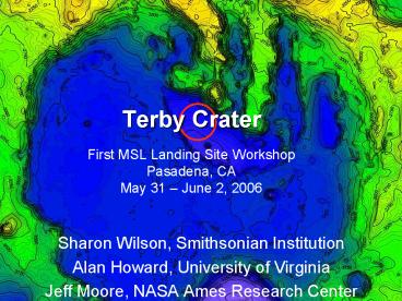
Terby CraterFirst MSL Landing Site
WorkshopPasadena, CA May 31 June 2, 2006
- Sharon Wilson, Smithsonian Institution
- Alan Howard, University of Virginia
- Jeff Moore, NASA Ames Research Center
2
Terby Crater
- D 170 km
- Noachian Leonard and Tanaka, 2001
- 28S, 287W
- Diverse suite of landforms
- Indicative of varying geologic processes
throughout martian history
3
Justification Interior Deposits
- Light-toned layers
- Ridges (gt2.5 km)
- Trough floors
- Crater floor exposed on scarps of the moat
deposit (400m) and crater floor - Troughs
- Moat-like depression
- Flat Crater Floor
- Viscous flow features
- Fan, channels, depressions, scoured caprock,
landslides
4
Possible Fluvial Evidence In the Landing Ellipse
ridges
Wall rock?
5
Sinuous ridges fluvial or glacial activity
related to formation of moat?
1 km
6
Scientific Objectives
- Smooth, flat, dust free surface with intermediate
TI (THEMIS NIR) - Ellipse LDs and sinuous ridges on moat floor
- Drive to sites in moat
- layered deposits in main ridges and crater floor
(moat scarp) - fluvial features in trough related to erosion of
LDs - access ancient wall rock (?)
7
Layered Deposits
- Indurated, fine-grained sediment based on
cliff-forming nature, TI and faults - Sub-horizontal bedding units Ansan and Mangold,
2004 Ansan et al., 2005, 2006, conformable with
regional slope (1.5 degree dip) - Laterally continuous on km scale
- Beds are massive and scalloped
- no fine-scale interbedding at MOC scale
- Hydrated mineral signature (clay or sulfates)
Ansan et al., 2005 Bibring et al., 2006 - Late Noachian/Hesperian Ansan et al., 2005
Millochau Crater by Mest and Crown
8
- Western Ridge
- 2.5 km thick layered sequence in N. Terby
- Layered mounds on trough floor
- Layered sequence with 4 units identified in each
ridge
9
- Layered sequence of 4 units recognized in both
ridges
10
Characteristics of Units 1 and 3
- 800 m thick
- Dark toned layers (50-70 m) interbedded with
light-toned layers (10-25 m) - Low albedo layers residual mantle or
compositional difference? - Very regular thickness of beds
- Laterally continuous
11
Unit 2
- Light-toned
- Some horiz bedding
- Discontinuous, curved laminations and small-scale
folding - Change in depositional environment
- Soft sediment deformation? Surge deposits?
Tectonic activity? Aeolian processes? - Unique to this unit
- Need more data!
12
Unit 4
- Caps layered ridges
- Intermediate-toned, massive layer sandwiched
between distinctive thin, dark-toned layers - Dark layers weather non-uniformly into a
small-scale knobby surface - Dark layers more indurated and are either
- coherent beds that break down along widely
(multi-meter) spaced fractures or - they occur as beds of multi-meter scale clasts
13
Origin of the Layered Deposits
Original Depositional Geometry
14
Original Depositional Geometry
Terby Rim
N
3/4 2 1
- No evidence of thinning, pinching out or
steepening of layers - No evidence for past lateral obstruction
- Possible layered ridges across moat depression
- Layers in ridges likely extended out past the
center of the crater - Possible Scenario Layers in crater floor only
correlate to lower unit in layered ridge - Mechanism to erode back layers and form moat?
15
Possible Origins of the Layered Deposits
Process Problem
Volcanic flows or intrusions Fine grained, repetitive nature, erodable X
Mass wasting Fine grained, repetitive nature, lack of source X
Volcanic Airfall Repetitive nature, consistent thickness, induration of layers, lack of obvious proximal volcanic source. X
Glacial Faults, absence of glacial flow and internal collapse features, layers of regular thickness X
Fluvial Geometry not consistent with prograding fan, lack of course grained material, consistent thickness and no obvious source X
Aeolian Dunes Fine grained, lack of cross-bedding X
Loess Fine-grained, terrain conforming and cliff-forming, need upslope winds, might be rhythmically layered O
Lacustrine Nature, geometry and hydrated signature consistent with deposition in fluid moderated by an environmental cycle such as climate or seasons O
16
Is Terby One-Of-A-Kind?
- Terby is special, but not unique!
- Similar morphology in other craters around Hellas
- Important to discern regional history of
deposition and erosion
20 km
17
Craters in Circum Hellas with Pits and Layers
Moore and Howard, 2005
18
-3.1 km
-6.9km
- Possible stands of ice covered lakes based on
topographic, morphologic and stratigraphic
evidence
-5.8km
-4.5km
Moore and Wilhelms, 2001
19
Histogram of Elevation Around Hellas
-6.9 km
Moore and Wilhelms
-5.8 km
20
Possible Water Stands
- -2.1 km, -3.1 km and -4.5 km
- High elevation related to deposition
- Low elevation related to erosion?
21
Hellas and surrounding region under water?
- 0.7 km
0.6 km
Elevations correlate to well-developed,
inward-facing scarps
22
Summary
ENGINEERING PARAMETER REQUIREMENT
Latitude 60N to 60S
Altitude 2 km
Landing ellipse radius 10 km
Slopes 3 (2 to 5 km length scale)
Slopes 5 (200 to 500 m length scale)
Slopes 15 (20 to 40 m length scale)
Slopes 15 (5 m length scale)
Rock Height 0.6 m
Load bearing surface Not dominated by dust
EDL winds Steady state horizontal 30 m/s
EDL winds Steady state vertical 10 m/s
EDL wind gusts/variability
Radar Reflectivity
Surface winds lt15 m/s (steady) lt30 m/s (gusts)
23
Summary
- Size and age of Terby represent a long period of
martian history - Geologic history is complex, but perhaps more
well-constrained than other craters with ILDs and
relevant to greater Hellas region - Climate-related landforms in Terby indicative of
potentially hospitable environments making it an
excellent candidate for MSL - Layered deposits consistent with lacustrine
deposition - Presence of hydrated minerals (clay?) might
indicate an ideal environment for preserving
organic material - Fluvial Features (sinuous ridges, fan, flow
features) also accessible
Recommended
CrystalGraphics Presentations


