P1252428415uYRom
1 / 26
Title: P1252428415uYRom
1
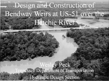
Design and Construction of Bendway Weirs at US-51
over the Hatchie River
Wesley Peck
Tennessee Department of Transportation Hydraulic
Design Section
2
General Information
3
General Information
- General Characteristics of the Hatchie River
- Mouth at Mississippi River
- Drains 2,600 square miles of west Tennessee and
north Mississippi - Majority of drainage area is agricultural or
undisturbed forested area - Only major river in west Tennessee undisturbed by
man - Low channel gradient of approximately 0.001ft/ft
- Class I Wild and Scenic River for state
- Basin is home to two National Wildlife Refuges
4
Historical Bridge Background
The original bridge opened in 1936 was 4,201 feet
long.
5
Historical Bridge Background
A bend of the river was straightened in order to
build the new bridge.
6
Historical Bridge Background
The route was upgraded to four lane divided in
1974. A new 999 ft long bridge was added for
southbound traffic.
7
Historical Bridge Background
The northbound bridge (built in 1936) collapsed
into the river in 1989.
8
Historical Bridge Background
The bridge was replaced with a new structure
which matched the one built in 1974.
9
Problem
A review by the National Transportation Safety
Board (NTSB) determined the cause of the failure
to be a combination of migration of the river
bank and local scour.
10
Problem
The river bank moved to a point where bents that
were previously on the floodplain were in the
middle of the channel. Local scour due to a
flood then further exposed the bent piles. The
piles failed due to buckling and embedment caused
by excessive exposure.
11
Problem
Analysis of Corps of Engineers cross-sections
shows significant movement of channel bank since
the first bridge was constructed.
- 0.8 foot per year from 1934 to 1975
- 4.5 feet per year from 1975 to 1981
- 1.8 feet per year from 1981 to 1988
- No significant change since replacement of failed
bridge
12
Current Situation
- The problem has shifted upstream due to riprap at
the bridge. - Active erosion of outside bank of the 90 bend
upstream of the bridge. - Active point bar formation on inside bank of
upstream bend. - Large scour hole in channel at the upstream bend.
13
Current Situation Topographical Map
14
(No Transcript)
15
(No Transcript)
16
(No Transcript)
17
Solution Bendway Weirs
Five bendway weirs were used due to their low
profile and the ability to redirect flow in the
channel.
- The study area was modeled using two dimensional
modeling software from FHWA and Brigham Young
University. - Topography and bridge characteristics provided by
field survey. - Mannings values from field inspection and
engineers judgement.
18
(No Transcript)
19
Weir Design Characteristics Hydrology
20
Weir Design Characteristics Location, Spacing,
and Angle
Design guidance in HEC-23. Modified based on
information from Derrick, LaGrone, and Whittler.
Also modified based on velocity vectors from
FESWMS model.
Angles vary from 60 in the center of the bend,
to 80 at the edge of the weir field.
21
Naming Conventions
- Velocity vector
- Angle of attack
- Angle of departure
- Degree of turning
22
Model Results Angle of Departure
Angle of departure varies depending on where
along the face of the weir it is measured. At
all five weirs velocity is lower at the tip of
the weir. The higher angles of attack result in
higher angles of departure.
23
Model Results Angle of Departure
Degree of turning is a measure of the efficiency
of the weir. It is a measure of the difference
between angle of attack and angle of departure.
Lower velocities near the river bank mean that
the weir is more efficient near the bank than at
the tip.
24
Model Limitations
- FESWMS is a two dimensional model. This is a
three dimensional situation.
- Floodplain is not modeled.
25
Project Summary Current Status
- System of five weirs built of riprap and rubble
stone. - Permanent maintenance road.
- Permanent cross-section markers for later
reference.
26
Summary Conclusions
- TDOTs model is reasonably consistent with
earlier work on bendway weirs. - Design guidance provided by LaGrone, and in
Hydraulic Engineering Circular-23 is accurate
within limitations of model. - Weir is more efficient nearer to the bank than at
tip due to lower velocities.


