Diapositiva 1
1 / 1
Title:
Diapositiva 1
Description:
DATA: 1177 springs location (yield 1ls-1), bedrock geology, quaternary deposits ... in ungauged basins from WofE analysis of spring-bedrock relationships (BFI_W ... –
Number of Views:35
Avg rating:3.0/5.0
Title: Diapositiva 1
1
Analysis of the relationships between
hydrogeological characteristics of mountain
basins and low flow discharge regional-scale
prediction of hydrological indexes in ungauged
basins of the northern Apennines (Italy)
Cervi F. 1 Borgatti L.2 Corsini A.1 Ronchetti
F.1 Bloschl G.31Università of Modena e Reggio
Emilia, Italy 2Università of Bologna, Italy 3
Technische Universitat Wien , Austria Correspond
ing author federico.cervi_at_unimore.it
ABSTRACT In the last decade the north of Italy
suffered a marked hydrologic deficit as a
consequence of decreasing mean annual
precipitation and increasing demand from industry
and agriculture. Rivers that outflow from the
northern Appennines in Emilia Romagna display an
highly variable discharge rate that is due to
inherited hydro-geological factors such as the
prevalence in the mountain catchments of low
permeability sedimentary rocks with low storage
coefficient. The growing interest for a proper
management of water courses, that has led to
directives regulating the amount of minimum water
that must permanently flow downstream from points
of water diversions and yield, makes the
prediction of hydrological indexes in ungauged
basins located in the mountain areas of relevant
practical importance, since it can support a
sustainable planning of surface water management
along the entire water course. The research has
being aimed at developing a spatial analysis tool
for regional-scale prediction of hydro-geological
indexes in ungauged basins, that still represent
the majority of cases in the upper catchment
areas in the northern Apennines. This has been
dealt with by linking statistical indexes of
discharge calculated for gauged basins (Q95,
Q347, Q355), to the results of spatial analysis
methods (such as Weight of Evidence WofE,
Logistic Regression LR, Neural Networks NNs) that
allow the storage coefficient of different
bedrock types to be relatively ranked by using
the spatial distribution of permanent groundwater
springs as main supporting evidence. The poster
summarises the main results obtained and
validated in a reduced test area within the
whole study area.
Testo
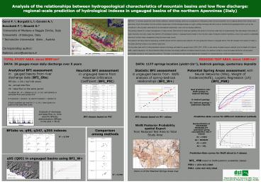
TOTAL STUDY AREA about 8000 km2 DATA 36
gauges mean daily discharge over 5 years
REDUCED TEST AREA about 1600 km2 DATA 1177
springs location (yieldgt1ls-1), bedrock geology,
quaternary deposits
Analytical BFI assessment in gauged basins from
river discharge data (BFI_Obs) BFI obs. (Vb /
Va)100 where Va annual total flow Vb base
flow on the same period
Potential Spring Areas assessment with Neural
Networks (NNs), Weight of Evidence(WofE),
Logistic Regression (LR) (BFI_PSR)
Statistic BFI assessment in ungauged basins from
WofE analysis of spring-bedrock relationships
(BFI_W)
Heuristic BFI assessment in ungauged basins from
Potential Infiltration Coefficient (BFI_PIC)
Best prediction rate
WofE springs vs. bedrock lithology G
bedrock geology GC bedrock geology quaternary
deposits
To obtain Vb N 30days (or 21, or 15) and
Qmin(I) is extracted from each group of N 0.9
Qmin(I) lt Qmin(I 1) and 0.9 Qmin(I) lt
Qmin(I-1) If both condition are met for I 2,
N-1, then Qmin is a point on the base flow curve
Example of discharge and base flow vs. time used
for BFIobs. determination (BFIobs in this plot
35.9)
Prediction-Rate curves for different statistical
methods
BFI classes based on W values
BFI classes based on PIC
Reclassification of POSTERIOR PROBABILITY
(potential-spring susceptibility) into 4 classes
A1 HIGH A2 MEDIUM A3 LOW A4 NIL
WofE Posterior Probability spatial Export from
Reduced Test Area to Total Study Area
Comparison among methods
BFIobs vs. q95, q347, q355 indexes
R2 0,704
Prediction-Rate curves for WofE sliced in 4
classes
q95 (Q95) in ungauged basins using BFI_W
Zoom-in of the Potential Springs Areas map
R2 0,790


