Polarimetric radar analysis of convection in the complex topography - PowerPoint PPT Presentation
1 / 1
Title:
Polarimetric radar analysis of convection in the complex topography
Description:
of northwestern Mexico during NAME 2004 ... Contact Info: Timothy Lang, CSU ... Climatology. Most frequent; 200-km range. Full 360s, complete in 15 min ... – PowerPoint PPT presentation
Number of Views:27
Avg rating:3.0/5.0
Title: Polarimetric radar analysis of convection in the complex topography
1
Polarimetric radar analysis of convection in the
complex topography of northwestern Mexico during
NAME 2004 Timothy J. Lang, Steven A.
Rutledge, Robert Cifelli, Lee Nelson, and Stephen
W. Nesbitt
1. Overview
3. Statistical Analyses
4. Case Study Analyses
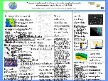
In this poster we report on preliminary results
from an investigation into the characteristics of
convection during NAME 2004, emphasizing rainfall
and microphysical structure, as well as the
effects of terrain.
While reflectivity statistics are similar among
the different terrain bands, clear differences in
D0 D0 via D0 1.529(ZDR)0.467 between land
(coastal plain and SMO) and sea (Gulf of
California) exist. Generally, larger D0s are
more common over land, and for high
reflectivities (i.e., convection) the sea D0 is
typically smaller than the land D0.
A cell-tracking algorithm, based on TITAN and
SCIT, has been applied to the 35 case studies.
Using this algorithm, the microphysical evolution
of every significant cell can be examined in
detail. Analyses can be broken down by terrain
elevation band, etc.
Three radars in core Monsoon region (NAME Tier I
NW Mexico) Network covered Gulf of California,
Sierra Madre Occidental, Coastal Plain, Baja
Peninsula, Pacific Ocean S-Pol S-Band,
Polarimetric, Doppler SMN Cabo and Guasave
radars (C-Band, Doppler) (only used S-Pol in
this study)
Case study example 15 July 2004 (Case 05) MCS
over high terrain moved toward the coast.
Analysis of two cells near their peak intensity
reveals significantly different microphysical
structures, with the coastal cell (Track 006)
having substantial more graupel aloft than the
higher-elevation cell (Track 008). Are these
differences representative of more systematic
variability with elevation?
NAME radar network (only Cabo, Guasave, and S-Pol
data were available for analysis)
S-Pol 24-h Ops 7/8-8/21
Two Modes Climatology Most frequent 200-km
range Full 360s, complete in 15 min Rain angles
(0.8,1.3,1.8) 0.0
- Storm Microphysics
- 90 hours total over 35 cases
- Usually 150-km range
- 2-3 PPIs with 0-1 RHIs in 15 min
- 360s _at_ rain angles (0.8,1.3,1.8)
On average, precipitating systems over the water
contain lower precipitation-sized ice mass values
(Cifelli et al. 2002) than those over land, while
differences between the different land elevation
bands are small . Ice - solid Liquid water - dash
2. Beam Blockage Correction
Blockage-correction and other and quality-control
procedures followed Cifelli et al. (2002) and
Lang et al. (2007).
0.8 (left) through 1.8 sweeps were blocked at
S-Pol, often over 90. There also sometimes were
multiple blocks along a single ray.
Unblocked
Blocked
Temporal evolution of individual cells is also
being examined. In this example (Track 022 from
Case 05), precipitation ice mass (black contours
g m-3) aloft leads the fallout of liquid
precipitation (blue contours) near the surface,
and demonstrates the importance of ice-based
precipitation processes in this cell.
For a given KDP range, ZH should also vary within
a fixed range for rain (Scarchilli et al. 1996).
Departures from this denote blocks. The
magnitude of the mean departure is the ZH
correction that must be applied.
Original KDP DEM
Land and ocean radar characteristics are nearly
12 h out of phase with one another. Convection
peaks during the morning over water, during the
afternoon over land. This is similar to the
results of Lang et al. (2007) using the 2-D
regional multi-radar dataset.
TRMM PR Intercomparisons
5. Preliminary Conclusions
- KDP-based blockage correction demonstrates
advantages relative to other methods,
particularly for short-term deployments with
limited raingage support (e.g., S-Pol during
TIMREX). - The largest differences in precipitation and
microphysical characteristics are between land
and sea, not between different land elevation
bands. Precipitation over the water is nearly 12
h out of phase with the land. - Precipitation over water appears to be the
result of DSDs with smaller D0 values, consistent
with reduced influence of ice-based precipitation
processes. - Case studies are underway to study the detailed
structure and evolution of NAME convection.
KDP and DEM-based corrections perform similarly
well, with KDP in slightly better agreement with
TRMM PR. Also, KDP is capable of correcting
higher blockage than DEM (gt 90).
There are minor morning peaks in the land data.
The afternoon peaks mostly coincide, with minor
differences that do not follow a trend (sometimes
low elevations peak first, sometimes high
elevations do). This may be related to increased
noise due to relatively fewer data points in any
one land elevation band.
All TRMM overpasses mean offsets KDP 0.05
dB DEM -0.35 dB
Contact Info Timothy Lang, CSU Atmospheric
Science, Ft Collins, CO 80523 (970) 491-6944,
tlang_at_atmos.colostate.edu


