IWMIDSP: Benchmark River Basins - PowerPoint PPT Presentation
1 / 22
Title: IWMIDSP: Benchmark River Basins
1
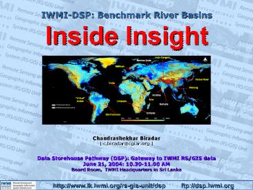
IWMI-DSP Benchmark River Basins Inside Insight
Chandrashekhar Biradar c.biradar_at_cgiar.org
Data Storehouse Pathway (DSP) Gateway to IWMI
RS/GIS data June 21, 2004 10.30-11.00 AM Board
Room, IWMI Headquarters in Sri Lanka
2
HOME PAGE
3
Focus on Benchmark River Basins
4
RS-GIS Data streamlined sofar
DSP1/Server1
DSP2/Server2
- 281 GB
- 197 Datasets
- 227 DataDocuments
- 950 Folders
- 9298 Files
River Basins
(Till June 1. 2004)
5
Focus on Benchmark River Basins Silent features
of IWMI-DSP
Powerful Search engine Checkbox active will
search all data plus documents Checkbox
inactive will search only datasets
Quick Readme in PDF description about the
dataset (Type, format, date, source, owner,
download site, credits, acknowledgments)
6
Focus on Benchmark River Basins Silent features
of IWMI-DSP
Quick preview is also available at search page
7
Focus on Benchmark River Basins Silent features
of IWMI-DSP
- All the search list will display page by page in
asp/htm browse page - If print page all search list will merged to
single printable page to facilitate one go
printing
8
Focus on Benchmark River Basins Silent features
of IWMI-DSP
- River basins data has been organized at various
level to facilitate the quick view and as well
different level of research needs.
9
Focus on Benchmark River Basins Silent features
of IWMI-DSP
Ruhuna-Subareas ?Malala ?Manikganga ?Walawe
?Kirindioya
Deduru-Oya Huruluweva Mahaweli Mahaweli-SystemC
All the rivers basins in DSP are listed in
RS-GIS-Data?River Basin Similarly National,
Regional and Global dropdown menu
_at_ Home page, only benchmark river basins listed
10
Focus on Benchmark River Basins Silent features
of IWMI-DSP
11
Focus on Benchmark River Basins Silent features
of IWMI-DSP
12
Focus on Benchmark River Basins Silent features
of IWMI-DSP
13
01-AVHRR-0.1Degree-Band1to2-reflectance-megafile
Data Type/Level
Sensors
Pixel Resolution
Bands
Type
Files
01- Primary Data
AVHRR
0.1 Degree
2 bands
Reflectance
Megafile
02-Secondary Data
MODIS
500 m
7 bands
Digital Numbers
Single tiles
03-Vector Data
DEM
90 m
196 bands
NDVI
Tile mosaics
04-Ground Truth Data
LULC
05-Publication
VECTOR
06-Presentation
Ground-truth
07-Maps
Publication
14
(No Transcript)
15
(No Transcript)
16
RS/GIS datasets _at_ IWMI-DSP for River basins
research
Basin level 8-km AVHRR data monthly and
10-day 1-km AVHRR data 10-day 250-m 2-band
reflectance MODIS data 500-m 7-band reflectance
MODIS data 1000-m 29-band reflectance MODIS data
Sub-basin level 28.5-79-m Landsat TM and MSS
data 23.6-m IRS-1c/1d data, 3 bands 15-90 meter
ASTER data 15-60-m ETM data 5-23.6-m IRS-1c/1d
data 30-m Hyperion data 10-30 m ALI data
Watershed level 5-m IRS-1c/1d data 1-4 meter
IKONOS data 0.61-2.44 m Quickbird data
17
RS/GIS datasets _at_ IWMI-DSP for River basins
research
Basin level GTOPO 30 1km DEM SRTM 30 1km DEM CRU
50km Precipitation LULC IGBP LULC USGS
Sub-basin level SRTM 90m DEM LULC LANDSAT
ETM ASTER 15 DEM SOIL MAP
Watershed level DEM NK 1m LULC IKONOS
18
RS/GIS datasets _at_ IWMI-DSP for River basins
research
Basin level Basin boundary Sub-basin
boundary Stream networks
Sub-basin level Basin boundary Sub-basin
boundary Administrative boundary Basin
soils Landuse land cover Stream networks
Watershed level Basin boundary Sub-basin
boundary Administrative boundary Basin
soils Landuse land cover Stream networks
19
Continuous Streams of MODIS Data Products
Krishna river basin
FCC (RGB) 2,1,6 (NIR, red, MIR1)
January, 2001
March, 2001
May, 2001
July, 2001
September, 2001
November, 2001
NDVI from AVHRR (8km)
NDVI from MODIS (0.5km)
Single mega file of 7band 8day reflectance data
available for the period 2000-2003
Various indices can be derived from the base
productsviz., NDVI, EVI, TVI, SVI etc
20
Landsat TM single tile image available for
download in most accessible formats and single
mosaic image also available for few river basins
Image Path/Row, date and file format, size can
seen in FTP window
Preview available for each tile as quick look
21
Multi resolution/scale DEM data sets for river
basin hydrology
In universal formats
SRTM 90 m
GOTO30 1km
22
(No Transcript)


