
GLG110 Geologic Disasters and the Environment - PowerPoint PPT Presentation
1 / 16
Title:
GLG110 Geologic Disasters and the Environment
Description:
GLG110 Geologic Disasters and the Environment. Instructor: Professor Ramon ... hubris (overbearing pride or presumption) or passion? GLG110 Fall 2002 Arrowsmith ... – PowerPoint PPT presentation
Number of Views:177
Avg rating:3.0/5.0
Title: GLG110 Geologic Disasters and the Environment
1
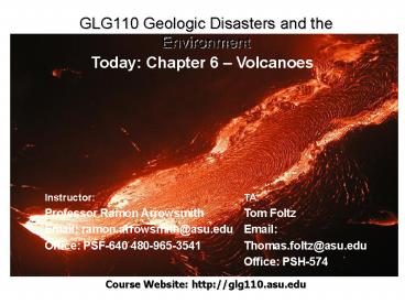
GLG110 Geologic Disasters and the Environment
Today Chapter 6 Volcanoes
Instructor Professor Ramon Arrowsmith Email
ramon.arrowsmith_at_asu.edu Office PSF-640
480-965-3541
TA Tom Foltz Email Thomas.foltz_at_asu.edu Office
PSH-574
Course Website http//glg110.asu.edu
2
Guest speaker
- Dr. Stanley Williams
- ASU Volcanologist
- Author of Surviving Galeras (with Fen Montaigne)
- http//geology.asu.edu/williams/
Northern Andes
Sampling volcanic gas
Nevado del Ruiz
3
Disaster of the day (I)
- hubris (overbearing pride or presumption) or
passion?
4
Mount St. Helens
- May 18, 1980
- Awoke in March, 1980 after 120 years of dormancy
seismic activity, bulging (1.5m/day), and small
explosions - Anticipated event most people evacuated
- Major flank failure and lateral blast
5
The smallest of five major volcanic peaks in
Washington State is Mount St. Helens, with an
elevation of 9,677 feet (2,950 meters) before the
eruption of May 18,1980. Another Cascade volcano,
Mount Adams (12,286 feet 3,745 meters), is in
the distance. The view is from the west.
6
On March 20, 1980, after a quiet period of 123
years, earthquake activity once again began under
Mount St. Helens volcano. Seven days later, on
March 27, small phreatic (steam) explosions
began. This view is from the northeast.
7
A "bulge" developed on the north side of Mount
St. Helens as magma pushed up within the peak.
Angle and slope-distance measurements to the
bulge indicated it was growing at a rate of up to
five feet (1.5 meters) per day. By May 17, part
of the volcano's north side had been pushed
upwards and outwards over 450 feet (135 meters).
The view is from the northeast.
8
On May 18, 1980, at 832 a.m. Pacific Daylight
Time, a magnitude 5.1 earthquake shook Mount St.
Helens. The bulge and surrounding area slid away
in a gigantic rockslide and debris avalanche,
releasing pressure, and triggering a major pumice
and ash eruption of the volcano. Thirteen-hundred
feet (400 meters) of the peak collapsed or blew
outwards. As a result, 24 square miles (62 square
kilometers) of valley was filled by a debris
avalanche, 250 square miles (650 square
kilometers) of recreation, timber, and private
lands were damaged by a lateral blast, and an
estimated 200 million cubic yards (150 million
cubic meters) of material was deposited directly
by lahars (volcanic mudflows) into the river
channels. Fifty-seven people were killed or are
still missing.
9
For more than nine hours a vigorous plume of ash
erupted, eventually reaching 12 to 15 miles
(20-25 kilometers) above sea level. The plume
moved eastward at a average speed of 60 miles per
hour (95 kilometers/hour), with ash reaching
Idaho by noon. By early May 19, the devastating
eruption was over. Shown here is a close-up view
of the May 18 ash plume
10
(No Transcript)
11
(No Transcript)
12
Trees blown down by the lateral blast. Two U. S.
Geological Survey scientists (lower right) give
scale. The direction of the blast, shown here
from left to right. Enough lumber to build
150,000 homes was damaged or destroyed.
Spirit Lake, once surrounded by lush forest, is
within the area devastated by blast. Remnants of
the forest now float on the surface of the lake.
Another Cascade volcano, Mount Rainier (14,410
feet 4,392 meters), is in the distance. The
view is from the south.
13
Mudflow (lahar) damage
14
Left. Pyroclastic flow. Above. Mudflow from later
smaller eruption (March 19, 1982)
15
After the May 18, 1980 eruption, Mount St.
Helens' elevation was only 8364 feet (2,550
meters) and the volcano had a one-mile-wide (1.5
kilometers) horseshoe-shaped crater, seen here
from the northwest. (September 16, 1980, by
Thomas J. Casadevall, USGS)
16
(No Transcript)
Recommended
CrystalGraphics Presentations


