Hurricanes Past, Present and Future - PowerPoint PPT Presentation
1 / 36
Title:
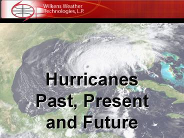
Hurricanes Past, Present and Future
Description:
What causes tropical storms and hurricanes to form? These storms form over warm water 80 degrees F or warmer. ... hurricane variability than do SST. ... – PowerPoint PPT presentation
Number of Views:62
Avg rating:3.0/5.0
Title: Hurricanes Past, Present and Future
1
HurricanesPast, Present and Future
2
(No Transcript)
3
(No Transcript)
4
Tropical Definitions
Tropical Depression - A closed area of low
pressure formed in the tropics with wind speeds
38mph or less. Tropical Storm A closed area of
low pressure formed in the tropics with wind
speeds between 39mph and 73mph. Hurricane An
intense area of low pressure formed in the
tropics with wind speeds 74mph or higher.
5
Saffir/Simpson Scale
6
(No Transcript)
7
(No Transcript)
8
(No Transcript)
9
(No Transcript)
10
(No Transcript)
11
What causes tropical storms and hurricanes to
form?
- These storms form over warm water 80 degrees F
or warmer. The depth of the warm water layer
should not be shallow. Hurricanes stir up with
ocean water and any colder water that may be just
below the surface will be mixed with the surface
layer, making the oceans surface temperature too
cool to sustain development. - They require light winds at the middle and upper
layers of the atmosphere so that the growing
circulation is not interrupted. - Anticyclonic outflow of air at the top of their
circulation will aid development. - Anything that can interrupt any of these three
will weaken and may eventually dissipate the
tropical cyclone. - They usually form between 10 and 35 degrees North
latitude, or between Trinidad and Cape Hatteras,
NC and as far east of the Cape Verde Islands.
Any closer to the equator and they are unable to
acquire the cyclonic spin and any farther north
and upper level wind and/or sea surface
temperatures can be unfavorable.
12
(No Transcript)
13
(No Transcript)
14
(No Transcript)
15
(No Transcript)
16
(No Transcript)
17
(No Transcript)
18
(No Transcript)
19
(No Transcript)
20
Tropical Cyclone tracks Non El Niño year 2005
21
Tropical Atlantic Activity Relatively Quiet June
August 2006
- 1 TC (Alberto) formed June 10 and made landfall
in Floridas Big Bend area. - 1 TC (Beryl) formed July 10 near the Southeast
Coast and remained offshore. - TCs Chris and Debbie, and lead Hurricane Ernesto
almost evenly spaced at early, mid and late
August.
22
Early Summer 2006 Tropical Atlantic SST Near
Normal
- Strong Bermuda High in 2006 due to very different
large scale pattern in place across North America
driven by the strongest North American Monsoon
Circulation in over 10 years. - Strong Bermuda High enhances trade wind
circulation generating greater evaporative
cooling of ocean. - 2005 record high Tropical Atlantic SST were 2
degrees C above average.
23
(No Transcript)
24
(No Transcript)
25
Increasing Risk of El Niño
- Several months of mixed atmospheric indicator
signals have converged to a more consistent
pattern in August. - Continued SST warming over much of the tropical
Pacific. - Continued decrease in the Southern Oscillation
Index (SOI). - Marked decrease in Trade Wind strength.
26
Short term Impact of increased Equatorial Pacific
SST
- Positive SST anomalies still weak and not yet at
El Niño levels. - Increased SST warming implies a shift in tropical
convection towards the dateline. - Such eastward-shifted convection often increases
vertical wind shear over the tropical Atlantic.
27
Tropical Cyclone Heat Potential
- SST of 80 degrees F (26.5 C) necessary for TC
development, but hurricanes generally need warm
conditions to extend to a depth of several
hundred feet. - 2005 TCHP capable of rapid hurricane
intensification were much more extensive than
early summer 2006.
28
(No Transcript)
29
(No Transcript)
30
(No Transcript)
31
Climate Change and Hurricane Intensity
- Perceived linkage receiving increased scientific
and media attention due to spike in major
hurricane frequency and intensity observed in
recent years. - Major scientific debate concerning quality and
interpretation of data used in recent studies
attempting to quantify any correlation.
32
(No Transcript)
33
Webster Data Considered Unreliable
- Hurricane intensity is measured by maximum
sustained winds at ten meters above the surface. - Hurricane intensity estimates throughout the 70s
and part of the 80s based on satellite estimates
only. - Only 2 GOES satellites during this interval makes
intensity estimates highly uncertain.
34
Atlantic Multi-Decadal Oscillation (AMO)
- The Atlantic has seen a very large increase in
major hurricanes during the last 11-year period
of 1995-2005 (average 4.0 per year) in comparison
to the prior 25-year period of 1970-1994 (average
1.5 per year). - Similar increases have occurred during peaks in
the AMO which is defined as an increase in
strength in the Atlantic Ocean thermohaline
circulation (THC) and is not directly related to
global temperature increase.
35
Dr Grays linkage position
- Seasonal and monthly variations of sea surface
temperature (SST) within individual storm basins
show only very low correlations with monthly,
seasonal, and yearly variations of hurricane
activity. - Other factors such as multi-decadal oscillations
tropospheric vertical wind shear, surface
pressure, low level vorticity, mid-level
moisture, etc. play more dominant roles in
explaining hurricane variability than do SST.
36
(No Transcript)


