
Enschede The Netherlands www'itc'nl - PowerPoint PPT Presentation
1 / 53
Title:
Enschede The Netherlands www'itc'nl
Description:
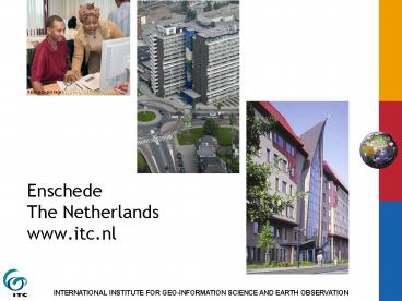
Photo: Gerard Kuster. Presentation content. What's ITC all about ... Remote sensing, Aerial photography, Radar, Airborne electronic-scanning devices, Satellites ... – PowerPoint PPT presentation
Number of Views:249
Avg rating:3.0/5.0
Title: Enschede The Netherlands www'itc'nl
1
EnschedeThe Netherlandswww.itc.nl
2
Presentation content
- Whats ITC all about
- Knowledge field Geo-information Science and
earth observation - ITCs core activities
- Education
- Research
- Project services
- Partnerships
- Alumni
3
Whats ITC all about?
- Established in 1950
- Largest international institute for higher
education in the Netherlands - Autonomous organisation
- Under the aegis of the Minister for Development
Cooperation and the Ministry of Education,
Culture and Science of the Netherlands
4
Mission
- Provide international education through knowledge
exchange - Capacity building
- Institutional development
- For and in economically and technologically less
developed countries
5
Key figures 2006
- Staff
- Scientific staff 161 fte
- Support staff 123 fte
- 25 nationalities
- Students
- 1364 newly registered students
- PhD researchers
- 56
- Alumni
- 18,437 mid-career professionals
- 171 countries
6
ITCs organisation chart
7
Facilities
- Well equipped building
- Lecture rooms
- MSc rooms
- Auditorium
- State-of-the-art computer facilities
- Laboratory facilities
- Restaurant
- Library
8
- Lodging accommodation
- Well furnished rooms or apartments
- Student support
- Student affairs office
- Medical facilities
- Sports and social activities
- Long-life e-mail accounts
9
Knowledge field Geo-information science and
earth observation
Internet GIS
10
Geo-information science andearth observation
- Combination of tools and methods for the
- collection
- storage and
- processing
- of geo-spatial data and for the dissemination
and use of these data and of services based on
these data
11
- Focus on tools and methods and on application of
these in - urban planning
- land administration
- disaster management
- strengthening civil society
- water management
- earth sciences
- environmental management and biodiversity
- food security
12
Earth observation
- Collect data about the earths surface and
subsurface - Based on aerospace survey techniques
- Remote sensing, Aerial photography, Radar,
Airborne electronic-scanning devices, Satellites
13
Geographical Information Systems
- Database used to
- Store
- Manipulate
- Access
- Transform
- Study trend patterns
- Examine environmental issues
- Simulate outcome of project proposal or planning
procedures - Data collected through earth observation
14
Geo-information science and earth observation
DATA COLLECTION
DATA INFORMATION DISSEMINATION
G I S ANALYSIS
Internet GIS
15
ITCs core activities
- Education / training 50
- Degree programme
- Diploma programme
- Certificate programme
- Research and Development 25
- Research projects
- PhD studies
- Visiting Scientists
16
- Project services 25
- Institutional development
- Contract training
- Contract research and development
- Advisory services
17
Education at ITC
- A multicultural environment
18
Target group
- Primarily mid-career professionals and scientists
from developing and emerging countries - Increasingly professionalsfrom industrialised
countries
19
ITCs programmes and duration
- Degree programme
- Master of Science 18 months
- Master 12 months
- Diploma programme
- Postgraduate diploma 9 months
- Diploma 9 months
Language of instruction is English
20
Language of instruction is English
21
Entry levels
- Programme Entry level
- MSc degree BSc
- Master degree BSc
- Postgraduate diploma BSc
- Diploma Sec. school
- Certificate courses BSc/Sec. school
22
Programme structure of MSc, Master, PGD and
diploma programmes
- Blocks and modules
- MSc degree 18 months, 4 blocks
- Core modules
- Specialisation modules
- Research profile modules
- MSc thesis
- Master degree 12 months, 4 blocks
- Core modules
- Application/specialisation modules
- Electives
- Individual final assignment
23
- Postgraduate diploma 9 months, 3 blocks
- First two blocks of MSc programme
- Final assignment
- Diploma 9 months, 4 blocks
- Core modules
- Specialisation modules
- Integrated group project
- Individual final assignment
24
Courses in the degree and diploma programmes
- Geo-information Science and Earth observation
for - Applied Earth Sciences
- Geoinformatics
- Governance and Spatial Information Management
- Land Administration
- Natural Resources Management
- Urban Planning and Management
- Water Resources and Environmental Management
25
Applied Earth Sciences (AES)
- Topics
- Earth Resource Exploration
- Earth Science Data Provision
- Geo-Hazards
- Geo-Engineering
- Programmes
- MSc degree
- Postgraduate diploma
- Certificate
26
Geoinformatics (GFM)
- Topics
- Remote Sensing and Digital Photogrammetry
- Spatial Data Modelling and Spatial Database
Design - Geographical Information Systems
- Cartography and Geo-visualisation
- Spatial Data Analysis
- Base Mapping from Sensor Data
- Programmes
- MSc degree
- Master degree
- Postgraduate diploma
- Certificate
27
Governance and Spatial Information Management
(GSIM)
- Topics
- Public Administration
- Economics, Policy design and policy evaluation,
Law, Governance and political science - Geo-information and GIS
- Data models and data bases, GIS theory and
techniques, Remote sensing and GPS, Visualisation
and cartography, Land administration and land
policy - Programmes
- MSc degree
28
Land Administration (LA)
- Topics
- Concepts of Land Policy and Land Management
- Land Administration Systems
- Process Design, Simulation and Management of
Workflows - Adjudication, Cadastral and Social Tenure Mapping
- Value Assessment and Land Use Classification
- Business Administration, Planning and Control,
Financial Management - Modelling of Data, Processes, Stakeholder
Analysis, Community Participation etc. - Programmes
- MSc degree
- Postgraduate diploma
- Certificate
29
Natural Resources Management (NRM)
- Topics
- Geo-information for Biodiversity Conservation
- Forestry for Sustainable Development
- Sustainable Agriculture
- Soil Information Systems for Sustainable Land
Management - Environmental System Analysis and Management
- Planning and Coordination in Natural Resources
Management - Programmes
- MSc degree
- Master degree
- Postgraduate diploma
- Certificate
30
Urban Planning and Management (UPM)
- Topics
- Urban Indicators and Monitoring
- Spatial Analytical techniques
- Statistics and Visualisation
- Conceptual Modelling of Urban Processes
- Data Gathering and Information Supply
- Governance of Urban Regions
- Planning and Management Approaches
- Policy Processes and Policy Instruments
- Methods and Tools in Contemporary Planning and
Management - Programmes
- MSc degree
- Postgraduate diploma
- Certificate
31
Water Resources and Environmental Management
(WREM)
- Topics
- Earth Observation-Based Water Cycle Studies
- Groundwater Assessment and Modelling
- Integrated Watershed Modelling and Management
- Water Engineering and Management
- Programmes
- MSc degree
- Postgraduate diploma
- Certificate
32
Accredited by the NVAO
- ITCs degree programmes are legally recognised in
the Netherlands and are accredited by the
Netherlands Flemish Accreditation Organisation
33
Joint courses
- To address the increasing demand for flexibility
in academic degree courses, ITC has entered into
partnership with reputable qualified educational
organisations in 14 countries - Target 2010
- 20 locations
- 350 students / 3,500 student months
34
Education partnerships
- Outside Europe
- Already implemented in Bolivia, China, the
Philippines, India, Iran, Nigeria, Ghana,
Tanzania, Mexico, Kenya and Indonesia - With European institutes
- Two MSc programmes have been implemented
- GEM with Southhampton University(UK), Lund
University(Sweden) and Warsaw University(Poland)
Supported by the EU Erasmus Mundus programme - GIMA with Delft University of Technology,
Utrecht University and Wageningen University and
Research Centre
35
Joint course Example Kumasi, Ghana KNUST
- MSc degree course GIS for Natural Resource
Management with the Kwame Nkrumah University of
Science and Technology - Six months in Enschede and 12 months in Kumasi
36
Course participants 1950-2006 Origin of ITC
students
Africa 31
Australia Oceania 1
Asia 7,745 Africa 5,664 Europe
2,801 America 1,964 Australia Oceania
174 Total Students 1950-2006 18,437 Total
Countries 1950-2005 171
1950 - 2006
37
Seeking the source
- Fellowships
- Netherlands Fellowship Programme
- European Union Erasmus Mundus
- European Union Alßan programme
- United Nations agencies
- Joint Japan World Bank Scholarship Programme
- International Fellowships Programme Ford
Foundation - The Huygens Programme
- STUNED Scholarship Programme
38
Research at ITC
39
Research
- Objective
- Discovery of new knowledge, support high-quality
education and capacity building - Through
- Research programme
- Graduate (PhD) programme
- Visiting scientists
- Joint research partnership agreements
40
Research spearheads
- Geo-information science and earth observation for
- strengthening civil society
- multifunctional use of space
- natural disasters and environment
- food and water security
- monitoring global change
41
PhD researchers registered at ITC
42
Number of academic publications
43
Project services at ITC
44
Project services
- Advisory services
- Institutional development projects
- Contract training
- Contract research and development
45
Numerical indicators per component
46
Land Administration Project Guatemala
- Development of teaching and research capacities
in Land Administration with the Faculty of
Agronomy (FAUSAC), University of San Carlos,
Guatemala - In partnership with Kadaster, DHV and Maastricht
School of Management - First phase is 3 years, started in 2004
- Co-funded by Netherlands Program for
Institutional Strengthening (NPT)
47
- Activities focus at
- Training of trainers
- Development of graduate program in Land
Administration at FAUSAC - Improvement of library and computer facilities
- Development of research program
48
Partnerships
- In the framework of institutional development
- To address the increasing demand for flexibility
in academic degree courses - With research partners who contribute
complementary scientific expertise
49
Education partnerships
50
GI-NET
- The establishment of a network of international
partners called the Geo-Information Network for
Education and Training - The network is active in research and
development, as well as in education, training
and advisory services.
51
ITC and United Nations University
- The UNU and ITC entered into an agreement
appointing ITC as an Associated Institution of
the UNU - UNU-ITC Cooperation is directed at developing and
carrying out a joint programme on Capacity
Building in Disaster Management and in Land
Administration - Programme activities are accommodated in two
schools - School for Disaster Geo-Information Management
- School for Land Administration Studies
52
Alumni support
- E-mail box
- News letter
- Alumni web pages
- Refreshercourses
- ITC News
- Library services
- Associations
- Events
53
The endThank you!
Recommended
CrystalGraphics Presentations


