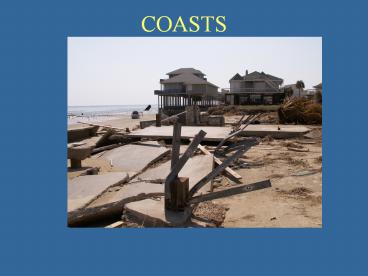
COASTS - PowerPoint PPT Presentation
Title:
COASTS
Description:
COASTS – PowerPoint PPT presentation
Number of Views:122
Avg rating:3.0/5.0
Title: COASTS
1
COASTS
2
(No Transcript)
3
(No Transcript)
4
(No Transcript)
5
Long-Shore Transport
6
High Energy Beaches
7
(No Transcript)
8
Low Energy Coasts
9
(No Transcript)
10
Back-Barrier Environmentscoastal marshwashover
deposits
11
(No Transcript)
12
Coastal Dunes
13
Foreshore Environment (Intertidal Swash
Zone)Seaward dipping laminationsHeavy mineral
placers
14
Laminated foreshore deposits in outcrop
15
The Upper Shoreface (Breaker and Surf
Zones)Oscillation ripples
16
(No Transcript)
17
Stop Thursday 10/2/08
18
Upper Shoreface DepositsCurrent ripples, ridge
(forset) and swell (trough)
19
Variable ripple patterns
20
Shoreface Trace Fossils(Ophiomorpha) and
othertracks, trails and burrows
21
Lower Shoreface (hummucks)
22
Wavy cross bedding
23
Shoreface depositsin outcrop
24
Determiningpaleoshoreline orientation
25
Thick prograding shoreface deposits
26
Prograding Clastic Shoreline Succession
27
The Texas Coast
28
Stop Thursday
29
(No Transcript)
30
Transgressive Clastic Shorelines
31
Transgressive Ravinement
32
(No Transcript)
33
Transgressive Ravinement
34
Transgressive Sheet Sands
35
The MAFLA Sheet Sand
36
Tide-Dominated Coasts
37
Low wave energy tide-dominated coasts (The
Florida Panhandle)
38
CoastalBarriers
39
The latest Transgression
40
Model for barrier formation
Follets Island
Galveston Island
Mustang Island
41
Galveston Island
42
(No Transcript)
43
Source of Sand that composes Galveston Island
44
Thickness of Galveston Island
45
Stop 10/16/08
46
Bolivar Peninsula Evolution
47
Spit Accretion
48
(No Transcript)
49
Aggradational BarriersMustang IslandThick
barrier sands with stacked tidal inlets
50
Transgressive barriers(Follets Island and South
Padre Island)Barrier sands rest of back barrier
sediments
51
Preservation of Barriers
52
(No Transcript)
53
(No Transcript)
54
Cheniers
55
Current changes along the Texas coast
56
Coastal Erosion-1.0 to 1.5 m/yr forGalveston
Island
57
(No Transcript)
58
(No Transcript)
59
West end of Galveston Seawall showing amount of
erosion that has occurred since the wall was
constructed
60
Highway 3005, Follets Island
After Ike
Before Ike
61
(No Transcript)
62
Monitoring Coastal Erosion (LIDAR)
63
(No Transcript)
64
Texas Open Beaches Act
65
Combating Beach Erosion
66
Straw Dunes
67
Geotubes
68
(No Transcript)
69
(No Transcript)
70
Beach Nourishment
71
Stop tuesday
72
BEACH NOURISHMENT
73
The difference between Texas and Florida is that
we have very little in the way of offshore sand
resources. Still, we spend millions of tax
dollars searching for sand.
74
Wetlands Loss
75
(No Transcript)
76
Rising Sea levelLong-term tide gauge
recordsindicate a few millimeters per year rate
of rise
77
(No Transcript)
78
Subsidence due to ground water use (1960s and
early 70s)
79
Oil and Gas Production
80
The upper Texas coast with a 2m sea level rise.
81
Hurricane ImpactThe Great Storm of 1900
82
Predicted Storm Tides
83
Storm Impact on Coasts
84
Hurricane Ivan
85
(No Transcript)
86
(No Transcript)
87
Hurricane Alicia
88
Ike
89
(No Transcript)
90
(No Transcript)
91


