NERACOOS Modeling - PowerPoint PPT Presentation
1 / 26
Title:
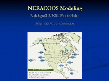
NERACOOS Modeling
Description:
Surface Wave Model (ug-SWAN) Local Inundation Models (FVCOM, ADCIRC, ... Unstructured grid version of SWAN surface wave model (UG-SWAN) ... – PowerPoint PPT presentation
Number of Views:66
Avg rating:3.0/5.0
Title: NERACOOS Modeling
1
NERACOOS Modeling
- Rich Signell (USGS, Woods Hole)
- NFRA NERACOOS Modeling Rep
2
GOMOOS in operation since 2001. Designed as a
general purpose system. System pays for
itself in lives saved due to fog, wave and met
measurements
3
NERACOOS RCOOS funding for year 1
4
Regional Forecast Models
5
UMAINE GoM-POM
- Huijie Xue, Steve Cousins
- Operational since 2002, accessible via GoMOOS web
page - POM model, forced by NAM-12 met model results,
OBCs from NCEP-RTOFS (Hycom) - Grid resolution 3-5 km
- Used to drive ecosystem model (Fei Chai)
- Forecast surface currents also delivered in
NOAA-GNOME compatible format
6
ECOM model
Meng Zhou Mingshun Jiang, UMASSB
Supports a water quality model required by Boston
sewage outfall permit
Grid resolution 1-3 km in Mass Bay
7
Will Perrie, Bash Toulany, BIO Model WaveWatch
III Resolution 0.1-0.2 degrees Forcing COAMPS
0.2 degree W. ATL Model/Buoy comparisons on
GoMOOS web site Provides OBCs for local SWAN
models
8
GOMTOX Model
Ruoying He, NCSUDennis McGillicuddy
WHOI Resolution 3-5 km Model ROMS cyst
function, swimming, growth/decay based on T,S,
Light, climatological nutrients Assimilates
GOMOOS current data Forecasts were used to guide
red tide monitoring
9
Changsheng Chen, Geoff Cowles, UMASSDBob
Beardsley, WHOI FVCOM unstructured mesh (0.1-0.3
km near coast)
10
Northeast Coastal Ocean Forecast System
(NECOFS) simplified for storm surge and
inundation prediction
Satellite SST Buoy Winds Insolation
North American Mesoscale Weather Model (NAM 32
km)
BCs
Regional Mesoscale Model (MM5,WRF)
Global Wave Model (WAVEWATCH)
BCs
Form Drag
Heat Flux Wind Stress P-E U,V
BCs
Surface Wave Model (ug-SWAN)
Ocean GCM
U,V, Waves, Radiation Stress
Satellite SST, U,V Buoy T,S,U,V,P
FVCOM
Global Tidal Model
Freshwater Input
Storm Surge
BCs
Bottom Stress
Local Inundation Models (FVCOM, ADCIRC, ...)
Sediment Transport Model (based on NOPP CSTMS)
11
NERACOOS regional FVCOM grids
Second Generation
Third Generation
- Horizontal resolution 0.3-1.0 km in the coastal
region - Generalized terrain-following coordinates 46
layers 10 uniform layers in the surface and
bottom boundary layers, respectively. - 1500-m cutoff off Georges Bank
- Capable to nest to the coastal-estuarine model
with a horizontal resolution of 10-500 m
- Horizontal resolution 0.5-1.0 km in the coastal
region - Sigma-coordinates 31 vertical layers
- 300-m cutoff off Georges Bank
12
UNH NE Water Balance Model
Joe Salisbury, Doug Vandemark, UNH
13
Common Needs
- More eyeballs on the products need for common
access, analysis and visualization tools - Better model coupling infrastructure
- Training and tools for advanced data assimilation
- Better modeling of river inputs (flow, nutrients,
sediment, etc) - Better Upstream boundary conditions Scotian
Shelf Northeast Channel - Better efficiency/reliability of obtaining met
forcing - Easier generation of realistic bathymetry
14
Additional Slides
15
NERACOOS RCOOS Status
- FY08 1.2 million, FY09 1.2 millionFY10 3.5
million (subject to availability) - Partners BIO, GoMOOS, NMFS, UCONN, UMAINE,
UMASS, UNH, WHOI - Focus on maintaining existing activities (BIO
shipboard modeling, GoMOOS buoys, LISICOS
buoys, Great Bay NH mooring) new nutrient
sensors NE inundation forecasts - Deferral of advanced HAB measurements to FY10
16
Northeast Coastal Ocean Forecast System (NECOFS)
- An integrated atmospheric-ocean model system
designed for the northeast US coastal region
covering a computational domain from the south of
the Long-Island Sound to the north of Nova
Scotian Shelf. - The system includes
- Two meso-scale meteorological models WRF
(Weather Research and Forecasting model) and MM5
(fifth-generation NCAR/Penn State non-hydrostatic
mesoscale model) - Unstructured grid Finite-Volume Coastal Ocean
Model (FVCOM) - Unstructured grid version of SWAN surface wave
model (UG-SWAN) - Sediment modules based on NOPP CSTMS (Community
Sed Trans) - Generalized biological modules
- Currently the forecast system delivers results
based on WRF, MM5 and FVCOM - Working on inundation model based on surgewaves
using new lidar/swath bathy topography in
sensitive regions
17
(No Transcript)
18
CF
From Vörösmarty et al CSDMS presentation
19
NERACOOS RA grant
- 400k per year for three years
- 100k per year to support NERACOOS administrative
structure - 300k per year to support long-range planning
- Science and technology
- Products and product development
- Data management and communication
- Oversight by newly forming NERACOOS Board
20
NERACOOS governance
- Ad-hoc executive committee has acted on behalf of
NE region - January 2008 finalization of NERACOOS bylaws
- Board with seven appointments each by academic
consortium, state government agencies, and NE Sea
Grant - Science and product requirements teams
- Incorporation as a non-profit
- First Board meeting 12-13 August 2008
21
IOOS background
- Objective
- Applications orientation with specific societal
goals - Organization and framework
- Linked with larger national and international
efforts - Evolving, inter-agency program spearheaded by
NOAA - 11 regions nationally, including NE Middle
Atlantic - Each region has
- Regional Association (RA)
- Regional Coastal Ocean Observing System (RCOOS)
- Funding
- Historical earmarks at 30 M/yr nationally
- Numerous NE earmarks
- Ultimate funding envisioned at 200M/yr
nationally - 2007 replacement of earmarks by competitive
process
22
NERACOOS RCOOS funding for year 2
23
(No Transcript)
24
Comparing models with data
- t, geocf_tslice(uri,temp,itime) common
CF matlab routine
25
(No Transcript)
26
Model Output Interoperability


