
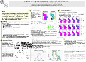
Multisensor and multiscale data assimilation of remotely sensed snow observations
1 / 1
Title:
Multisensor and multiscale data assimilation of remotely sensed snow observations
Description:
Two data assimilation techniques are used, the Ensemble Kalman filter and the ... One of the challenges inherent in such a data assimilation system is the ... –
Number of Views:119
Avg rating:3.0/5.0
Title: Multisensor and multiscale data assimilation of remotely sensed snow observations
1
Multi-sensor and multi-scale data assimilation of
remotely sensed snow observations Konstantinos
Andreadis1, Dennis Lettenmaier1, and Dennis
McLaughlin2 1. Department of Civil and
Environmental Engineering, Box 352700, University
of Washington, Seattle, WA 98195 2. Department
of Civil and Environmental Engineering,
Massachusetts Institute of Technology, Cambridge,
MA 02139 Catchment-scale Hydrological Modeling
Data Assimilation International Workshop, 9-11
January 2008, Melbourne, Australia
ABSTRACT A synthetic twin experiment is used to
evaluate a data assimilation system that would
ingest remotely sensed observations from passive
microwave and visible wavelength sensors (snow
water equivalent and snow cover extent derived
products, respectively) with the objective of
estimating snow water equivalent. Two data
assimilation techniques are used, the Ensemble
Kalman filter and the Ensemble Multiscale Kalman
filter. One of the challenges inherent in such a
data assimilation system is the discrepancy in
spatial scales between the different types of
snow-related observations. This study makes a
first assessment of the feasibility of a system
that would assimilate observations from multiple
sensors and at different spatial scales for snow
water equivalent estimation.
Elevation (m)?
Forest Cover ()?
- Spatial maps of different SWE simulations for
selected dates - Open-loop forcings created by perturbing
precipitation and temperature with lognormal and
gaussian multiplicative errors respectively and
generating an ensemble about those perturbed
values
- Study domain is part of the upper Colorado River
basin - Covers parts of Wyoming, Utah and Colorado
- Relatively high elevation (average 2,300 m)?
- Denser forest cover in SE, S and NW parts of
the basin
Truth
Open-loop
MSEnKF
EnKF
Observed
1 Dec 2003
- Identical twin synthetic experiment
- Snow properties are simulated with the Variable
Infiltration Capacity (VIC) model (Andreadis et
al., 2008)? - Truth model simulation with nominal forcings
(precipitation and air temperature)? - Open-loop corrupt nominal forcings with errors,
generate an ensemble about those, and simulate
snow properties with that ensemble
- Importance of snow to the hydrologic cycle
through its effects on water storage and land
surface energy balance - Strategies for large scale observation of snow
properties has focused on remote sensing - Visible wavelength sensors
- Snow Cover Extent observations
- No information on water storage and cloud cover
limitations - Passive microwave wavelength sensors
- Brightness temperature a function of snow
properties - Snow water equivalent observations
- Problems with presence of wet snow, signal
saturation and snow metamorphism - Additional information from hydrology models
- Forced with meteorological data and represent
the effects of soils, topography and vegetation - Uncertainties in forcing data and model
parameters - Objective of study is to evaluate and compare
data assimilation techniques using multi-scale
remotely sensed observations of snow cover and
water equivalent
15 Jan 2004
- Filter model simulation with open-loop ensemble
of forcings, and assimilation of synthetic
observations (both EnKF and MSEnKF)? - Observations synthetically generated by adding
errors to true fields of snow water equivalent
(SWE) and cover extent (SCE)? - Spatial resolutions emulating MODIS aggregated
to model resolution (10 km) and AMSR-E (25 km)? - Errors being N(0,20 mm) for SWE and N(0,0.1) for
SCE
10 Mar 2004
- Creating the tree topology
- SCE observations on finest scale and SWE
observations at scale immediately above,
dictating tree levels to be 6 since finest scale
is 10 km - Three criteria used to automatically assign
states to neighboring nodes distance, elevation,
and forest cover - The algorithm moves from coarser scales down the
tree, assigning blocks (no need to be
rectangular) of model pixels to nodes based on a
distance threshold first, and then elevation and
forest cover as scale becomes finer - Tree topology represents the spatial structure
of physiographic controls on snow accumulation
and ablation processes
- Multiscale tree provides a physically consistent
framework for assimilation of multi-sensor
observations - Similar performance between techniques, probably
because of the selected tree topology (in order
to have MODIS at finest scale and AMSR-E at one
scale above)? - Increasing model spatial resolution (therefore
increasing problem dimensionality), will lead to
larger finest scale state vectors and
hypothetically larger differences between the
EnKF and the MSEnKF - Perform similar experiment but assimilating
passive and active microwave brightness
temperatures, and using a forward radiative
transfer model (e.g. DMRT)?
- Two techniques are evaluated in this preliminary
test, both based on the Ensemble Kalman filter
(EnKF)? - Model error covariance represented through an
ensemble of model states - Update occurs sequentially every time an
observation is available - First technique square root impleme- ntation of
EnKF (Evensen, 2004)? - Second technique Multiscale EnKF (MSEnKF, Zhou
et al. 2007)? - Covariances are represented through a multiscale
tree that relates states through local
parent-child relationships - States assigned to finest scale nodes, while
measurements are assigned according to their
spatial support
- Time series of basin-averaged SWE (left plot)
and SCE (right plot)? - Study period 1 Sep 2003 31 May 2004
- MSEnKF and EnKF simulations similar improvement
over Open-loop
Basin Snow Cover Extent
Basin Snow Water Equivalent
Andreadis, K., P. Storck, and D. Lettenmaier
(2008) Modeling snow accumulation and ablation
in forested environments, submitted to Water
Resources Research. Evensen, G. (2004) Sampling
strategies and square root analysis schemes for
the EnKF, Ocean Dynamics, 54, 539-560. Zhou, Y.,
D. McLaughlin, and D. Entekhabi (2007) An
Ensemble multiscale filter for large nonlinear
data assimilation problems, submitted to Monthly
Weather Review.
Recommended
CrystalGraphics Presentations


