COSMIC FormoSat 3 - PowerPoint PPT Presentation
Title:
COSMIC FormoSat 3
Description:
LEO. vleo. vGPS. Tangent point. COSMIC high resolution profiles. Profile the (sporadic) ionospheric ... density profile information COSMIC also provides ~3000 ... – PowerPoint PPT presentation
Number of Views:59
Avg rating:3.0/5.0
Title: COSMIC FormoSat 3
1
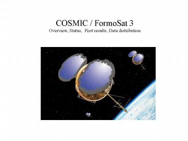
COSMIC / FormoSat 3 Overview, Status, First
results, Data distribution
2
Outline
- COSMIC Introduction / Status
- Early results from COSMIC
- Neutral Atmosphere profiles
- Refractivity
- Temperature, Water vapor
- Planetary Boundary layer
- Ionospheric results
- GPS Electron Density Profiles
- Global maps of Scintillation
- TIP and TBB (CERTO)
- Summary
- On-line Data Tool Demonstration
3
COSMIC/Formosat 3 at a Glance
4
Launch on April 14, 2006 Vandenberg AFB, CA
- All six satellites stacked and launched on a
Minotaur rocket - Initial orbit altitude 500 km inclination 72
- Will be maneuvered into six different orbital
planes for optimal global coverage (at 800 km
altitude) - All satellites are in good health and providing
initial data
COSMIC launch picture provided by Orbital
Sciences Corporation
5
COSMIC Satellite Ground Tracks mid-August 2006
6
The velocity of GPS relative to LEO must be
estimated to 0.2 mm/sec (velocity of GPS is 3
km/sec and velocity of LEO is 7 km/sec) to
determine precise temperature profiles
7
The velocity of GPS relative to LEO must be
estimated to 0.2 mm/sec (20 ppb) to determine
precise temperature profiles
8
COSMIC high resolution profiles
Profile the (sporadic) ionospheric E-layer with
1-km vertical resolution
Area dominated by noise - used for
noise calibration of profile
Area affected by noise - profiles are noisy
and/or affected by climatology
Highest quality profiles 5-30 km
Some profiles affected by boundary layer effects
(super refraction)
9
GPS radio occultation measurements processing
10
Lay-out of radio occultation data processing at
CDAAC indicates the use
of ancillary data (climatology)
Input (phase and amplitude)
6) Calculation of the bending angle from L1 raw
complex signal
1) Detection of L1 tracking errors and truncation
of the signal
7) Combining (sewing) (5) and (6) L1 bending
angle profiles
2) Filtering of raw L1 L2 Doppler
8) Ionospheric calibration of the bending angle
3) Estimation of the occultation point
4) Transfer of the reference frame to the local
center of Earths curvature
9) Optimal estimation of the bending angle
5) Calculation of L1 and L2 bending angles from
the filtered Doppler
10) Abel inversion
Output (refractivity)
11
Atmospheric refractive index
where is the light velocity in a vacuum
and is the light velocity in the
atmosphere Refractivity
(1) (2)
(3)
- Hydrostatic dry (1) and wet (2) terms dominate
below 70 km - Wet term (2) becomes important in the
troposphere and can - constitute up to 30 of refractivity at the
surface in the tropics - In the presence of water vapor, external
information information is needed to
obtain temperature and water vapor - Liquid water and aerosols are generally ignored
- Ionospheric term (3) dominates above 70 km
12
On-line Tutorial on Radio Occultation
http//www.meted.ucar.edu/COSMIC/
13
COSMIC Soundings in 1 Day
COSMIC Radiosondes
Sec 3, Page 10
14
Ionospheric Occultation Global Coverage
- About 2500 ionospheric occultations per day
- Profiles of electron density between 100 and 800
km - Total Electron Content to all GPS satellites in
view
15
Getting COSMIC Results to Weather Centers
Operational Processing
JCSDA
TACC
NCEP
Input Data
NESDIS
CDAAC
ECMWF
CWB
GTS
UKMO
BUFR Files WMO standard 1 file / sounding
JMA
Canada Met.
Science Archive
NRL
Data available to weather centers within minutes of on-orbit collection
16
COSMIC Data Availability
- Data opened up to public in July 2006
- All Data (including raw data) available at the
end of each day - Real-time products (profiles of bending,
refractivity, ) in WMO standard format available
via the GTS - Post-processed data for climate research will be
updated every few months - Data use agreement with NSPO required for use of
all data and data products (via TACC or CDAAC
website)
17
COSMIC Data Policy
- Real-time data (raw data, excess phase data,
etc.) available upon approval of letter request
to NSPO director and UCAR president - All requests have been approved
- Next slide shows how to sign up (or go directly
to) - http//tacc.cwb.gov.tw/service/policy.htm
18
COSMIC Sounding Penetration (Day 239, 2006)
19
Atmospheric refractivity Tropical Sounding
refractivity
Dry Temperature Polar Sounding
temperature
Precision of Radio Occultation Measurements 0.2
or 0.5 deg in temperature (between 10-20 km)
20
Penetration of Planetary Boundary layer with
COSMIC
Comparison of Refractivity with GFS (AVN)
21
Water Vapor Pressure Comparison COSMIC (FM3 and
FM4 ) vs. GFS
22
COSMIC Ionospheric NmF2 - 1 week
23
Comparison of 2 Ionospheric Profiles
24
Ionospheric Total Electron Content Data
In addition to electron density profile
information COSMIC also provides 3000 daily LEO
- to - GPS TEC arcs
25
Longitudinal variability of ionosphere
1
- Low latitude density crests and trough are a
product of photoionization, recombination, and
transport - Electric fields interact with the Earths
magnetic field to transport plasma vertically at
the equator, which diffuses downward along the
magnetic field lines - Meridional neutral winds also transport plasma
along magnetic field lines
Clayton Coker, NRL
- TIP reveals the complexity of these ionospheric
drivers as a function of longitude
26
FM4
Paul Bernhardt, NRL
27
Summary
- COSMIC was launched on-schedule and on-budget
- All 6 GPS receivers are working
- TIP and CERTO (TBB) instruments working
- CDAAC automated processing is working
- Obtaining good radio occultation profiles in
ionosphere (2500 /day) and neutral atmosphere
(1200 / day) - Data freely available (registration required)
- About 220 users have signed up so far
- Transferred 519 Gb of data (1.7 million files) to
106 different users between Aug.1 - 28

