Research Vessels - PowerPoint PPT Presentation
1 / 41
Title: Research Vessels
1
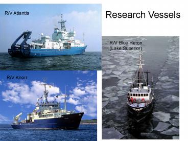
Research Vessels
R/V Atlantis
R/V Blue Heron (Lake Superior)
R/V Knorr
2
(No Transcript)
3
Sea surface temperature (infrared) Advanced Very
High Resolution Radiometer (AVHRR)
Regional
Global SST anomalies
4
Sea surface Temperature Gulf Stream Meanders
and Rings
5
Ocean color from space SeaWiFS Chlorophyll
Satellite swaths during orbit
Chlorophyll around Antarctica
Galapagos Islands
6
International Constellation of Ocean Color
Satellites
7
FY-1D Sept. 12, 2002 1338 GMT
8
SeaWiFS true color (visible wavelengths)
Yangtze River flood
Hurricane George off Florida
9
CODAR
Note individual satellite pixels of size 1 km2
10
Wind over the ocean from radar interferometry
11
Global bathymetry is known partly from gravity
measurements
12
ROVs
Jason Jr.
ARGO
ARGO
13
Slocum Electric Glider
(an AUV)
14
Glider Operation
Moves in a saw-toothed trajectory
Forward speed of 1 knot
Depth range 4-200 meters
Navigation done using GPS, dead reckoning and
the altimeter
Average deployment duration is 30 days and 1500 km
15
(No Transcript)
16
AUVs
17
Adaptive Sampling with REMUS AUVs
18
DSRV ALVIN Woods Hole Oceanographic Inst.
19
Deep Rover
A plastic sphere with motors, propellers, arms,
and instruments
20
Sonar echo sounding for detailed bathymetry
Marine archeology sidescan sonar image (hard to
believe its not a photo)
21
Deep-tow
22
Seismic profiling
23
Seismic profiling strong sound at right
frequencies to penetrate sediment layers
Ancient river bed cut through Pre-existing shelf
sediments
Towed chirper gets transponder closer
to Bottom, away from ship
24
Now, we move from remote to in situ sampling
methods. In situ means in place, so these
methods measure the properties of the seawater
in which they sit.
25
Deep Ocean bottom-anchored buoys - the TOGA/TAO
Array.
26
An anchored buoy for studying the effect of
atmospheric dust on surface ocean chemistry and
biology
27
Free drifting buoys
Holey sock drogue
28
Inadvertent drifting buoy experiments -- the
Lagrangian approach.
Fixed current meter The Eulerian approach
29
New Jersey Shelf Observing System (In Situ Data)
Storm Center
(GMT)
Met Tower Data
Storm Center
Storm Center
(GMT)
(EST)
30
Bottom dredge For collecting rocks from A region
with little sediment (e.g. mid-ocean ridge) Used
on the Challenger expedition and
virtually unchanged today. (top view)
31
Deep-sea sediment core locations
Deep-sea sediment coring -gt paleoceanography
The Vema
Core repository
gravity corer
Core recovery
32
Deep-sea rotary drilling
33
Water sampling what are we looking for?
34
Niskin bottles in the wet lab of a ship
35
Towed fish for Clean water sampling
36
Collecting uncontaminated samples from the
seawater stream pumped into the ships lab from
the towed fish
37
CTD C conductivity (salinity) Ttemperatu
re Ddepth
38
Rosette frame Schematic Loaded with bottles on
deck
39
A crawling profiler CTD for use on a
bottom-anchored mooring
Current meter
Pressure (depth) sensor
Salinity and temperature sensors
40
Sampling suspended particles from seawater in
situ.
41
Sediment trap for catching sinking particles
Top view (baffle)


