
Using Handheld Computers and GPS Devices for Field Data Collection
1 / 31
Title:
Using Handheld Computers and GPS Devices for Field Data Collection
Description:
Using Handheld Computers and GPS Devices for Field Data Collection –
Number of Views:269
Avg rating:3.0/5.0
Title: Using Handheld Computers and GPS Devices for Field Data Collection
1
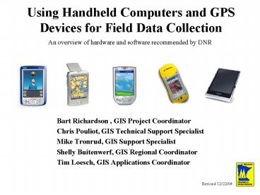
Using Handheld Computers and GPS Devices for
Field Data Collection
An overview of hardware and software recommended
by DNR
- Bart Richardson , GIS Project Coordinator
- Chris Pouliot, GIS Technical Support Specialist
- Mike Tronrud, GIS Support Specialist
- Shelly Buitenwerf, GIS Regional Coordinator
- Tim Loesch, GIS Applications Coordinator
Revised 12/22/04
2
Palms Pendragon
Pocket PCs ArcPad
Tablet PCs ArcView
3
(No Transcript)
4
Palms Pendragon
Mike Tronrud
5
Garmin iQue 3600
Hardware Cost 500 Software Cost Pendragon
Forms 4.0 225 Total Cost 725 Memory 32 MB,
requires additional 40 128mb memory
card Processor 200 MHz Motorola DragonBall MXL
ARM 9 Operating System Palm Built in devices
Display, Speaker, Microphone, Antenna, Touch
screen, GPS
6
Garmin iQue 3600
- Pros
- High resolution screen
- Includes detailed street maps
- Integrated GPS receiver
- Simple and standardized field data collection
- Cons
- Short Battery Life (3-4 hours)
- Not Waterproof
7
Palm Zire 72
Hardware Cost 300 GPS Price Jacket GPS
200 Software Cost Pendragon Forms 4.0
225 Total Cost 725 Memory 16mb, requires 40
128mb memory card Processor 312MHz Intel
Xscale Operating System Palm Built in devices
Display, Camera, Voice recorder
8
Palm Zire 72
- Pros
- Built in Camera
- Bluetooth wireless capability
- Simple and standardized field data collection
- Cons
- Requires a separate GPS unit
- Fair photo quality
- Not Waterproof
9
(No Transcript)
10
Covers majority of hillside North of Johnson Dam
11
(No Transcript)
12
Pocket PCs ArcPad
Bart Richardson
13
Dell Axim 30x
Hardware Cost 350 Software Cost ArcPad
500 GPS Cost Bluetooth GPS 200 Total Cost
1,050 Memory 64 MB ROM, 64 MB RAM Processor
624 MHz Intel XScaleTM Operating System Windows
Mobile 2003 Built in devices Display, Touch
screen, Speaker, Microphone, Extra battery,
Flash Card
14
Dell Axim 30x
- Pros
- High resolution screen
- ArcPad Software
- Supports shapefiles and geo-referenced images
- GPS data captured as shapefiles
- Edit all shapefile attributes and features
- Relatively cheap ArcPad solution
- Cons
- Not field rugged
- Separate GPS unit needed
15
Trimble GeoXM
Hardware Cost 2,750 Software Cost ArcPad
500 Total Cost 3,250 Memory 64 MB RAM, 512
MB Flash data storage Processor 206 MHz
Intel StrongARM Operating System Windows Mobile
2003 Built in devices Outdoor Display, Touch
screen, Speaker, Microphone, WAAS GPS
16
Trimble GeoXM
- Pros
- Integrated GPS
- Outdoor display
- Field rugged, water-resistant
- ArcPad Software
- Supports shapefiles and geo-referenced images
- GPS data captured as shapefiles
- Edit all shapefile attributes and features
- Cons
- Expense
17
Collecting land cover data
18
(No Transcript)
19
(No Transcript)
20
(No Transcript)
21
(No Transcript)
22
Tablet PCs ArcView
Chris Pouliot
23
Gateway M275 Series
Hardware Cost 3,500 Software Cost Arcview 3.x
1,200, DNR Garmin Free GPS Cost 200 Total
Cost 4,900 Memory 1 GB Processor 1.5 GHz
Operating System Windows XP Other Features
Display, Touch screen, Keyboard, CD/DVD,
Firewire, USB2, 40GB HD, IR Wireless
24
Gateway M275 Series
- Pros
- Large Screen
- Keyboard/Pen
- Extremely flexible software options
- Accommodates large GIS datasets
- Point/Line/Polygon capture
- Attribute data entry
- Immediate CD Backup
- Cons
- Short battery life (2 hours)
- Not field rugged not waterproof or armored
- Weight/Portability
- Cost
25
(No Transcript)
26
Swan Survey
27
Swan Survey
28
Deer Survey
29
Trends Whats Next?
- More ruggedized
- Rubberized bumpers, shock and water resistant
casings, less temperature sensitive, improved
viewability - WAAS signal reception
- Since WAAS is line-of-sight signal, some
companies developing algorithms so can continue
to use WAAS up to 45 minutes after signal is lost - Bluetooth
- 30 ft wireless connection allows for
mix-and-match components easily upgradeable,
less costly, more customizable
30
Conclusions What to Choose?
- What field data will you need to collect?
- Will you need to edit data in the field or back
in your office? - How often will you collect field data?
- How accurate does the data need to be?
- What is your budget?
- Do you already have some components you might be
able to use in a solution?
31
Conclusions Three Solution Categories
Palm, Garmin or bluetooth GPS, and Pendragon
(725.00)
Pocket PC (ie Trimble GeoXM/XT) and ArcPad
(3500.00)
Tablet, bluetooth GPS, ArcView, and DNRGarmin
(5000.00)
Recommended
CrystalGraphics Presentations


