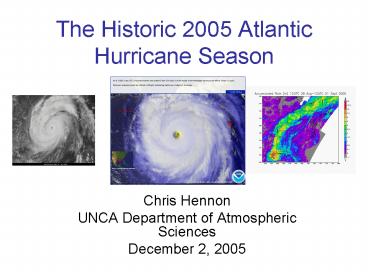
The Historic 2005 Atlantic Hurricane Season
1 / 38
Title: The Historic 2005 Atlantic Hurricane Season
1
The Historic 2005 Atlantic Hurricane Season
- Chris Hennon
- UNCA Department of Atmospheric Sciences
- December 2, 2005
2
(No Transcript)
3
Outline
- 2005 Atlantic Seasonal Forecasts
- 2005 Storms
- Katrina
- Rita
- Wilma
- Historical Perspective
4
Warning Signs.....
5
Atlantic SSTs very warm
6
Neutral El Niño conditions
7
2005 Seasonal Forecasts
Accumulated Energy Index 120 - 190 of
long-term mean (1 May) 180 - 270 of
long-term mean (1 August)
8
2005 Seasonal Forecasts
3 December 2004 .....slightly above average
season for 2005 We do not, however, expect
anything close to the 2004 hurricane
season (11 named storms)
1 April 2005 ...above-average hurricane season
for the Atlantic Basin for 2005 We
have adjusted our forecast upward from
December... ....may further raise our
prediction if El Niño do not develop (13
named storms)
31 May 2005 We foresee a well above-average
hurricane season (15 named storms)
5 August 2005 We foresee one of the most
active seasons on record (20 named storms)
9
Season Summary (As of Dec. 2)
- 29 Tropical Depressions
- 26 Named Storms (Tropical Storm or higher)
- 14 hurricanes
- 7 major hurricanes (Category 3 or above)
- 3 Category 5 hurricanes
Tropical Storm Epsilon (1 Dec. 2005) (now a
hurricane!)
10
Hurricane Katrina
11
Official NHC Forecasts Beginning 1800 UTC August
26
12
Katrina formed from the remnants of TD-10 and
another disturbance in the SE Bahamas. Steady
intensification and a move toward S. Florida was
forecast
13
South Florida Landfall (Cat-1) 082505 2209
UTC Rainfall estimates were up to 20 south of
the storm center
14
August 25, 2005 As Katrina was making landfall
in South Florida, sea surface altimetry
data showed a warm eddy in the Gulf of Mexico
spun off from the Loop Current. This source of
fuel would lay directly ahead of the future track
of Katrina
Submitted by Kerry Emanuel to Tropical Storms
email list
15
Concentric Eyewall Moat. Katrina would become
a Cat-5 after completing the cycle
16
NOAA P-3 flight level winds on eyewall
penetration (1800 UTC 27 August). Note the double
wind maxima, suggesting the eyewall cycle was
still in progress. The outer maxima would
eventually take over and contract, ultimately
creating a 20 nautical mile wide, nearly
perfectly circular eye
17
2010 UTC 28 August Central pressure
plummets throughout the day to a minimum of 902
mb with 175 mph sustained winds. Katrina is a
Category-5 hurricane
18
SSM/I Pass 0247 UTC 29 August The combination
of the new eyewall cycle,intrusion of dry air
into the western side of the circulation, and
the loss of energy from leaving the warm
eddy weakened Katrina to a Category-4 just before
landfall.
19
GOES-12 Water Vapor, 1415 UTC 29 August. Note
the intrusion of drier air impinging on the
western side of the circulation.
20
Katrina Totals
- 1302 killed (est. - second most for U.S. storm)
- 70 - 130 billion damage (most expensive ever)
- Over 1 million people displaced
21
Hurricane Rita
- 897 mb minimum sea level pressure
- 4th Most Intense in the Atlantic (up until that
time) - Reopened some levy breaches in New Orleans
- 6 direct deaths
22
(No Transcript)
23
(No Transcript)
24
(No Transcript)
25
(No Transcript)
26
(No Transcript)
27
(No Transcript)
28
(No Transcript)
29
(No Transcript)
30
(No Transcript)
31
Actual
32
Hurricane Wilma
- Most intense tropical cyclone ever recorded in
the Atlantic Basin (882 mb) - 47 deaths (Mexico, U.S., Cuba)
33
Hurricane Wilma Track
http//en.wikipedia.org/wiki/ImageWilma_2005_trac
k.png
34
882 mb
930 mb
35
Hurricane Wilma from the International Space
Station
http//www.nasa.gov/images/content/136586main_iss0
12e05235_high.jpg
36
New Records
37
Why was the 2005 season so hyper-active?
Why were there so many tropical cyclogenesis
events in the northern Caribbean?
Why did many storms, including Katrina,
intensify so rapidly?
Why were there only a couple of storms that
formed in the eastern Atlantic?
Whats in store for 2006?
38
Questions?


