
Geoinformatics synonym: Planetary Informatics - PowerPoint PPT Presentation
1 / 34
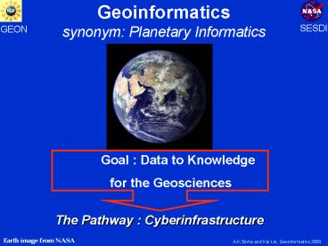
Title: Geoinformatics synonym: Planetary Informatics
1
Geoinformatics synonym Planetary Informatics
SESDI
GEON
Goal Data to Knowledge for the Geosciences
The Pathway Cyberinfrastructure
Earth image from NASA
A.K.Sinha and Kai Lin, Geoinformatics 2006
2
What do Geo-scientists want from
cyberinfrastructure?
- Data inter-operability
- Access to High Performance Computation grid
based - Visualization to aid interpretation
- On line Tools for computations , modeling and
making legacy data digital and geospatial - Archive and preserve legacy data
- Ease of registration, discovery and access to
data (static and streaming) from distributed
systems smart search - And most importantly query based Integration of
diverse disciplinary dataknowledge discovery ,
hypothesis evaluation and hazard assessment - Advancing geoscience education
A.K.Sinha and Kai Lin, Geoinformatics 2006
3
Why do we need cyberinfrastructure?
- An integrative environment that provides products
and services for research, education, decision
makers and the broader community adds societal
relevance to such useful scientific goals as - Hazard and Resource Management
- Climate Change
- EarthScope
A.K.Sinha and Kai Lin, Geoinformatics 2006
4
Integration a buzz word but with complex
solutions
- What is Integration?
- Relationships in information contained in
heterogeneous and multi-disciplinary databases - What are our choices?
- Layering of data (commonly used) integration
done by the user - Schema based integration (merging of schema, but
user must be knowledgeable about the
organization, e.g. semantics of schema, and an
unlikely activity for most geoscientists) - Ontology based semantic integration utilizing
workflows (supported by ongoing GEON project)
Data Registration is Important for integration!
A.K.Sinha and Kai Lin, Geoinformatics 2006
5
A Geoscientists Information Integration Scenario
What is the distribution and U/ Pb zircon ages of
A-type plutons in VA? How about their 3-D
geometry using gravity data ?
? Information Integration
Geochemical Database (chemical data)
Geochronologic database (Concordia)
Digital geologic map Of Virginia (plutons in
Virginia)
Geophysical Database (gravity contours)
A.K.Sinha and Kai Lin, Geoinformatics 2006
6
Discovery and Integration of Geoscience Data
is a two step process
- Discovery of earth science datastep 1
- Integration of earth science datastep 2
Leading to
A.K.Sinha and Kai Lin, Geoinformatics 2006
7
Current Technologies for Discovery of Data
- Commercial Approaches
- IBM WebSphere Data Integration Suite
- Google like search engines
- Others
- Visit Library, Call Friends
- GEON Approach
- Smart Search Ontology based discovery
A.K.Sinha and Kai Lin, Geoinformatics 2006
8
- How do Ontologies help with Smart Discovery and
Semantic Integration?
A.K.Sinha and Kai Lin, Geoinformatics 2006
9
What is an Ontology?An explicit formal
specifications of the terms in the domain and
relations among them (Gruber 1993)
Thesauri narrower term relation
Frames (properties)
General Logical constraints
Formal is-a
Catalog/ ID
Informal is-a
Formal instance
Disjointness, Inverse, part-of
Terms/ glossary
Value Restrs.
based on AAAI 99 Ontologies panel McGuinness,
Welty, Ushold, Gruninger, Lehmann
- From McGuinness, 2005
A.K.Sinha and Kai Lin, Geoinformatics 2006
10
What is Ontology? Why use Ontology?
For earth scientists, it simply means making
information such as classification schemes, and
known relationships between concepts and
associated data such as those that exist between
rocks , density and seismic velocity available in
a logical language that computers can work with
Motivations for Using Ontologies A better way to
discover datasets Use the knowledge in
ontologies to find datasets A better way to
query datasets Query through ontologies
without knowing the details of the schemas A
better way to integrate multiple datasets
Integrate multiple datasets on-the-fly if they
are registered to ontologies A better way to
segment large data bases Transfer only parts of
data bases required for integration
A.K.Sinha and Kai Lin, Geoinformatics 2006
11
High Level Ontology Packages
Import NASA Semantic Web for Earth Science
Numerics Ontology
Import NASA Semantic Web for Earth Science
Units Ontology
Import http//www.isi.edu/ pan/OWL-Time.html
Planetary Structure
Geologic Time
Planetary Material
Physical Properties
GeoImage
PlanetaryLocation
Planetary Phenomenon
Import NASA Semantic Web for Earth Science
Space Ontology
Import NASA Semantic Web for Earth Science
Physical Property Ontology
Import NASA Semantic Web for Earth Science
Physical Phenomena Ontology
A.K.Sinha and Kai Lin, Geoinformatics 2006
12
Registering geochemical and isotopic datasets
Element Ontology
A.K.Sinha and Kai Lin, Geoinformatics 2006
13
Screen Capture of Attributes for the Element
Uranium
A.K.Sinha and Kai Lin, Geoinformatics 2006
14
Planetary Structure
Registering structural, stratigraphic, geologic
maps
A.K.Sinha and Kai Lin, Geoinformatics 2006
15
Geologic Time
Registering an earthquake event requires these
classes !
A.K.Sinha and Kai Lin, Geoinformatics 2006
16
Registration of Data key to discovery and
integration
- Level 1. Discovery of data resources (e.g.,
gravity, geologic maps, etc) requires
registration through use of high level index
terms. GEON has deployed extension of AGI Index
terms -will be cross indexed to others such as
GCMD, AGU - Level 2. Discovering Item level databases
requires registration at data level ontologies
(e.g. bulk rock geochemistry, gravity database) - Level 3. Item detail level registration (e.g.,
column in geochemical database that represents
SiO2 measurement) . This level of registration is
a requirement for semantic integration
A.K.Sinha and Kai Lin, Geoinformatics 2006
17
Level 1Registration at the Index Term Level
GEON Index Ontology
AGI Index Terms
http//www.geoscienceworld.org/
18
Level 2 Registration at the Item Level
Structure
Isotope
Location
Mineral
Rock
Element
A.K.Sinha and Kai Lin, Geoinformatics 2006
19
Level 3 Registration at the Item Detail Level
(Example1)
GEON approach of registering data to concepts
removes structural (format) and semantic
heterogeneity
1
0..n
A Section from Planetary Material Ontology
A.K.Sinha and Kai Lin, Geoinformatics 2006
20
High Level Ontology Packages
Import NASA Semantic Web for Earth Science
Numerics Ontology
Import NASA Semantic Web for Earth Science
Units Ontology
Import http//www.isi.edu/ pan/OWL-Time.html
Planetary Structure
Geologic Time
Planetary Material
Physical Properties
GeoImage
PlanetaryLocation
Planetary Phenomenon
Import NASA Semantic Web for Earth Science
Space Ontology
Import NASA Semantic Web for Earth Science
Physical Property Ontology
Import NASA Semantic Web for Earth Science
Physical Phenomena Ontology
A.K.Sinha and Kai Lin, Geoinformatics 2006
21
How is Stratigraphic data (of lava flows) related
to ontologies?
Ontologies
Planetary Material
Is a
has a
Planetary Structure
Columbia River
has a
Planetary Location
has a
GeoImage
has a
Geologic Time
Catoctin, VA
A.K.Sinha and Kai Lin, Geoinformatics 2006
22
How is Paleontology data related to Ontologies ?
Paleontology
Ontologies
is a
Planetary Material
has a
Planetary Structure
has a
Planetary Location
has a
GeoImage
has a
Classification of Fossils based on shapes
Geologic Time
23
Working in a web environmentWeb Ontology
Language (OWL)
From ontologies to a language for computers
Well defined semantics Formal properties well
understood (complexity, decidability) Known
reasoning algorithms Implemented systems (highly
optimised)
Full
DL
Things OWL Doesnt Do..requires use of WORKFLOWS
discussed later default values arithmetic string
operations partial imports
Lite
A.K.Sinha and Kai Lin, Geoinformatics 2006
24
A Geoscientists Information Integration Scenario
What is the distribution and U/ Pb zircon ages of
A-type plutons in VA? How about their 3-D
geometry using gravity data ?
? Information Integration
Geochemical Database (chemical data)
Geochronologic database (Concordia)
Digital geologic map Of Virginia (plutons in
Virginia)
Geophysical Database (gravity contours)
A.K.Sinha and Kai Lin, Geoinformatics 2006
25
Integration Scenario A-type pluton query
- Classifying A-types from an Igneous rock database
- Integrating between Relational and Spatial
(shapefiles) databases to query and interactively
display GIS results
A.K.Sinha and Kai Lin, Geoinformatics 2006
26
Integration Scenario Stages for access to data
and tools in a workflow environment
- Ontology System
- Location
- States
- Virginia
- Classification System
- Rock Classifiers
- Igneous
- Pluton
- A-type
- Mineral
- Zircon
- Geologic Time
- Dating Methods
- U-Pb Zircon Methods
1
Zr
2
4
3
104 Ga/Al
3
5
6
6
5
6
A.K.Sinha and Kai Lin, Geoinformatics 2006
27
729
722
745
730
706
Distribution and ages of A-Type plutons based on
integration of multiple databases
724
735
A.K.Sinha and Kai Lin, Geoinformatics 2006
28
What are Earth scientists interested in?Going
from Objects to Processes
- OBJECT ONTOLOGY Static portrayal of the earth
current research - What.is it?
- Where...is it?
- Whenwas it formed?
- 2. PROCESS ONTOLOGY Dynamic portrayal of the
earth future research - Why...Processes that integrate What,Where,When
- How.. Is it societally relevant? e.g.
VOLCANOES as hazards and agents for
Climate Change
Leads to
A.K.Sinha and Kai Lin, Geoinformatics 2006
29
May 18, 1980 USGS
Volcano Hazard Assessment ontologies to support
semantic integration become societally and
scientifically relevant
A.K.Sinha and Kai Lin, Geoinformatics 2006
30
Packages for an Ontology for Volcanoes
SESDI ( NASA)
Volcanic System
Phenomenon
Material
Data Types
Climate
Instruments
SWEET
GEON
(NASA)
(NSF)
IMPORT EXISTING ONTOLOGIES
Import NASA Semantic Web for Earth Science
Physical Phenomena Ontology
A.K.Sinha and Kai Lin, Geoinformatics 2006
31
A.K.Sinha and Kai Lin, Geoinformatics 2006
32
SESDI PROJECT
Data types to be discovered and integrated
through an ontology of Volcanoes
33
SESDI PROJECT
Linking Volcanic Systems to Environment and
Phenomenon
Sinha et.al, Geoinformatics 2006
34
Disciplinary informatic projects are necessary,
but connecting them through integration
technologies is the key to changing the culture
of geoscientists. GEON/SESDI provide research
roles for information management of static and
streaming data, and integration within and across
disciplines
A.K.Sinha and Kai Lin, Geoinformatics 2006