Nuclear Safety, GIS and Remote Sensing - PowerPoint PPT Presentation
Nuclear Safety, GIS and Remote Sensing
Background image: http://bazzinet.info/content/media/wallpapers/misc/nucleardawn.jpg ... The European Commission, Joint Research Centre and other organizations ... – PowerPoint PPT presentation
Title: Nuclear Safety, GIS and Remote Sensing
1
Nuclear Safety, GIS and Remote Sensing
The European Commission, Joint Research Centre
and other organizations set out a few years ago
to create a GIS program that would allow nuclear
site inspectors to check up on almost any site in
the world via satellite imagery. The satellite
images can be used to crosscheck a sites info,
which has already been geo-referenced, given by a
country. This is for detecting discrepancies and
undeclared activities at a site.
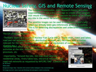
- The GIS program includes
- Thematic layers of a countrys Nuclear Fuel Cycle
(NFC) main cities, rivers and lakes road and
rail networks electric distribution network NFC
facilities RD activities relevant for the NFC
manufactures and export of equipment of nuclear
interest (Contini doc.)
- Detailed info about a site databases of nuclear
material, activities at the site, multimedia
files depicting the facilitys processes, etc - Importantly, Around the site, the map must
describe residential areas, rivers/lakes/sea,
electrical networks, and road/rail networks as
requested by INFCIRC/540 (Contini doc.)
By Bill Brown Works Cited Background image
http//bazzinet.info/content/media/wallpapers/misc
/nucleardawn.jpg GIS images and text
www.ec-gis.org/Workshops/6ec-gis/papers/contini-nu
clear.doc
PowerShow.com is a leading presentation sharing website. It has millions of presentations already uploaded and available with 1,000s more being uploaded by its users every day. Whatever your area of interest, here you’ll be able to find and view presentations you’ll love and possibly download. And, best of all, it is completely free and easy to use.
You might even have a presentation you’d like to share with others. If so, just upload it to PowerShow.com. We’ll convert it to an HTML5 slideshow that includes all the media types you’ve already added: audio, video, music, pictures, animations and transition effects. Then you can share it with your target audience as well as PowerShow.com’s millions of monthly visitors. And, again, it’s all free.
About the Developers
PowerShow.com is brought to you by CrystalGraphics, the award-winning developer and market-leading publisher of rich-media enhancement products for presentations. Our product offerings include millions of PowerPoint templates, diagrams, animated 3D characters and more.


