
Using LandsatBased Continuous Fields Data for Land Cover Change Analysis
1 / 42
Title:
Using LandsatBased Continuous Fields Data for Land Cover Change Analysis
Description:
Using LandsatBased Continuous Fields Data for Land Cover Change Analysis –
Number of Views:155
Avg rating:3.0/5.0
Title: Using LandsatBased Continuous Fields Data for Land Cover Change Analysis
1
Using Landsat-Based Continuous Fields Data for
Land Cover Change Analysis
Eric Brown de Colstoun1,2
- 1 Science Systems and Applications, Inc.
- 2 Biospheric Sciences Branch,
- NASA/Goddard Space Flight Center
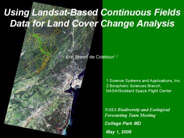
NASA Biodiversity and Ecological Forecasting Team
Meeting College Park MD May 1, 2008
2
Continuous Fields of Vegetation
Bare Grass Tree
ISLSCP Initiative II VCF 0.25 Degree
- Continuous fields of vegetation characteristics
are thought to better describe land cover than
discrete classifications (mosaics/ecotones). - Much work done at continental/global scales with
AVHRR, MODIS (DeFries, Townshend, Hansen). NLCD
2001 has impervious and canopy cover for U.S. - Different from spectral un-mixing in that
approach is supervised. - Some ambiguity in definitions make utilization
sometimes difficult (tree cover, crown cover,
canopy cover, etc).
3
Consequences of Land Cover/Use Changes on
National ParksA Research/Educational
Partnership in the Upper Delaware River Basin
- Funded by NASAs New Investigator Program (2004).
- 3-year project to develop tools for land
cover/use change monitoring in and around
national parks from Landsat satellite. - Use time series of Vegetation Continuous Fields
for Land Cover change analysis. - Use state-of-the-art in Landsat processing
(calibration, atmospheric correction) and
regression tree algorithms. - Model consequences of changes on water/energy
cycles using the GAPS model. - Develop pilot curriculum that includes Earth
system science, remote sensing, and modeling. - Partners include the River Valley GIS consortium
(UPDE, DEWA), LEDAPS (Jeff Masek, NASA/GSFC)
Elissa Levine (NASA/GSFC GLOBE), Woods Hole
Research Center, Shippensburg U., GLOBE program,
Landsat Program Office, Northeastern and Colonial
Intermediate Units, educators/students from area
schools.
4
Delaware River Basin Watersheds
5
(No Transcript)
6
(No Transcript)
7
Mosaic of two Landsat ETM scenes Acquired on
September 23, 1999 3,2,1 The area of study is
the Upper Delaware River Basin (Yellow) and
includes several counties in PA, NY, NJ
8
Research Overview
Landsat Data 1984-2005
1) Calibration Tie sensor response over time to
surface signal
2) Atmospheric Correction Remove atmos. (e.g.
haze) effects from signal
Atmos. Correction LEDAPS
CUBIST Regression Tree
High Spatial Resolution Training Data Air Photos,
IKONOS
Land Cover maps can be derived from the tree and
imp. cover
Tree, Impervious 1984-2005
Land Cover/Use
Validation
Land Cover/Use Change 1984-2005
9
http//ledaps.nascom.nasa.gov/ledaps/ledaps_NorthA
merica.html
10
http//ledaps.nascom.nasa.gov/ledaps/ledaps_NorthA
merica.html
11
Continental Scale Disturbance 1990/2000
http//ledaps.nascom.nasa.gov/ledaps/ledaps_NorthA
merica.html
12
ETM L7 TOA Mosaic (3,2,1)
The Impact of LEDAPS Atmos. Corrections
13
ETM L7 SR Mosaic (3,2,1)
14
Data Pre-Processing
October 1, 2005
November 15, 2004
15
2005 Epoch Processing Mask
16
1990s Processing
August 19, 1995
April 15, 1996
17
1995 Epoch Mask
18
August 26, 1984
September 21, 1984
1980s Data! Can you say compositing?
19
1980s Processing Mask
20
Training Data Development
-We derive the tree cover and/or impervious
cover at the 30m Landsat Scale from the high
resolution data at 0.6 m. (I.e. we aggregate the
air photos to 30m). -Several samples in a larger
region (e.g. Pike County) are used to train the
regression tree to recognize similar patterns
elsewhere in the county. -The entire region is
processed based on the regression tree trained
above. -This is done for every year in the data
base (84/85, 88/89, 95/96, 99/00, 04/05).
Color Infrared Air Photo (0.6 m Resolution)
21
Training Data Development(cont.)
For each training pixel -Reflectance (Landsat
1-7) -NDVI -Tasseled Cap (B, G, W) -Leaf on/Leaf
off
22
Final Training Data (n30348)
23
Landsat True Color 3, 2, 1
09/21/1984
08/19/1995
10/01/2005
24
Landsat True Color 3, 2, 1
09/21/1984
08/19/1995
10/01/2005
25
2005 Impervious Cover for Pike Co. PA
26
Claire Jantz, Shippensburg U.
27
2005 Development Upper Delaware River Basin
Claire Jantz, Shippensburg U.
28
2030 Predicted Development Upper Delaware River
Basin
Claire Jantz, Shippensburg U.
29
Tree Cover Time Series
1984 1995 2005
30
09/21/84
10/01/05
Tree Loss 84-05
LEDAPS Forest Disturbance 88-01
31
08/26/84
10/01/05
Tree Loss 84-05
LEDAPS Forest Disturbance 88-01
32
Training Data Results
33
Educational Activities
- Two successful training/prof. development
workshops - Pocono Environmental Education Center (October
2005). - NEIU and Colonial IU Joint Workshop (May 2006).
- Field validation activity, September 2006.
- Weekend validation of Landsat 2005/2006
products in the field with students, parents,
volunteers, NPS staff. - Trained 58 Science, Math, Geography teachers from
33 middle/high schools. 90 student participants
in field validation. - We helped NASA to survey the area and I had
fun. - I believe it is a great experience for anyone
interested in Geography/Science.
- They did not give us any bug spray!
34
2005 Tree Cover Validation with Student Acquired
Data
35
Conclusions
- Continuous fields approach using Landsat data
overcomes many of the limitations of discrete
classifications. - Data provide near continuous estimates of
LCLUC. - We can estimate regional impervious/tree cover to
6/13. - Is this good enough (ecological thresholds) ?
- Techniques can be tailored for continental and
global monitoring. Suggest use Geocover,
Mid-decadal Global Land Survey (MDGLS). - However, up front costs of data processing may be
prohibitive for many agencies (e.g. NPS, USFWS,
EPA).
36
What is Needed?
- We need to move away from an Imagery mentality
to a Data Products mentality. Research has been
stunted because of costs of imagery. - Need continental scale, standardized products
from Landsat (ECODRs?). - Need community recognized algorithms (e.g.
Cloud/shadow mask) ! - LEDAPS needs to be improved for better
real-time monitoring. - Basic research into continuous fields
(definition, scaling, change over time). - Regression tree best practices (pruning,
sensitivity, error analyses). - We need to evolve our thinking of Urban land
cover/use classes. - Models also need to evolve to better describe the
global urban environment and how to handle
new/improved remotely-sensed data.
37
03/14/01 Geocover
04/27/88 Geocover
09/24/87
11/09/01
38
Atmos. Corrections (Cont.)
39
Regression tree approach
Establish linear models for estimating a bands
values on the target scene. - Values for a
target scene band are the dependent
variable - Values from all bands from a prior
and/or a post date image are used as
independent variables.
40
Divide and Conquer to handle non-linearity and
high order interactions Cubist example
Rule 1/1 10230 cases, mean 85.3, range 60 to
122, est err 4.1 if band01 lt 99 band04 gt
52 band04 lt 77 then dep 10.2 0.66
band01 0.42 band02 - 0.12 band03 - 0.05
band05 Rule 1/2 610 cases, mean 85.7, range
65 to 134, est err 5.6 if band01 lt
103 band04 lt 52 then dep 4.4 0.65
band01 0.48 band02 0.18 band06 - 0.15
band03 - 0.21 band04
Death and Fabricius 2000 http//www.ruleques
t.com/cubist-info.html
41
The Approach used by Cubists
1) Develop classical regression tree -all nodes
mutually exclusive -subdivide data into subsets
which minimize the simple linear model
weighted standard deviation of residuals 2)
Develop Generalized rules from the regression
tree in step 1 -makes trees easier to interpret
-less rules than tree leaves (a.k.a.
terminal nodes) -generalized by deleting
excessive conditions -rule sets can overlap,
predictions are averaged in overlap areas for
smoother output -usually as accurate as a pruned
regression tree 3) Generalized rules are used to
make predictions across the image
Quinlan 1993
42
Cubist linear models
- Construct classical multivariate linear model for
each generalized rule - Simplification of linear model
- eliminate parameters to minimize estimated
error - uses a greedy search to remove variables that
contribute little
Quinlan, J.R. 1992. Learning with continuous
classes. In proceedings AI92, Singapore World
Scientific.