
China Geography - PowerPoint PPT Presentation
1 / 6
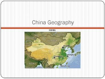
Title:
China Geography
Description:
Two major rivers supplied water for earliest civilizations. Chang ... Both flow east from Plateau of Tibet to Yellow Sea. Loess. Annual floods deposited rich ... – PowerPoint PPT presentation
Number of Views:1140
Avg rating:3.0/5.0
Title: China Geography
1
China Geography
2
Chinas Geography
- Rivers, Soils, Climates
- Chinas first civilizations developed in river
valleys - Two major rivers supplied water for earliest
civilizations - Chang Jiang, also called Yangzi
- Huang He, or Yellow River
- Both flow east from Plateau of Tibet to Yellow Sea
3
Loess
- Annual floods deposited rich soil, loess, on
flood plains - Valley of Huang He particularly fertile due to
loess - Fine dusty soil
- Carried into China by desert winds
4
Crops
- Most of eastern China covered with fertile soils
some regions better suited than others for
growing certain crops - Southern Chinawarm, receives plenty of rainfall,
excellent region for growing rice - Further northclimate cooler, drier suitable for
grains, wheat, millet
5
Isolation
- Combination of rivers for irrigation, fertile
soil for planting allowed Chinese to thrive, as
did Chinas relative isolation - Mountains, hills, desert protected China from
invasion - Himalaya Mountains separate southern China from
India, rest of southern Asia vast Gobi Desert
prevented reaching China from west
6
Shang Dynasty
- Main Idea
- Chinas river valley civilizations built the
foundations of a long-shared Chinese culture. The
achievements of the Shang and Zhou dynasties can
be felt to this day.