Coastal Processes - PowerPoint PPT Presentation
1 / 37
Title: Coastal Processes
1
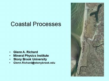
Coastal Processes
- Glenn A. Richard
- Mineral Physics Institute
- Stony Brook University
- Glenn.Richard_at_stonybrook.edu
2
Geologic Features of Long Island
- Harbor Hill Moraine
- Terryville Outwash Plain
- Ronkonkoma Moraine
- Hempstead Outwash Plain
- Barrier Beaches
The major geological features on Long Islands
surface are the result of glacial activity and
coastal processes.
3
Maximum Extent of the Most Recent Continental Ice
Sheet(about 20,750 years ago)
FromUnited States Geologic Survey
Long Island
4
Long Island Aquifers
Source of artesian well at West Meadow Beach is
confined aquifer
5
Waves
From Geologic Setting of the Modern Shore
(USGS) http//3dparks.wr.usgs.gov/nyc/shoreline/sh
oreline.htm
6
Development of a Spit
New York State Orthoimagery Program
Beach drift
waves
The inlet brings tidal waters laden with sediment
and nutrients into the marsh about twice daily.
Note that beach drift, caused by waves, carries
sediment toward the west-northwest along the
beach.
7
Great South Bay
Mud and Sand Distribution
Eelgrass Distribution
From The Great South Bay, Schubel, J.R, T.M.
Bell, and H.H. Carter, editors
8
Great South Bay Geologic History
20750 years ago Glacial ice maximum, Hempstead
Outwash Plain 20000 to 15000 year ago - sea level
rise 0.5 meters/century 15000 to 5000 years ago
sea level rise 0.1 meters/century 8500 years
ago ancestral barrier island formed and later
drowned 7500 years ago present barrier beach
formed 2 km seaward of present location today
sea level rise 0.3 meters/century
1 meter of sea level rise ? 1500 meters of shore
retreat northward on Hempstead Outwash Plain 0.3
meters rise per century ? 500 meters/century
shoreline retreat expected
9
Fire Island
Wind, carrying sand
10
Some Minerals in Beach Sand
Quartz (white) 98 on Fire Island Garnet (red)
1 on Fire Island Magnetite (black) 1 on
Fire Island
11
Eelgrass (Zostera marina)
- Food for brant geese
- Coating of algae, which are eaten by some snails
- Nassa snails, feeds on mollusks
- Hermit crabs eat Nassa
- Spirorbis worms create tubes on eelgrass
- Beds shelter fish, crabs, clams and crustaceans
Photo from http//www.buzzardsbay.org/eelgrass.ht
m
12
Hurricanes
13
Hurricane Frequency
From http//www.nhc.noaa.gov/HAW2/english/basics/c
limo.shtml
14
Monthly Hurricane Tracks
From http//www.nhc.noaa.gov/HAW2/english/basics/c
limo.shtml
15
Storms can create inlets
Great Hurricane of 1938 was its creation of the
Shinnecock Inlet and the widening of the Moriches
Inlet to the west.
September 24, 1938. Taken 3 days after the Great
New England Hurricane, this image shows the new
Shinnecock Inlet and many overwash fans along the
adjacent shore
From http//www2.sunysuffolk.edu/mandias/38hurric
ane/geological_impact.html
From http//www.lishore.org/photos/ShinHist/38092
4.html
16
Orthoimagery ofFlax Pondand Vicinity
17
Sea level rising since retreat of last ice sheet
began
Tree stumps in life position in intertidal zone
evidence of sea level rise (Hubbard County Park,
Flanders)
18
Long Island Sound Geologic History
Up to about 3 million years ago, a lowland that
was initially carved into the coastal-plain by
rivers. When the Wisconsinan glacier was at its
maximum, sea level was about 91 meters (300 feet)
lower than it is today, and the shoreline was 80
to 110 kilometers (50 - 70 miles) south of Long
Island. Because this moraine stood high on the
southern margin of the Long Island Sound basin,
it made a dam for meltwater from the glacier. As
the ice continued to retreat northward, glacial
Lake Connecticut formed north of the moraine dam.
The expanding glacial lake eventually grew to
be about the same size as present-day Long Island
Sound, 15,000 years ago, the glacier had
retreated out of the State and glacial Lake
Connecticut had just about completely drained to
the sea through an outlet in the moraine dam at
the Race (between Fishers and Long Islands). A
shallow sea, at a stable elevation of about -40
meters (-130 feet), probably existed in the basin
from around 13,500 years ago to around 9,000
years ago.
19
Long Island Sound Bathymetry
West Meadow Beach
20
Three Village Area Elevation and Bathymetry
21
Beach Drift in Three Village Area
Port Jefferson Harbor
Flax Pond
Conscience Bay
Setauket Harbor
West Meadow
Digital elevation map showing harbors and
moraine Arrows indicate directions of beach drift
22
Crane Neck Point
23
Loess with Bank Swallow Burrows in a Coastal Bluff
- Loess silt deposited by strong winds from the
ice sheet.
24
West Meadow Tidal Flats
25
Mouth of West Meadow andStony Brook Harbor
26
West meadow,1930
From Fred Mushacke at NYSDEC and Suffolk County
Planning
27
West Meadow,1961
From Fred Mushacke at NYSDEC and Suffolk County
Planning
28
North Shore Beaches are Pebbly
Diabase
Quartz
Source of pebbles morainal headlands
Conglomerate
Diabase continental rifting Conglomerate
Cretaceous delta, and precipitation of hematite
from water in sediments Quartz Many sources,
including veins in crystalline rock
29
Large Dunes on South ShoreSmall Dunes Develop on
North ShoreSmaller Ones on North Shore
Wind, carrying sand
Dune Grass (Ammophila breviligulata) traps and
binds windblown sand to create dunes.
30
Salt Peat at Flax Pond
31
High Marsh
32
Salt Marsh Vegetation Zonation
Salt marsh vegetation forms zones according to
position in the tidal range.
Mean High Water
Low MarshSpartina alterniflora
High MarshSpartina patensDistichlis spicata
33
Salt Marsh 1930 and 1961
34
The Water Table Emerges at the Shoreline
Tupelo and Phragmites at edge of salt marsh
35
Horseshoe crab and fiddler crab
36
Slipper shells on horseshoe crab and eastern
oyster
37
Some Major Geologic Eventsthat have Impacted the
Area WhereLong Island is Now Located
480 Million Years Ago Taconian Orogeny 400
Million Years Ago Acadian Orogeny 290 Million
Years Ago Alleghenian Orogeny Pangea
(supercontient) 250 Million Years Ago Rifting
of Pangea Atlantic Ocean 80 Million Years
Ago Cretaceous River delta 1.6 Million
Years Ago Start of period of ice advances and
retreats 20,750 Years Ago Last ice sheet
retreats
Moraines and Outwash
Plains Present Day Shoreline Processes
Beaches and Salt Marshes
Gneiss, Schist, Quartzite
Diabase,Arkose
Sandstone,Fossils


