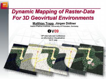
Dynamic Mapping of RasterData For 3D Geovirtual Environments - PowerPoint PPT Presentation
1 / 16
Title: Dynamic Mapping of RasterData For 3D Geovirtual Environments
1
Dynamic Mapping of Raster-DataFor 3D Geovirtual
Environments
- Matthias Trapp, Jürgen DöllnerHasso-Plattner-Inst
itute, University of Potsdam, Germany
13th International Conferenceon Information
Visualisation14-17 July
2
motivation
- Using 3D geovirtual environments as scenery for
visualization of dynamic geo-referenced thematic
data
3
motivation
- Using 3D geovirtual environments as scenery for
visualization of dynamic geo-referenced thematic
data
Preprocessing Time days-hours
Preprocessing Time hours-minutes
Preprocessing Time minutes
4
wrap-up challenges goals
- Strong coupling of geometry and appearance
- Real-time rendering constraints
- Large-scale data sets require specific
out-of-core renderer - Results in (time-consuming) data pre-processing
- ? Cannot be used to visualize time-critical data
- Goals
- partially decoupling geometry and appearance to
- enable dynamic multi-texture mapping
- enable color transfer function
- for a large number of mapping configurations
- in real-time
5
overview dynamic texture mapping
- Given input data
- 3D point (fragment) of original model
- Data color layers
- Mapping parameterizations
- Requested final color
- Data color layers
- 1D/2D/3D image/textures
- data values, masks
- color gradients
6
texture coordinate generation
- Projective texture mapping
Everitt 2001 - Orthogonal projection matrix
U
V
7
color transfer functions
- Describes color mapping of data values
- Define blending equations between mappings
8
rendering at a glance
- Extending OpenGL/DirectX multi-texturing pipeline
- Single-pass rendering
- Per-fragment dynamic texturing using shader
programs - GPU Data representation texture arrays
- Projective mappings encoded in texture-buffers
- Performance evaluation
9
application examples
- Hierarchical combination of raster data layers
Building category data
Traffic frequency data
10
(No Transcript)
11
application examples
- Object or route highlighting
Route
Landmark objects
Landmark objects
12
(No Transcript)
13
application examples
- Projective symbols to facilitate the design
of interactive 3D digital maps
14
application examples
- Focus context visualization 2D magic lenses
15
conclusions
- Summary
- Extendable concept for dynamically mapping 2D
raster-data - Approach based on projective texture mapping
- Fully-hardware accelerated implementation
- Limitations
- Works only for 3D GeoVE that can be approximated
by a plane - Limited texture resolution
- Future Work
- Extend color transfer to style transfer functions
16
thank you...
Contact Matthias Trapp matthias.trapp_at_hpi.un
i-potsdam.de Jürgen Döllner
juergen.doellner_at_hpi.uni-potsdam.de
Computer Graphics System Group
www.hpi.uni-potsdam.de/3d Researchgroup
3D-Geoinformation www.3dgi.de


