Variogram PowerPoint PPT Presentations
All Time
Recommended
Between and beyond: Irregular series, interpolation, variograms, and smoothing Nicholas J. Cox
| PowerPoint PPT presentation | free to download
Between and beyond: Irregular series, interpolation, variograms, and smoothing Nicholas J. Cox
| PowerPoint PPT presentation | free to download
... variogram b) Fitted nested model c) Decomposed variogram. Lag distance ... a)Variogram of the raw data b) Variogram of the linear residuals. Lag distance / m ...
| PowerPoint PPT presentation | free to download
'Spatial Data Analysis: Theroy and Practice' by Robert ... Isotropy. Variograms: What are their features? Anisotropy. Variograms: What are their features? ...
| PowerPoint PPT presentation | free to view
The semi-variogram based error variance model: (2) Minimize the ... uncertainty information is provided (5) undesired drastic change of attribute values ...
| PowerPoint PPT presentation | free to view
Precision agriculture tries to address variability ... Anisotropy. Variograms. Variograms (circular, exponential and spherical models) were fitted to the data ...
| PowerPoint PPT presentation | free to view
Work by researchers, such as Neuzil and Tracy (1981), Brown (1987), Tsang and ... Kriging : uses the information from a variogram to find an optimal set of ...
| PowerPoint PPT presentation | free to download
(g) (h) Results (Interpolation Accuracy) Results. Hot spot pattern: local Getis-OrdStatistic ... error Clustering level Hot spot areas. Variogram of 30-m ...
| PowerPoint PPT presentation | free to download
B = Brig. C = Cr telongue. F = Feldsberg. K = Konstanz Lake. L = L man Lake. V = V troz ... (Fig. 3) H Brig-L man. Experimental variogram. 3-D Groundwater Pegase ...
| PowerPoint PPT presentation | free to view
A robust empirical variogram estimator (Z(x)-Z(y))2 is chi ... Fourth root is variance stabilizing. Cressie and Hawkins: Least squares. Minimize. Alternatives: ...
| PowerPoint PPT presentation | free to download
... the appropriate weights for points that are 'close' allows for anisotropy. Spatial structure is determined by modeling the empirical variogram auto ...
| PowerPoint PPT presentation | free to view
Anisotropy might thus be manifested by varying range with direction (constant ... Surface variogram: Main axes of anisotropy ellipse are at 132 and 42 ...
| PowerPoint PPT presentation | free to view
The interaction between 3D Earth Modeling and Geostatistics ... Horizontal anisotropy ratios and ranges. Horizontal Wells. Horizontal variograms ...
| PowerPoint PPT presentation | free to view
Nugget. Sill. Range. Theoretical variogram. Summary of the parameter estimation ... (estimated) nugget = 0.0773. Minimised weighted sum of squares: 4.2704. Call: ...
| PowerPoint PPT presentation | free to view
Integral scale. Example of general relative variogram from a plot. Slope. Value at 1.5m lag ... Integral scale as a function of terrain slope (T) and average daily ...
| PowerPoint PPT presentation | free to view
Have to fit and save the theoretical variogram first ... Generalized least squares. Generalized least squares fit by REML. Model: pH.1981 ~ log.SO4.1981 ...
| PowerPoint PPT presentation | free to view
A u s t r a l i a n C e n t r e f o r P r e c i s i o n A g r i c u ... 25% Quantile 6.5. 75% Quantile 10.9. Yield (Mgha-1) Yield Variogram for South 25. 5. 10 ...
| PowerPoint PPT presentation | free to view
Geostatistics GLY 560: GIS for Earth Scientists Introduction Premise: One cannot obtain error-free estimates of unknowns (or find a deterministic model) Approach: Use ...
| PowerPoint PPT presentation | free to download
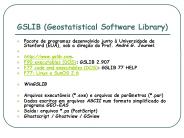
GSLIB (Geostatistical Software Library) Pacote de programas desenvolvido junto Universidade de Stanford (EUA), sob a dire o do Prof. Andr G. Journel.
| PowerPoint PPT presentation | free to download
True understanding of the spatial variability in the soil map is very limited. Distinct boundary (too continuous or sudden change) ...
| PowerPoint PPT presentation | free to download
psiA= 30 degree from North. Spatial prediction by Kriging ... 1990 survey cruise. in the Atlantic continental shelf of Long Island, New York. Change coordinate ...
| PowerPoint PPT presentation | free to view
Each subregion is described by is a statistical distribution Zi ... Escala de polui o. Zona A. Zona B. rea Polu da. Regionalized Variable. Z(x) = m(x) (x) ...
| PowerPoint PPT presentation | free to download
Z~Nn( , ) = [ si-sj; )] = V( ) Maximize. and q maximizes the profile likelihood ... of quantities such as global mean temperature need models for global covariances. ...
| PowerPoint PPT presentation | free to download
Geostatistics revisited Introduction: ... Modelling flow and transport in heterogenous media ... Many in the groundwater community either failed to
| PowerPoint PPT presentation | free to download
Title: GEOG 578 GIS Application Author: um Last modified by: feihua Created Date: 1/17/2005 10:43:30 PM Document presentation format: On-screen Show
| PowerPoint PPT presentation | free to download
Isobel Clark, Geostokos, Scotland. Environmental Statistics, Session 6A2 ... expected value map at un-sampled locations. Kriged standard error map. Amarillo by ...
| PowerPoint PPT presentation | free to download
Title: PowerPoint Presentation Author: Antoni Magri Last modified by: phil Created Date: 3/7/2002 4:20:14 PM Document presentation format: On-screen Show (4:3)
| PowerPoint PPT presentation | free to view
Arthur J. Lembo, Jr. Cornell University ... Arthur J. Lembo, Jr. Cornell University. IDW. ArcGIS provides a nice interface to view points ...
| PowerPoint PPT presentation | free to view
Groundwater data requirement and analysis
| PowerPoint PPT presentation | free to view
Four-band sensor flown in Lear jet (blue, green, red, near infrared) ... FULL (ORANGE) AND 1/256 (BLUE) IMAGES SUPERIMPOSED. CONCLUSIONS ...
| PowerPoint PPT presentation | free to view
progress & new directions. Two-stage sample design. Spatial modeling of EMAP data ... For some, did two manual and one automatic fit ...
| PowerPoint PPT presentation | free to download
1. Characterization of Spatial Heterogeneity for Scaling ... S. Garrigues1, D. Allard2, F. Baret1. 1INRA-CSE, Avignon, France. 2INRA-Biom trie, Avignon, France ...
| PowerPoint PPT presentation | free to view
Geostatistics and Archelogy Created by ExploStat. 12 ... Geostatistics and Archelogy Created by ExploStat. 15. Optimize Sampling Plan using Block Kriging ...
| PowerPoint PPT presentation | free to view
Molly Leecaster. N. Scott Urquhart. Ken Schiff. Project Funding ... 1000 sims. Fit using automated procedure in Splus. This may have introduced artifacts ...
| PowerPoint PPT presentation | free to download
Station density stays the same ... let station density grow, keeping ... where the sum is over Fourier frequencies, avoiding 0, and f is the spectral density ...
| PowerPoint PPT presentation | free to download
Topic: The Meuse soil pollution data set ... Mixed: adust by eye, evaluate statistically; or vice versa. Fitting the model manually ...
| PowerPoint PPT presentation | free to download
Stat 592A Spatial Statistical Methods peter@stat.washington.edu pds@stat.washington.edu Course content 1. Kriging 1. Gaussian regression 2. Simple kriging 3.
| PowerPoint PPT presentation | free to download
Landscape Scale Modeling of Trout Habitat Conditions. Beth Gardner. CSS 620. The BeaverKill ... Historically prestigious trout fishery ...
| PowerPoint PPT presentation | free to view
Karin Rebel, Ph.D. Candidate Soil and Crop Sciences. Introduction. Methods. Modeling process ... Phytoremediation is an emerging technology that uses either ...
| PowerPoint PPT presentation | free to view
Title: No Slide Title Author: David L.Combs Last modified by: nsu Created Date: 10/26/1999 8:37:18 PM Document presentation format: On-screen Show Company
| PowerPoint PPT presentation | free to download
Review of Geostatistics in Aquatic Systems Joshua French and Scott Urquhart Department of Statistics, Colorado State University Fort Collins, Colorado
| PowerPoint PPT presentation | free to download
Spatial variability of soil carbon: effects of management, topography, and soil texture ... Sand/silt/clay contents hydrometer method ...
| PowerPoint PPT presentation | free to view
This presentation has not been formally reviewed by EPA. ... 1994 Southern California Bight Pilot Project. EMAP design. 77 samples ...
| PowerPoint PPT presentation | free to download
Special Topics in Geo-Business Data Analysis. Week 3 Covering Topic 6. Spatial Interpolation ... Pockets of unusually high customer density are identified as more ...
| PowerPoint PPT presentation | free to download
STAT 592A(UW) 526 (UBC-V) 890-4(SFU) Spatial Statistical Methods peter@stat.washington.edu www.stat.washington.edu/peter/592
| PowerPoint PPT presentation | free to download
Performance Presentations, Audit, and Surveillance of In Situ Schemes ... What about core photo scanning? Vshale driven. Discriminant Analysis ...
| PowerPoint PPT presentation | free to view
Turning raw data into useful information. A collaboration between human and machine ... Machine does tedious, complex stuff. Early Spatial Analysis. John Snow, 1854 ...
| PowerPoint PPT presentation | free to download
Wave Modeling, Tomography, Geostatistics and Edge Detection. Youli Quan ... SYNTHETIC EXAMPLE ON ATTENUATION TOMOGRAPHY. Crosswell geometry, RT method for modeling ...
| PowerPoint PPT presentation | free to view
Random process is the ensemble of daily rainfall profiles for each year. ... For a process to be ergodic it must be stationary, but not vice versa. ...
| PowerPoint PPT presentation | free to view
Hyperspectral Remote Sensing Endmember selection
| PowerPoint PPT presentation | free to download
Introduction to Spatial Statistics Geostatistics Group: Faye Belshe, Smitri Bhotika, Mike Gil, Mike Hyman, Kenny Lopiano, Jada White Slides contributed by Dr ...
| PowerPoint PPT presentation | free to view
Model Based Geostatistics Archie Clements University of Queensland School of Population Health Variable Coefficient Odds Ratio Intercept 1.9 (-2.3 - 10.3) LST 35 ...
| PowerPoint PPT presentation | free to download
... theory-free. Disadvantages. theory-free. directional effects ... A set of weights i unique to x. chosen such that the estimate is. unbiased. minimum variance ...
| PowerPoint PPT presentation | free to download
Quantifying spatial patterns. of transpiration in xeric. and mesic forests. Jonathan D. Adelman 1 ... Wyoming: xeric site, low-lying creek hilltop gradient ...
| PowerPoint PPT presentation | free to download
Most common technique is geostatistics Special branch of statistics developed by George Matheron (1963) (Centre de Morphologie Mathematique).
| PowerPoint PPT presentation | free to view

