Topographic PowerPoint PPT Presentations
All Time
Recommended
topographic map a map which shows elevation of the land with the use of contour lines, shapes , and symbols contour lines lines drawn to connect points of the same ...
| PowerPoint PPT presentation | free to view
The principal aim of the Topographic Survey is to illustrate some important land features such as grade points, walkways, driveways, retaining walls etc. Genesis Land Surveying Inc. provides its clients the best topographic services for initiating new construction without any hurdle.
| PowerPoint PPT presentation | free to download
Get the world-class Topographic Survey services with the combination of expertise, technology and highly innovative surveyors at Genesis Land Surveying Inc. - your one-stop survey solution. From tress, grade points, walkways to catch, building, we serve you with all the specific details you requested. https://bit.ly/2JhMvqR
| PowerPoint PPT presentation | free to download
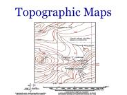
Topographic Maps What is a Topographic Map? In contrast to most maps, a topographic map shows the shape of the Earth s surface by using contour lines.
| PowerPoint PPT presentation | free to download
Topographic Maps A map that shows the surface features of Earth Shows the eLEvATion of an area Height of an object above sea level Topographic Map Features Natural ...
| PowerPoint PPT presentation | free to download
Title: Topographic Maps Author: christopher.harner Last modified by: Benjamin, Christopher Created Date: 6/8/2004 12:46:58 PM Document presentation format
| PowerPoint PPT presentation | free to view
Topographical Maps Topographical Map A topographic map is a detailed and accurate map of cultural and natural features. Terms to Know Elevation Height above sea ...
| PowerPoint PPT presentation | free to view
Topographic Maps Topic 2.2 Regents Earth Science Gradient aka: slope The rate of change between 2 places within a field Equation ESRT page 1 field A region in space ...
| PowerPoint PPT presentation | free to view
What is a Topographic Map? Topographic maps are special maps that show the relief (highs and lows) of Earth s surface. Topographic maps are different from regular ...
| PowerPoint PPT presentation | free to download
Topographic Maps EQ: How are elevation, relief and slope shown on a topographic map? G1-4 Topographic Map Shows the surface features of an area as if you were looking ...
| PowerPoint PPT presentation | free to view
2-D 3-D Building a home Landscaping Hiking Fishing Camping Planning a highway Why are Topographic Maps Useful? Who uses Topographic Maps?
| PowerPoint PPT presentation | free to download
Topographic Maps Mr. King Hints to work with topographic maps. Small lines perpendicular to contour lines are called hachure lines. Hachure lines point downhill.
| PowerPoint PPT presentation | free to view
Topographic Maps http://en.wikipedia.org/wiki/Image:Topographic_map_example.png Show the shape of the Earth s surface Lines on the map are called contour lines ...
| PowerPoint PPT presentation | free to download
Topographic Maps Lesson Objectives Define a topographic map and state its uses. Describe how contour lines show the elevations, shape, and slope of the land.
| PowerPoint PPT presentation | free to download
Do you need a trustworthy topographical survey in London? Then, contact Benchmarkses a prominent site engineer services provider in London. Our primary focus is offering topographic surveying services that are exceptional to those offered by the market. Our skilled team of professionals uses innovative tools to provide precise and effective topographic surveys for a variety of applications.
| PowerPoint PPT presentation | free to download
Topographic Maps. T. Bates. Hugo A. ... Identify the meanings of some symbols and colors used on topographic maps. ... How are contour lines drawn on maps? ...
| PowerPoint PPT presentation | free to download
Topo map Since the 1600s, ... the U.S. Geological Survey ... The contour lines of a depression make a small circle the shape of the depression, ...
| PowerPoint PPT presentation | free to view
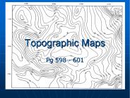
Topographic Maps Pg 598 - 601 Lesson Objectives Define a topographic map and its uses. Describe how contour lines show the elevations, shape, and slope of the land.
| PowerPoint PPT presentation | free to download
In contrast to most maps, a topographic map shows the shape of the Earth's ... 6.Just looking at the map, would it be easier to head down from the peak going ...
| PowerPoint PPT presentation | free to view
Topographic Profiling-DeMarco The first step: So, if we were to look at a profile view of line AB on our topographic map, what might we expect to see?
| PowerPoint PPT presentation | free to view
Ice sheets. Ice caps. Outlet glaciers. Piedmont glaciers ... fed by ice sheets & caps. essentially valley glaciers. flow to sea. ice cover of plateaus ...
| PowerPoint PPT presentation | free to view
Reading Topographic Maps TEKS 8.2 (E) construct graphs, tables, maps, and charts using tools including computers to organize, examine, and evaluate data.
| PowerPoint PPT presentation | free to download
Small lines perpendicular to contour lines are called hachure lines. Hachure lines point downhill. ... A cross section line (X,Y) crosses contour lines to help ...
| PowerPoint PPT presentation | free to view
Required: Readings: 16-1 to 16-9.1 &16-9.5 Figures: 16-1 to 16-4. Recommended, not required, extra readings: Hydrographic Surveys section 16-12.
| PowerPoint PPT presentation | free to download
The picture on the right is what it looks like in two dimensional form. Demonstration cont'd ... tools such as perspective or stereoscopic views of terrain. ...
| PowerPoint PPT presentation | free to view
Introduction to Topographic Maps Topographic Maps Two dimensional model of the Earth s surface (represents 3-D world) Topographic maps are also known as contour maps.
| PowerPoint PPT presentation | free to view
Reading Topographic Maps TEKS 8.2 (E) construct graphs, tables, maps, and charts using tools including computers to organize, examine, and evaluate data.
| PowerPoint PPT presentation | free to view
Topographical Surveys are one of our specialities. We point to every detail during the survey and explain it to our customers to satisfy their needs. So, if you are looking for the best topographical survey companies in UAE, then Falcon Laboratory LLC is the best choice for you. If you have any queries regarding the land survey? Visit us now!
| PowerPoint PPT presentation | free to download
Saddle (Purple) The landform that confuses more beginners than any other. ... the points on one diagonal high and the other low, you probably have a saddle. ...
| PowerPoint PPT presentation | free to view
... the book on pages 212-213. The difference between bottom illumination (left) and. natural illumination from above (left) can be significant. ...
| PowerPoint PPT presentation | free to view
Township based on a horizontal line called baseline ... Paleocene. 37 to 58 my. Eocene. 24 to 37 my. Oligocene. 5 to 24 my. Miocene. Cenozoic. 2 to 5 my ...
| PowerPoint PPT presentation | free to view
https://360surveys.ca/ From a simple site survey to highly detailed 3D models, our team can tailor the final product to your specific needs.
| PowerPoint PPT presentation | free to download
There are many methods available to map the Earth around us. The old techniques and the latest techniques have vast differences. A topographic survey using drones is the latest technique that is used for various purposes. For more Information about topographical surveys using drones visit Falcon 3D.
| PowerPoint PPT presentation | free to download
USGS Topographic Maps. The most common maps used for backcountry navigation. USGS Map ... USGS 30 minute x 1 degree. 1:100,000 scale Topographic Map. Around the ...
| PowerPoint PPT presentation | free to view
Write the elevation of the index contours below their tics on your paper. ... dot on the graph paper at the corresponding elevation Make a small dot for each ...
| PowerPoint PPT presentation | free to view
A topographical survey is a precise representation of a site (property, area of land, defined boundary) that is scaled and detailed to show all-natural and manmade features and their levels. A topographical survey is extremely detailed and necessitates the participation of topological professionals to ensure the accuracy of the reports provided.
| PowerPoint PPT presentation | free to download
Green River Topographic Map Activity Green River Topographic Map Activity What is the contour interval? Green River Topographic Map Activity What is the contour interval?
| PowerPoint PPT presentation | free to download
The Department of Lands and Surveys was the main source for base topographic data. ... Defining symbolisation. Quality Assurance. Topology Rules ...
| PowerPoint PPT presentation | free to view
Green River Topographic Map Activity Green River Topographic Map Activity What is the contour interval? Green River Topographic Map Activity What is the contour interval?
| PowerPoint PPT presentation | free to view
the differences in elevation and slope between the higher and lower parts of the ... The Radio Tower on the Nike Site. Hawthorn South School. Little Bear Lake ...
| PowerPoint PPT presentation | free to view
Digital Mapping. Application Development. Data Conversion. 1980. 2005. 2000. 1990. All that to say . Spatial Fusion. Open Cite. Arc/IMS. WMS. WFS. GML XML ...
| PowerPoint PPT presentation | free to view
Location- from apex of trigonum femorale to hiatus tendineus, opening into fossa poplitea. ... Fossa poplitea - content. Arteries. A. poplitea continuation ...
| PowerPoint PPT presentation | free to view
15-min lightning strikes ending 9:30 p.m. (Relatively little lightning in the ... Lightning activity was minimal due to a lack of ice processes in the storm, ...
| PowerPoint PPT presentation | free to view
There are many methods available to map the Earth around us. The old techniques and the latest techniques have vast differences. A topographic survey using drones is the latest technique that is used for various purposes. For more Information about topographical surveys using drones visit Falcon 3D.
| PowerPoint PPT presentation | free to download
Planimetric and Topographic Mapping
| PowerPoint PPT presentation | free to view
Drawing a Topographic Profile. Topographic maps depict Earth viewed from above. For Example. Topo. Often a topographic profile or 'side-view' will provide a more ...
| PowerPoint PPT presentation | free to view
Data Visualisation using Topographic Mappings. Colin Fyfe. The University of Paisley, ... K latent points in a latent space with some structure. ...
| PowerPoint PPT presentation | free to download
To make a topographic profile: 1. Place scrap paper along the line AB on your contour map of the volcano island. 2. Put a tick mark wherever a contour touches ...
| PowerPoint PPT presentation | free to download
Topographic maps are also ... line on a map that connects points of EQUAL elevation. - show elevation ... by dashed lines (hachure marks) on the inside ...
| PowerPoint PPT presentation | free to view
Falcon Survey Engineering Consultants has been one of the premier land survey and topographic survey companies in Abu Dhabi. They specialize in building surveys, construction layouts, subdivision design, boundaries, pipelines, gas and oil well locations, unit surveys, digitizing, title and boundary surveys, wetlands delineation, map reproduction and preparation, and provide dedicated mapping services.
| PowerPoint PPT presentation | free to download
Desert Knights. Ongoing Support to OEF/OIF. Coalition Provisional Authority ... Eagle Vision II. Team. CJTF7 Space. Support Team. Topographic Team. NCOIC (SFC) ...
| PowerPoint PPT presentation | free to view
At WL Surveys, we provide you the top notch quality of Topographic & Detailed Surveying Services in Victoria. Our experts are always there to fulfil your need of expert’s assistance. Feel free to contact us!!
| PowerPoint PPT presentation | free to download
Navigating with a Compass and Topographic Map Begin by laying your laminated topographic map on a flat, non-metallic surface that does not interfere with your ...
| PowerPoint PPT presentation | free to download
A term that describes the height of a point on Earth's surface above (or below) sea level. ... Tip 4: What do those funny hachure marks mean? ...
| PowerPoint PPT presentation | free to view
Copy URL : gooread.fileunlimited.club/pwaug/1975160630 | Sarrafian's Anatomy of the Foot and Ankle: Descriptive, Topographic, Functional Fourth Edition
| PowerPoint PPT presentation | free to download
Digital Terrain Modelling process (Weibel and Heller, 1991) ... Non-honouring of data points due to insufficiently fine grid chosen to reduce computing time ...
| PowerPoint PPT presentation | free to view


