Ntrip PowerPoint PPT Presentations
All Time
Recommended
NTRIP-based DGPS service in Hungary Tam s Horv th F MI Satellite Geodetic Observatory Penc, Hungary NTRIP-based DGPS service in Hungary Tam s Horv th F MI ...
| free to download
PRECISE REAL-TIME DIFFERENTIAL NAVIGATION USING NTRIP STREAMS ... Map: BKG, Frankfurt. NTRIP Sites, Many ... Source: BKG, Frankfurt. USA Off-Line ...
| free to download
Title: PowerPoint-Pr sentation Subject: NTRIP Author: Dettmering Last modified by: Dettmering Created Date: 6/6/2003 11:43:20 AM Document presentation format
| free to download
Federal Agency of Cartography and Geodesy, BKG. Contents. Ntrip ... Ntrip usage, examples - Networked DGPS/RTK - Navigation. Networked Transport of RTCM via ...
| free to view
The number of post-processing GNSS users decreases rapidly. At the same time, the community of ... Splitter. Caster. September 2004. Ntrip becomes RTCM Standard ...
| free to view
Compass-Sport Bt., Budapest, Hungary. County of Orange, California, USA ... Netherlands. td group spa, Italy. Tecnotron Elektronik GmbH. Ntrip Test & Validation ...
| free to view
Networked Transport of RTCM via Internet Protocol (Ntrip) ... GART-2000 Rover Control & GIS Data Collection Software, NtripClient ...
| free to view
CRS Transformation between National Coordinate System and ETRS89. 3 ... Real-time observations disseminated through the Internet using the NTRIP protocol ...
| free to view
Ntrip Broadcaster Europe. EUREF-IP. Other. www.euref-ip.net ... Monitoring. Broadcaster. Applications. Help Desk. Ready to educate / train PoC s on-the-Job ...
| free to view
FCT/UNESP DGPS EM REDE: DESENVOLVIMENTO E IMPLANTA O VIA INTERNET NO ESTADO DE S O PAULO Luiz Fernando Antonio Dalbelo Jo o Francisco Galera Monico
| free to download
Main Concepts. Modify CORS sites for real time data transmission. GPS receiver data ... Network Design Issues. What format? What stations? What software? What ...
| free to download
MT 1, 3, 9, Meter Level Accuracy. RTCM 2.1 and 2.2: Carrier Phase Data, RTK ... MT 1004 etc, Centimeter Level Accuracy. RTCM Data Formats ...
| free to view
Title: Networked DGPS via Internet Subject: CGSIC 14-15.03.2005 Author: Dirk St cker Last modified by: Dell Created Date: 10/23/2003 7:17:27 AM Document presentation ...
| free to download
VRS Trimble Survey Controller (Trimble Digital Fielbook) . ...
| free to download
Trimble VRS Now in Europa Herausforderungen und L sungen bei der Realisierung eines Dienstes in verschiedenen L ndern RTK nutzen Trimble VRS Now Themen Trimble ...
| free to view
market requires reasonable price and easy access. few reference ... support for internet based real time data access. minimum hardware requirements (100MHz ...
| free to view
Software components developed under GNU General Public License ... cm-level accuracy with a few hours of data, dm-level accuracy with one minute of data. ...
| free to view
INTEGRITY MONITORING SYSTEM FOR SPACE-BASED NAVIGATION AND POSITIONING IN MALAYSIA Ooi Wei Han1, Moslin S.I1., Ahmad N.1, Subari M.D.1, Musa T.A.2, Othman R.2, Omar A ...
| free to download
VII California Team Meeting
| free to view
Title: PowerPoint-Pr sentation Last modified by: Neidhardt Document presentation format: Benutzerdefiniert Other titles: Arial MS Gothic Wingdings DejaVu Sans Symbol ...
| free to download
Hacking, viruses security concept required. Dipl.-Ing. ... security enhanced software. automatic updates ... feel free to ask. http://www. .de/ dirk.stoecker ...
| free to view
route surveys for pipelines and underwater cables; ... Railway maintenance. Environmental monitoring. HP. APPLICATIONS. VBS. INTRODUCTION. AM. CONTACT US ...
| free to view
Open Source sw for NtripClient, NtripServer, NtripCaster, stream decoding and conversion ... User and stream provider registration. Precise coordinates for non ...
| free to download
Georg Weber, Denise Dettmering, Harald Gebhard ... CGSIC 43rd Arlington, Virginia, March 10-11, 2004. DGPS & Internet - Classic Approach ...
| free to view
Realtime GPS and Earthquake Early Warning
| free to download
... available in real-time via IP communication links (open internet) ... charter and terms of reference. Pilot Projects. leverage the outputs from WG activities ...
| free to download
Resources and Support for HighPrecision RealTime GNSS Networks
| free to view
ToR and Work Plan of ExGG with status June 2004 were agreed with ... Hydrography. Transport. Administrative units. Basic data (INSPIRE) Small scale : ERM & EGM ...
| free to view
More than 200 CORS stations with 2 hour datasets were used for the test since the CORS positions are well known This scatter plot ... tropospheric modelling In ...
| free to download
CGSIC IISC European Meeting, Prague, Czech Republic, March 14-15, 2005 ... Rover receivers for rent. Training courses for end users and state officials ...
| free to view
SLOVENIAN GPS NETWORK SIGNAL: SLOVENIA-GEODESY-NAVIGATION-LOCATION Dalibor RADOVAN Geodetic Institute of Slovenia Ljubljana SIGNAL National GPS network under ...
| free to download
No streaming format available and in use today meets the essential needs of the ... to define RTIGS requirements for streamed content and resolution for state space ...
| free to download
ftp://ftp.ngs.noaa.gov/dist/whenning/GLRHMC/ BEST METHODS FROM THE GUIDELINES: THE 7 C s CHECK EQUIPMENT COMMUNICATION CONDITIONS CONSTRAINTS(OR NOT ...
| free to download
Storing of highrate files nothing new for IGS. At CDDIS back to 2001, doy121 ... Handling of unhealthy SVs. Limitation of supported observation types ...
| free to view
200 offices in over 50 countries. Merge with Thales-Geosolutions Nov 2003 ... going under trees. www.omnistar.nl. CGSIG Prague Hans Visser Tuesday, 15 March 2005 ...
| free to view
The Ethiopian Reference System and the future direction
| free to view
CZEPOS - an active network of permanent GNSS stations in the Czech Republic ... to foster the implementation of GNSS techniques in the Czech Republic ...
| free to view
Plate Boundary Observatory GPS Update
| free to view
... error for 1993-1997 ZIP code level breast cancer SIR's, Smoothing ... Comparison of some Urban and Rural ZIP Codes. Original SIR = 1.18. Expected count = 180.9 ...
| free to view
Federal Agency for Cartography and Geodesy, Frankfurt am Main, Germany. Outline. Introduction ... Term 'highrate' is a relative one. Usually means 1 Hz sampling rate ...
| free to download
Perth. OmniSTAR Pty. OmniSTAR B.V. Dubai. Johannesburg. OmniSTAR ... Perth Australia. www.omnistar.nl. CGSIG Prague Hans Visser Tuesday, 15 March 2005. 14 ...
| free to view
a set of core AFREF stations (the 1st order network) ... Review closures and adjust baseline network ... Do it yourself or...
| free to view
? Geodetski In titut Slovenije. SLOVENIAN GPS NETWORK SIGNAL: ... Bessel ellipsoid. Gauss-Krueger projection. Locally deformed classic triangulation Datum 1948 ...
| free to view
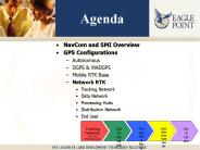
Presentation to HNTB for the St Louis ITS Project ... NavCom and SMI Overview GPS Configurations Autonomous DGPS & WADGPS Mobile RTK Base
| free to download
ISO 19111 (ISO/TC 211, WI 11) Spatial referencing by coordinates DIS November 2000, IS 2003 Scope WI 11 describes the conceptual schema and defines the description ...
| free to view
GPS Infrastructure Overview
| free to view
NATIONAL REPORT OF SPAIN. Instituto Geogr fico Nacional ... Iberia, Morocco, Balearic, Canary, Azores. BPE 4.2. Time series of non-EPN stations ...
| free to view
Bay Area. Following s show a sample of current VII California testbed research ... MTC leading regional San Francisco Bay Area HOT lane effort ...
| free to view
... and ingests ground-based GPS data to produce 2-D maps of TEC ... Real-time ionospheric maps of total electron content ... 15 Mexican sites will join ...
| free to view
31 organismes gestionnaires de r seaux GPS temps r el. R union du ... En concurrence : exemple de la Suisse. Diverses configurations : R seau public - Temps ...
| free to view
Continuously Operating Reference Stations CORS
| free to view
Let's consider a beam which is a steady stream of bunches, RMS length of 1 bunch ... Units ampere/volt3/2 are implicit -- klystron makers usually just say 'perveance ...
| free to download
... tender in May 2004 receivers Leica GRX 1200 Pro, antennas Leica AT504 Choke Ring ... station control data for post-processing Leica Software Spider ...
| free to view


