
Mosaicking PowerPoint PPT Presentations
All Time
Recommended

Automatic registration, seamless mosaicking and applications D. Fedorov, B. Sumengen, B. S. Manjunath 2005, Vision Research Lab, UCSB This research was supported by ...
| PowerPoint PPT presentation | free to download

Under an affine transformation, pixel locations in frames and are related by a ... Full 6-parameter inter-frame affine motion model. Full result of A, B, and C. ...
| PowerPoint PPT presentation | free to view

Direct digital acquisition requires mosaicking of several images ... Test different digital camera footprints. Resolve issues before proceeding to all states ...
| PowerPoint PPT presentation | free to view

What are DOQ? Digital Orthophotoquad (DOQ) - A raster data theme, built from scanned aerial photography, rectified and mosaicked to form a planimetrically correct map ...
| PowerPoint PPT presentation | free to view

National Park Service Hurricane Preparedness Available Data * Mosaicked 2004 True Color DOQQs for Florida parks * General base data available for most parks but not ...
| PowerPoint PPT presentation | free to download

Fig.4 Example of scatterplot of ERS coherence versus growing stock volume ... The JERS images have been mosaicked, cut down into new sections, and ...
| PowerPoint PPT presentation | free to download

Also we need a 'VCL' type instrument for the vertical dimension in vegetation ... Analysis of suitability of GeoCover images for 1990 for Southern Africa by GLCF ...
| PowerPoint PPT presentation | free to download

Title: No Slide Title Author: jws Last modified by: Kevin Howald Created Date: 7/8/1998 4:12:15 PM Document presentation format: On-screen Show Other titles
| PowerPoint PPT presentation | free to download

Chapter Image Enhancement Analysis and applications of remote sensing imagery Instructor: Dr. Cheng-Chien Liu Department of Earth Sciences National Cheng Kung University
| PowerPoint PPT presentation | free to view

IKONOS World Imagery Updates Project Scope 50 million sq. km. of imagery Select Best Of 2 million IKONOS scene archive Select - Ortho - Color Balance ...
| PowerPoint PPT presentation | free to download

Reporter : Chien-Ting Kuo. Hsiang-Cheh Huang, Yu-Hsiu Huang, Jeng-Shyang Pan, Yuh-Yih Lu ... 1. Locating the area containing confidential information ...
| PowerPoint PPT presentation | free to view

Oceanic Imaging Consultants, Inc. Software Services Systems Professional seafloor mapping software, created by surveyors, for surveyors
| PowerPoint PPT presentation | free to download

Exercises A site selection model. Cell counts, area calculation ... 1 CATHRO MUCK 1-8 WOODLAND. 2 CUTAWAY LOAMY SAND 0-8 WOODLAND. 3 WATER WATER NA NA ...
| PowerPoint PPT presentation | free to view

Tone matched. Edge matched. FSA - Aerial Photography Field Office 'Seamless' Ortho Imagery ... Edge Matched and Tone Matched. within counties. within UTM zones ...
| PowerPoint PPT presentation | free to download

Most computer games / videos are ... with Quality spatial resolution Stereo Smooth motion Little time delay between user interactions and visual effects ...
| PowerPoint PPT presentation | free to download

Major upgrade. ESRI s what s new 177 pages! http://help.arcgis.com/en/arcgisdesktop/10.0/pdf/whats_new_in_arcgis_10.pdf. 1.) Direct support for PDS and ...
| PowerPoint PPT presentation | free to download

Jack Ickes, Intergraph/Zeiss Kevin Perkins, Applanix David Fuhr, Airborne Data Systems Sponsored by: ASPRS Primary Data Acquisition Division
| PowerPoint PPT presentation | free to download

1. XMM-Newton Extended Source Analysis Software. Steve Snowden & Kip Kuntz ... Creates exposure corrected, background subtracted, and adaptively smoothed images ...
| PowerPoint PPT presentation | free to download

ALMA Science Examples Min S. Yun (UMass/ANASAC)
| PowerPoint PPT presentation | free to download

The solution is in action on customer site with currently more than 10TB of data (8 billion points). Airborne Laser Scanning (ALS) produces vast amounts of data, ...
| PowerPoint PPT presentation | free to download

Montage: An Astronomical Image Mosaic Service for the NVO Anastasia C. Laity, IPAC Nate Anagnostou, IPAC Bruce Berriman, IPAC John Good, IPAC Joseph C. Jacob, JPL
| PowerPoint PPT presentation | free to download
Use free MrSID Software Development Toolkit (SDK) to enable existing ... Aerial/Satellite Imagery. Geographic Information Systems. Document Management Systems ...
| PowerPoint PPT presentation | free to download

DMC Calibration Klaus Neumann Product Manager DMC - Camera Head Production Raw Die Zeiss Jena Clean Room Facilities DMC Calibration - Overview Geometric Calibration ...
| PowerPoint PPT presentation | free to download

1 free of significant beam blockage. 2 free of ground clutter ... 1 Hydro-estimator (formerly Auto-estimator) product from NESDIS (Vicente et al. 1998) ...
| PowerPoint PPT presentation | free to view

ESTO An Astronomical Image Mosaic Service for the National Virtual Observatory http://montage.ipac.caltech.edu/
| PowerPoint PPT presentation | free to download

3D sensed data can be studied for surgical paths to be followed by a ... Special devices needed to fuse/register real ... US performs surgery on a patient ...
| PowerPoint PPT presentation | free to download

Set covered pixels to foreground and uncovered to background. Remove small clusters of ... Pixels of all background images are now aligned with current image ...
| PowerPoint PPT presentation | free to view

NEST Next ESA SAR Toolbox User Training Course
| PowerPoint PPT presentation | free to view

Toward SMAC (Simplified Method for Atmospheric Correction) Vegetation Indices (NDVI / EVI) ... Maximum value from stack. Exclude cloud (Mask1) Exclude swath ...
| PowerPoint PPT presentation | free to view

MOD09 Surface Reflectance Direct Broadcast implementation. SEADAS L1 processor ... and AVN ozone data sets in lieu of GDAS and OZ_Daily products for NRT ...
| PowerPoint PPT presentation | free to view

3D sensed data can be studied for surgical paths to be followed by a ... User's free hand grabs a physical arm model under the table in injection training. ...
| PowerPoint PPT presentation | free to download

It is now possible to do orthorectification in ArcMap, image/raster must have ... Viewpoints, potential Oblique Imagery layers with Image Server ...
| PowerPoint PPT presentation | free to download

... or drones Imaging modes and data: UAV data collection ... UAV data collection Data Products from UAV data collection Image Management Workflow Using ...
| PowerPoint PPT presentation | free to download

Registration and Its Medical Applications. Attila Tan cs, K lm n Pal gyi, ... Relating preoperative images and surgical plans to the physical reality of the ...
| PowerPoint PPT presentation | free to download

Increasing Access to Satellite Data for Conservation The Protected Area Archive Tool
| PowerPoint PPT presentation | free to view
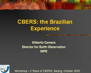
CBERS: the Brazilian Experience. Gilberto Camara. Director for Earth Observation. INPE ... Landsat TM images to evaluate deforestation in the Brazilian Amazon ...
| PowerPoint PPT presentation | free to download

Integration of Living Marine Resource and Oceanographic Satellite Data
| PowerPoint PPT presentation | free to view

What to run, what is the input, how to set parameters, what is ... setenv MOPEX_INSTALLATION /loca/mopex_032905. setenv SIRTF_JAVA ${MOPEX_INSTALLATION}/java ...
| PowerPoint PPT presentation | free to view

1 SAIC, contractor to U.S. Geological Survey (USGS) Center for Earth Resources ... Phone and email inquiries (issue resolution) Direct contact (conferences, ...
| PowerPoint PPT presentation | free to download

PRELIMINARY RESULTS FOR THE 0-1 HOUR MULTISENSOR PRECIPITATION NOWCASTER 6R.4 Shucai Guan and Feng Ding RS Information Systems/Hydrology Laboratory
| PowerPoint PPT presentation | free to view
Remote Sensing Applications
| PowerPoint PPT presentation | free to download

River Forecast Centers (RFC's) NCEP. Office of Climate, Water, and Weather Services (OCCWS) ... Office of Hydrologic Development ...
| PowerPoint PPT presentation | free to download

with a lot of helpful advice from. Caltech Astronomy (Djorgovski, Mahabal, ... ZEA, AIR, CYP, CAR, MER, CEA, COP, COD, COE, COO, BON, PCO, SFL, PAR, AIT, MOL, ...
| PowerPoint PPT presentation | free to view

Ten State MidAtlantic Cropland Data Layer Project
| PowerPoint PPT presentation | free to view

History of fingerprints. Human fingerprints have been ... In 1788, a detailed description of the anatomical formations of fingerprints was made by Mayer. ...
| PowerPoint PPT presentation | free to download
... to build the SWAT model for Guadalupe ... Create SWAT project. Delineate watershed (DEM, ... the SWAT input files. Setup and run SWAT. Water quality ...
| PowerPoint PPT presentation | free to download

map and Scan. pattern. Multimode interferometry: implementation. Page 8 ... Las Vegas. Geocoded phase ampl. Bn: 35 m. IS2. WSS: 14/3/03, IMS: 29/11/02. SRTM DEM ...
| PowerPoint PPT presentation | free to download

Flight Summary. No Extensions Finished. 18 days early. 28.0% 93. 27. 08/29 [09/15] 16/23 [06/15] ... of Days from start of flight to finish: IA and MN. Year ...
| PowerPoint PPT presentation | free to view
ECE 472/572 Digital Image Processing Lecture 2 Elements of Visual Perception and Image Formation 08/25/11 * Roadmap Introduction Image format (vector vs ...
| PowerPoint PPT presentation | free to download


Classification GEOG370 Instructor: Christine Erlien Overview Classification Reclassification Buffers Neighborhood functions, filters, & roving windows Classification ...
| PowerPoint PPT presentation | free to view

Initial investigation for deconvolution (EVLA Memo 101) ... Significant increase in code complexity= increase in development time ...
| PowerPoint PPT presentation | free to download

Homography between. image plane. plane at infinity. Navigation by the stars: Image of stars ... e.g. translation, homography, Fundamental matrix, etc. ...
| PowerPoint PPT presentation | free to view

BBS & CBC. 1970-1999. Birds. Modeling Method. Data Type ... for ugly or complicated models ... Inverting the habitat model to forecast range distribution ...
| PowerPoint PPT presentation | free to download

WFM 6202: Remote Sensing and GIS in Water Management [Part-B: Geographic Information System (GIS)] Lecture-8: Spatial Analysis Akm Saiful Islam Institute of Water and ...
| PowerPoint PPT presentation | free to view