
Mapping Aerial Camera PowerPoint PPT Presentations
All Time
Recommended

This new technology is changing the way construction businesses approach surveying, site analysis, and project management. aerial drone mapping Know More: https://www.falconsurveyme.com/our-services/aerial-mapping/
| PowerPoint PPT presentation | free to download

The Phase One P3 Payload is an integrated plug-and-play solution for the DJI M300 drone. It is designed to maximize the productivity of the most demanding inspection projects where time, safety, and image details are paramount for success. P3 Payload for DJI M300 leverages the DJI ecosystem for mission planning and execution to provide a flexible solution with the highest quality imagery.
| PowerPoint PPT presentation | free to download

Drone mapping services have transformed the landscape of surveying and mapping, offering unparalleled precision, efficiency, and cost-effectiveness. As these technologies continue to advance, we can expect even more accurate data collection, faster processing times, and expanded applications.
| PowerPoint PPT presentation | free to download

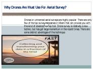
As the popularity of aerial drone cameras continues to rise, professional drone pilots. Source: http://www.wildrabbitaerial.com. Information shared above is the personal opinion of the author and not affiliated with the website.
| PowerPoint PPT presentation | free to download

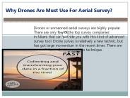
Aerial mapping drones have a variety of applications in the mapping and land surveying industries. They are used to assist surveyors in quickly, easily, and affordably mapping big areas. The purpose of deploying drones is to improve processes and minimize time-consuming manual mapping and surveying. For more information about our Aerial mapping services please visit: https://www.falcon3dme.com/drone-inspection-services.html
| PowerPoint PPT presentation | free to download

... Mapping from Large Scale Aerial Photography. Ron Berg ... Economical if 'in-stock' Low resolution (1-100m) Aerial photography. Small or large projects ...
| PowerPoint PPT presentation | free to view

Digital Aerial Imaging Systems: Current Activities and Issues Current Aerial Mapping Sensor Test and Evaluation Activities and Results American Society for ...
| PowerPoint PPT presentation | free to download

Gremsy Pixy U comes with multi-camera support. A comprehensive solution for the purpose of aerial surveying, inspection, mapping and many other applications for drone applications!
| PowerPoint PPT presentation | free to download
Our iXM cameras, which are designed specifically for UAVs, are quick, incredibly responsive, robust, and easy to integrate with your aerial photography drone for a variety of inspection and mapping missions. iXM cameras are available with a variety of RSM lenses for the Phase One P3 Payload's best image quality and performance.
| PowerPoint PPT presentation | free to download

We seek to deliver cost effective results for farmers, vineyard and golf courses owners. We can map hundreds of acres quickly and accurately for general crop monitoring and farm planning using aerial NDVI and RGB cameras. For more details please visit at https://www.highexposure.com.au/aerial-photography-for-aerial-mapping/agriculture/
| PowerPoint PPT presentation | free to download

Gremsy Pixy U and gremsy Pixy F are new age camera gimbals for aerial videography, mapping accuracy; and offer longer flight times for drone and UAVs during aerial photography. Just visit the link: https://bit.ly/2Zfg0Ud
| PowerPoint PPT presentation | free to download

Discover the best high resolution aerial imagery of the UK with GetMapping.co.uk. Explore stunning visuals for mapping and analysis purposes.
| PowerPoint PPT presentation | free to download

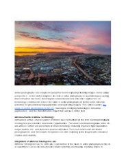
Aerial imaging is the process of capturing images of ground surfaces with the help of cameras attached to vehicles, such as helicopters, parachutes, aircraft, kites, unmanned aerial vehicles (UAVs), balloons, vehicle-mounted poles, and airships. Aerial imaging helps in risk mitigation, resource planning, mapping, research and excavation, security and surveillance, urban planning, engineering, farming management, tourism, and others.
| PowerPoint PPT presentation | free to download
Discover high-quality aerial photography services in the UK with Getmapping. Our innovative geospatial solutions offer scalable options for mapping, data hosting, online delivery, and web-based GIS. Trust our portfolio of value-added products to meet your specific needs and enhance your projects.
| PowerPoint PPT presentation | free to download

The Farm Service Agency's. National Agricultural. Imagery Program (NAIP) ... Direct Digital 35mm Cameras. Aerial Mapping Cameras (1:40,000 QQC) Satellite Imagery ...
| PowerPoint PPT presentation | free to download

Discover the best high resolution aerial imagery of the UK with GetMapping.co.uk. Explore stunning visuals for mapping and analysis purposes.
| PowerPoint PPT presentation | free to download

The final product of drone mapping or aerial surveying in construction is a map. The two most prevalent ways of mapping with drones are photogrammetry and laser ranging (LiDAR). Using either way, you'll get a different kind of map and you'll need specialised tools to analyse the data.
| PowerPoint PPT presentation | free to download

We offer licensed surveys include 3D tampa mapping, aggregate & stockpile volume measurement in Miami, East & West Coast at Florida Aerial Survey Technologies
| PowerPoint PPT presentation | free to download

Dortmunds Experten für unbemannte Luftfahrt Sie möchten Ihre Projekte durch neue Perspektiven auf ein bisher ungeahntes Niveau bringen? Wir von Drone-Experts unterstützen Sie auf vielfältige Weise in Ihren Vorhaben.
| PowerPoint PPT presentation | free to download
If you want drone mapping services, rely on Agri Drone Specialists! We also offer drone seeding services to help farmers or landowners with precision agricultural solutions. Contact us at 027 323 8155 or visit https://www.agridronespecialists.co.nz/
| PowerPoint PPT presentation | free to download

Colour Aerial imagery Perth (combination of Red, Green and Blue) is what we are accustomed to seeing with our own eyes.
| PowerPoint PPT presentation | free to download
We offer licensed surveys include 3D tampa mapping, aggregate & stockpile volume measurement in Miami, East & West Coast at Florida Aerial Survey Technologies
| PowerPoint PPT presentation | free to download
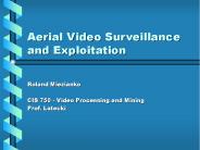
Aerial Video Surveillance and Exploitation ... 2 Camera must scan the region of interest to get the full-picture Objects of interest move in and out of ...
| PowerPoint PPT presentation | free to download

The accuracy of aerial drone surveying is significantly influenced by the performance and kind of drone, the quality of its components, the camera resolution, the height at which the drone flies, the vegetation, and the method and technology used to geolocate the aerial photos. With a high-end surveying drone, absolute precision may now be achieved under ideal conditions.
| PowerPoint PPT presentation | free to download

Future Market Insights has recently published a market research report on Global Smart Camera market. The study presents a detailed analysis on the historical data, current and future market scenario for the Smart Camera market.
| PowerPoint PPT presentation | free to download

Oman being one of the leading countries in GCC is advancing in technology at a quick pace and to be a part of this technology improvement, R&D at Customized Drones™ is contributing in the advancement of the technology and will be launching mapping drones in Oman soon.
| PowerPoint PPT presentation | free to download

In the realm of agriculture, large-scale farming poses unique challenges. Managing extensive tracts of land, monitoring crops, and optimizing resources is no small feat. Enter drone mapping services—a groundbreaking technology reshaping large-scale farming. Here’s how drones are revolutionising the industry. Read more :-https://www.agridronespecialists.co.nz/drone-mapping/
| PowerPoint PPT presentation | free to download

One of the most exciting areas of development for drones is in the field of drone services. Drone services encompass a wide range of applications that leverage the unique capabilities of drones to provide fast, efficient and cost-effective solutions to a variety of challenges.
| PowerPoint PPT presentation | free to download

Explore the vast collection of Indshine’s ariel maps. Indshine offers access to updated ariel maps to reduce field inspections with a better resolution than satellite maps. Indshine is one of the recognized ariel maps services provider that offers orthographic ariel maps across numerous industries.
| PowerPoint PPT presentation | free to download

The aerial imaging market refers to the use of aerial photography and remote sensing to capture images of the Earth's surface from an elevated position. It utilizes advanced imaging technologies such as digital cameras, LiDAR, and multispectral sensors mounted on aircraft, helicopters, or drones. Aerial imaging finds applications in various industries including agriculture, construction, real estate, and environmental monitoring.
| PowerPoint PPT presentation | free to download

With massive rise in the popularity of UAV’s or drones that are extensively used for precision of aerial photography but you can have unlimited fun while flying and strapping a camera to this object can bring some of the most stunning aerial images that you have ever come across. See more @ https://www.singaporeaerialphotography.com/
| PowerPoint PPT presentation | free to download

Factors that can contribute to their success or failure. Economic impact ... Paris Pike Reconstruction, KY (12 Miles) Aerial Photo Costs (3 Altitudes) $ 6,000 ...
| PowerPoint PPT presentation | free to view

ASPRS Photogrammetry - Part2 ... should continue to calibrate film mapping cameras using the present calibrator and the Simultaneous Multiframe Analytical ...
| PowerPoint PPT presentation | free to download
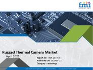
Future Market Insights (FMI) has published a new market research report on social employee recognition systems. The report has been titled, Global Rugged Thermal Camera Market: Global Industry Analysis,Forecast. Long-term contracts with large enterprises and private companies are likely to aid the expansion of business revenues, and innovation in the industry will enable social employee recognition system vendors to reach out to new potential customers in emerging markets. These factors are expected to help the global market for social employee recognition systems observe stellar growth in next few years.
| PowerPoint PPT presentation | free to download

Mapping Drones have become more and more common for those working in archeology and architecture professions, as it is a great source of efficiency for topographic survey. The topographic survey includes accurately mapping with the help of a drone/UAV the natural and man-made features of a particular piece of land. The goal is to represent the three-dimensional features of the terrain in a two-dimensional format, typically in the form of a topographic map.
| PowerPoint PPT presentation | free to download
Focusing on the Small Details, Seeing the Large Picture
| PowerPoint PPT presentation | free to download
Rajiv Vidya Mission (SSA) HYDERABAD
| PowerPoint PPT presentation | free to download

Contact us at 64 027 323 8155 or alex@agridronespecialists.co.nz to get our drone services for seeding, mapping, fertilisation, weed or crop spraying purposes! Our specialists can understand your requirements and customise drone services. More details visit https://www.agridronespecialists.co.nz/
| PowerPoint PPT presentation | free to download

LinkedAll Aerial Solutions is a DJI Authorized Dealer and Repair Center. We sell and service the entire DJI product line from Consumer to Enterprise applications. From drones for agricultural to public safety to Oil & Gas applications, we can help! Our team has the knowledge and expertise to help you choose the right product for your needs. Our DJI Repair technicians are trained by DJI to have the ability to diagnose and restore your drone to normal operating condition.
| PowerPoint PPT presentation | free to download

Heavy investment in R&D activities related to drone technology have fueled the use of innovative tools for the development of commercial drones. In addition, increase in demand for GIS (geographic information system), LiDAR (Light Detection and Ranging), aerial & mapping services across various industries is expected to boost the adoption of commercial drones. In addition, increased demand for aerial imaging market in developing economies and rapid penetration of high definition cameras present lucrative opportunities to the commercial drone market. The global Commercial Drones market was valued at $2,145 million in 2015, and is projected to reach $10,738 million by 2022, growing at a CAGR of 26.2% from 2016 to 2022. Download Sample PDF Copy@ https://www.alliedmarketresearch.com/request-sample/974
| PowerPoint PPT presentation | free to download
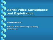
Aerial Video Surveillance and Exploitation Roland Miezianko CIS 750 - Video Processing and Mining Prof. Latecki Agenda Aerial Surveillance Comparisons Technical ...
| PowerPoint PPT presentation | free to download

Aerial photography is a method where in the images are clicked and taken from great heights. The cameras that are used to capture this type of shots are not supported on any tripod or stand but are taken handy or fitted on drones, helicopters, small airplanes or other devices. See more @ http://www.singaporeaerialphotography.com/
| PowerPoint PPT presentation | free to download
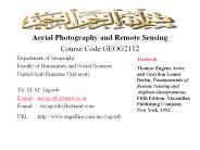
Course Code GEOG2112 Department of Geography Faculty of Humanities and Social Sciences United Arab Emirates University Dr. M. M. Yagoub E-mail: myagoub@uaeu.ac.ae
| PowerPoint PPT presentation | free to download
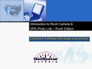
GPS-Photo Link Ricoh Edition Camera & Software that maps your photos The Problem More and more industries are using photographs to illustrate the data points they ...
| PowerPoint PPT presentation | free to download
The Global Aerial Imaging Market size is expected to reach $3.2 billion by 2023, rising at a market growth of 13% CAGR during the forecast period. Full report - http://kbvresearch.com/aerial-imaging-market/
| PowerPoint PPT presentation | free to download

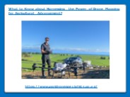
Do you know about the advancements in the agriculture landscape? Have you heard about drone mapping services? It is a cutting-edge technology for farmers to optimise their yields and minimize resource usage.
| PowerPoint PPT presentation | free to download

Mobile mapping services are an innovative technology that utilizes advanced mapping tools and sensors to collect and analyze data on the move.
| PowerPoint PPT presentation | free to download
Elements of Photogrammetry with Applications in GIS. McGraw-Hill. The End! Please fill out a lesson evaluation I have Gleim Learn to Fly booklets here, ...
| PowerPoint PPT presentation | free to download

Falcon 3D is one of the leading survey engineering companies in UAE. To track, map, survey, inspect, and manage your worksite projects, contact the Falcon 3D experts today.
| PowerPoint PPT presentation | free to download
Accurate surveying & professional land mapping services include topographical mapping, contour mapping progress mapping, volume calculation and elevation mapping.
| PowerPoint PPT presentation | free to download

Whipsmartmi.com describes potential business opportunities in the “Aerial Imaging Market”. The goal of the report is to estimate market, & future development
| PowerPoint PPT presentation | free to download

UAV Market by Point of Sale, Systems, Platform (Civil & Commercial, and Defense & Government), Function, End Use, Application, Type (Fixed Wing, Rotary Wing, Hybrid), Mode of Operation, Mtow, Range & Region - Global Forecast to 2027
| PowerPoint PPT presentation | free to download

Spatially Accurate Aerial Oblique Views
| PowerPoint PPT presentation | free to view
Thomas Eugene Avery and Graydon Lennis Berlin, Fundamentals of Remote Sensing ... 1969: Neil Armstrong and Buzz Aldrin became the first humans to walk on the Moon. ...
| PowerPoint PPT presentation | free to download

Advanced Mapping with Digital Sensors
| PowerPoint PPT presentation | free to view

Drones that master the art of data collection efficiently are now part of the current inspection standard. The use of unmanned aerial vehicles (UAVs) has prompted various businesses to adopt new methods. Please Visit: https://www.falcon3dme.com/drone-inspection-services.html
| PowerPoint PPT presentation | free to download