
Lcluc PowerPoint PPT Presentations
All Time
Recommended

Forest Cover Monitoring in Northeastern China. Guoqing Sun, ... Can we improve our knowledge of China's Northeastern forests using remote sensing resources? ...
| PowerPoint PPT presentation | free to view

NASA's Land Cover Land Use Change Program. NASA's Land Cover Land Use Change ... Land-Use and Land-Cover Change: Decadal-Scale Dynamics of Land Ownership, (Land ...
| PowerPoint PPT presentation | free to view

The NASA Direct Readout and LCLUC Program
| PowerPoint PPT presentation | free to view

The role of land-cover change in montane mainland SE Asia ... suitability. Location. factors: soil, access., topography, bioclimate, demography, socio-economic, ...
| PowerPoint PPT presentation | free to view

To develop a comprehensive, high-resolution database of recent and current land ... High resolution. watershed modeling. Ground truthing. LULC change. scenarios ...
| PowerPoint PPT presentation | free to view

The Role of LandCover Change in Montane Mainland Southeast Asia in Altering Regional Hydrological Pr
| PowerPoint PPT presentation | free to view

Post-USSR land cover change in Eastern Europe. socioeconomic forcings, effects on ... Saiga antelope. Brown Bear. Umbrella species. for biodiversity ...
| PowerPoint PPT presentation | free to download

How does climate variability affect the abundance of organisms? ... Are the organisms in communities fungible, e.g.: how stable are trophic webs at ...
| PowerPoint PPT presentation | free to download

Land Change Science
| PowerPoint PPT presentation | free to view

Classification for Integrated LandChange Science
| PowerPoint PPT presentation | free to view

NASA Earth Systems Science Fellowships (2) ... to develop detailed understanding and explanations of causes and consequences of ...
| PowerPoint PPT presentation | free to view

Calibration Status for Current Instruments and Plans for Future Instruments: ... Research Scanning Polarimeter, POLDER, MODIS, Sun Photometer network [EOSP] ...
| PowerPoint PPT presentation | free to download

Operational Monitoring of Alteration in Regional Forest Cover Using Multitemporal Remote Sensing Dat
| PowerPoint PPT presentation | free to view

1) 'Shifts' implies an observable baseline against which to ... the El Ni o/Southern Oscillation impact on the Northern Hemisphere annular mode. GRL 34:L101701 ...
| PowerPoint PPT presentation | free to download

... Student, TAMU Department of Biological & Agricultural ... Graduate Student, TAMU Department of Civil Engineering. Funding Sources: Presentation References ...
| PowerPoint PPT presentation | free to view

... WW W W W W W W W W W W W W W W W W W W W W W W W W W W W W W W ... 456789:CDEFGHIJSTUVWXYZcdefghijstuvwxyz GpSs tFTO ...
| PowerPoint PPT presentation | free to view

Earth System Data Records (ESDR) and Climate Data Records (CDR) Dave Siegel Crystal Schaaf Norm Nelson
| PowerPoint PPT presentation | free to download

Land Use Choices and Consequences: What Have We Learned and Future Challenges
| PowerPoint PPT presentation | free to download

Geographic proximity to Hong Kong. Cultural ties to overseas Chinese investors. China ... 3 March 1996 TM 432 Land-Use Change Map. water. natural vegetation ...
| PowerPoint PPT presentation | free to view

Burned area mapping in Southern Africa: Case Study Synthesis and Regional Application of MODIS data
| PowerPoint PPT presentation | free to view

LC Mapping and Modeling Group
| PowerPoint PPT presentation | free to view

Data Issues in the Miombo Network
| PowerPoint PPT presentation | free to view

Poster Presentation. Note: A fullsize (3'x4') poster was presented at the ... each part of the original poster being placed on a in this presentation. ...
| PowerPoint PPT presentation | free to view
Land Report Back Chris Justice
| PowerPoint PPT presentation | free to download

Partnership between USGS and NASA, in support of CCSP ... vegetation dynamics (disturbance, recovery, fragmentation, biome migration, etc) ...
| PowerPoint PPT presentation | free to view
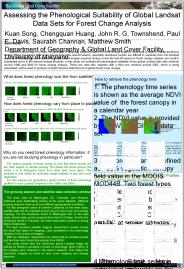
Vegetation phenology is a major consideration in acquiring satellite ... This makes the GeoCover imagery set ideal for land cover mapping and change detection. Hanoi ...
| PowerPoint PPT presentation | free to download

Yellow river used for irrigation. River ran dry in 1972. For 15 days ... Yellow River. India River Interlink Plan $200 billion plan. to bring water to south India ...
| PowerPoint PPT presentation | free to view

ArcMap Tool for Pre-processing SSURGO Soil Database for ArcSWAT Aleksey Sheshukov Prasad Daggupati Ming-Chieh Lee Kyle Douglas-Mankin Biological and Agricultural ...
| PowerPoint PPT presentation | free to download

coded and run using IDL. grows rubber and rice annually (active classes) from 1988 1999 ... landscape and class-level pattern metrics ...
| PowerPoint PPT presentation | free to view

Use of aerial photography, Landsat for interpreting change. Aerial Photo. Landsat Data ... Biomass C stock in forests; NPP; Wood growth. AL(1990), DE(1986), FL ...
| PowerPoint PPT presentation | free to view

Estimating and Monitoring Effects of Area Burned and Fire Severity on Carbon Cycling, Emissions, and
| PowerPoint PPT presentation | free to view

Land Cover and Land Use Change in Temperate East Asia: ... LSWI) will improve land cover characterization, e.g., phenology, classification. ...
| PowerPoint PPT presentation | free to view

ArcMap Tool for Pre-processing SSURGO Soil Database for ArcSWAT Aleksey Sheshukov Prasad Daggupati Ming-Chieh Lee Kyle Douglas-Mankin Biological and Agricultural ...
| PowerPoint PPT presentation | free to download

Global observation of forest cover and land-use dynamics (GOFC/GOLD) in Africa ... and research institutions in DRC, Malawi, Mozambique, Tanzania, Zambia and Zimbabwe. ...
| PowerPoint PPT presentation | free to view

NASA developing Earth Science Data Records (Science Quality Data) in support of ... Production system MODAPS augmented with a Land test system, ...
| PowerPoint PPT presentation | free to download
Breakout Session II Data Records and Related Observations: Land Time Series Data Products from Systematic Satellite Missions: Moderate Resolution -
| PowerPoint PPT presentation | free to download

Land Cover and Land Use Change in Amazonia
| PowerPoint PPT presentation | free to view
Using LandsatBased Continuous Fields Data for Land Cover Change Analysis
| PowerPoint PPT presentation | free to download

Miles of interstate highway. House income. House value. Ecological Section. State ... realizations of 1985 forest cover map. Third is the maximum likelihood map. ...
| PowerPoint PPT presentation | free to view
Data must include satellite sensor data products from multiple (at least two) satellite sensors, one of which must be on the Terra and/or Aqua platform, ...
| PowerPoint PPT presentation | free to download

Modeling Siberian Boreal Forest LandCover Change and Carbon under Changing Economic Paradigms
| PowerPoint PPT presentation | free to view

The Role of Land Cover Change in Montane Mainland Southeast Asia in Altering ... vulnerability in Xishuangbanna prefecture in southwestern China, Environmental ...
| PowerPoint PPT presentation | free to view

THE ROLE OF LANDCOVER CHANGE IN MONTANE MAINLAND SE ASIA IN ALTERING REGIONAL HYDROLOGICAL PROCESSES
| PowerPoint PPT presentation | free to view

In the Everglades is 420Mt Dry Matter. Scrub mangroves. 3D Mapping of Mangrove. in the Everglades and the Airborne Tour. Shark River (West Coast) ...
| PowerPoint PPT presentation | free to view

... system will utilize satellite remote sensing data, Geographic Information System ... Develop a PC-based GIS database to provide updated forest cover/land use maps, ...
| PowerPoint PPT presentation | free to view

Earth radiation budget (including solar irradiance), Upper-air temperature, Wind ... Fire. GPP and NPP. LAI and fPAR. Land Cover and Change. PAR and Incident ...
| PowerPoint PPT presentation | free to download

Will provide an opportunity for feedback from the user community on ... Vince Ambrosia, PI. Altair UAS Flight Line 10/28 pm & 10/29/06 am. #3. Esperanza. Fire ...
| PowerPoint PPT presentation | free to download

Collect and report information on status and trends of Nation's forested ... to measure trees on the ground, but 30-m pixel is tiny speck on Landsat image ...
| PowerPoint PPT presentation | free to view

Kazakhstan is the ninth largest country in the world and, after ... transformed 230,000 km2 of loess steppe in Northern Kazakhstan to cultivation of grains. ...
| PowerPoint PPT presentation | free to view

Terrestrial Ecology Program
| PowerPoint PPT presentation | free to download

Satella: Tool for Peer to Peer Landsat Data Sharing. Bruno Margerin (SSAI) ... Bruno Margerin: bruno@turbodog.gsfc.nasa.gov. John Owens: jowens@umd.edu ...
| PowerPoint PPT presentation | free to view

How can scientists share data easily ? we need a way let data users know - who has ... Success of Napster/Gnutella music file sharing networks illustrate people ...
| PowerPoint PPT presentation | free to view

Value Added Products from MODIS TimeSeries Data Sets to support DOIUSGS Invasive Species Management
| PowerPoint PPT presentation | free to download

Land-Use Change in Temperate East Asia: Land Cover Changes Impacts on Carbon ... to 2003 to characterize vegetation phenology, seasonal dynamics and inter-annual ...
| PowerPoint PPT presentation | free to view

Landsat Global Land Surveys: Status Update
| PowerPoint PPT presentation | free to view

4th Global Vegetation Workshop Defourny et al'
| PowerPoint PPT presentation | free to view