
Geospatial India PowerPoint PPT Presentations
All Time
Recommended

Explore top Geoinformatics colleges in India with our comprehensive guide. Discover accredited institutions offering cutting-edge programs in geospatial technology.
| PowerPoint PPT presentation | free to download

Learn Geospatial Technology at leading geoinformatics colleges in India. Make your career a success with cutting-edge education.
| PowerPoint PPT presentation | free to download
Understanding land measurement conversions is crucial for real estate transactions in India. This article covers key conversions like square feet to square meters, highlights their significance, and explains the importance of accurate measurements in land records. Dive into the essentials for informed property dealings.
| PowerPoint PPT presentation | free to download
Geospatial Intelligence - Challenges. AIMLEAP Outsourcebigdata is a Trusted Partner for Digital IT, #BIAnalytics, Automation & #DataManagement, #dataprocessing #Datamining #Dataenrichment #Datascraping.
| PowerPoint PPT presentation | free to download

Geospatial solutions collect, manage, organize, and store data pertaining to geographic information such as zip codes, addresses, or latitudinal and longitudinal coordinates to a location. This includes data accumulated by satellites, digital and analog maps, and street and aerial imagery. Some instances of geospatial solution technologies include Global Positioning Systems (GPS), Geographic Information Systems (GIS), imagery analysis, and remote sensing.
| PowerPoint PPT presentation | free to download

This report studies the global Geospatial Imagery Analytics market, analyzes and researches the Geospatial Imagery Analytics development status and forecast in United States, EU, Japan, China, India and Southeast Asia.
| PowerPoint PPT presentation | free to download

Global geospatial solutions market size is expected to reach $1009.56 Bn by 2028 at a rate of 15.9%, segmented as by solution type, hardware, software, service
| PowerPoint PPT presentation | free to download

Indian Remote Sensing Programme
| PowerPoint PPT presentation | free to view
Rajiv Vidya Mission (SSA) HYDERABAD
| PowerPoint PPT presentation | free to download

Discover how Geoinformatics in India is leading the way to address future challenges. Explore innovative solutions, technologies, and applications in this dynamic field.
| PowerPoint PPT presentation | free to download

According to a new report Global Geospatial Analytics Market (2016-2022), published by KBV Research, the global Geospatial Analytics Market is expected to attain a market size of $79.8 billion by 2022, growing at a CAGR of 18.0% during the forecast period. FULL REPORT: https://kbvresearch.com/news/global-geospatial-analytics-market/
| PowerPoint PPT presentation | free to download

Witness the largest gathering of the international geospatial community which culminates the value and power of GIS technology. Visit: http://www.aflexgis.com/aflexgis/ .
| PowerPoint PPT presentation | free to download

The global market for geospatial solutions is projected to grow at a compound annual growth rate (CAGR) of 13.8%, reaching a value of US$1,691.4 billion by the end of 2030, up from US$684.3 billion in 2023. The geospatial solution market, a dynamic sector in the technology industry, utilizes spatial data to provide valuable insights into location intelligence. Geospatial solutions leverage various technologies, including geographic information systems (GIS), global positioning systems (GPS), and remote sensing, to analyze and interpret spatial information. These solutions play a crucial role in different sectors by facilitating informed decision-making through the mapping and visualization of geographical data.
| PowerPoint PPT presentation | free to download

Discover the immense potential of an M.Sc in Data Science in India. Explore top programs and embark on a rewarding career in data-driven industries.
| PowerPoint PPT presentation | free to download

TBRC global geospatial analytics market report includes solutions, services, surface and field analytics, geovisualization.
| PowerPoint PPT presentation | free to download

Teems India is a Specialized High Voltage Transmission Line Construction, Installation, Erection and Stringing and GIS based company in Chennai, also we are the International Transmission Line Contractors for EPC and GIS Projects on Turnkey basis.
| PowerPoint PPT presentation | free to download
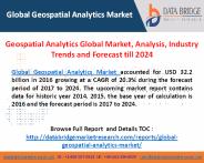
Global Geospatial Analytics Market, By Geography; Type (Surface Analytics, Network Analytics, Geovisualization); Technology (Remote Sensing, GPS, GIS); Application (Surveying, Medicine & Public Safety, Disaster Risk Reduction & Management, Climate Change Adaptation); Vertical – Industry Trends and Forecast to 2024
| PowerPoint PPT presentation | free to download

Geographic Information Systems (GIS) Courses in India by NIBT. Learn GIS from the best GIS Training providers. GIS (Geographic Information Systems) is a growing industry with job opportunities in over 70 fields all over the globe. NIBT is one of the few best providers of GIS Courses in India
| PowerPoint PPT presentation | free to download

The global geospatial solutions market size is expected to grow from $378.45 billion in 2021 to $444.32 billion in 2022 at a compound annual growth rate (CAGR) of 17.4%.
| PowerPoint PPT presentation | free to download

Rising use of AI and ML in geospatial analytics, increasing number of government projects, and rapid urbanization are some key factors driving market revenue growth
| PowerPoint PPT presentation | free to download

Explore premier courses fueling India's tech revolution in Machine Learning and Data Science for comprehensive skills and expertise.
| PowerPoint PPT presentation | free to download

TBRC global electrical safety personal protective equipment report includes head protection, eye and face protection, electrical, automotive... @ @ https://bit.ly/3FFVkJa
| PowerPoint PPT presentation | free to download

Discover the ultimate guide to becoming a data science pro in India. Navigate your career path with insights, tips, and strategies for success.
| PowerPoint PPT presentation | free to download

TBRC global geospatial imagery analytics market report includes agriculture, mining and manufacturing, defense and security, energy, insurance, other applications https://bit.ly/3yGxgTq
| PowerPoint PPT presentation | free to download

The Global Geospatial Analytics Market is expected to attain a market size of $79.8 billion by 2022, growing at a CAGR of 18.0% during the forecast period. Full report - https://kbvresearch.com/global-geospatial-analytics-market/
| PowerPoint PPT presentation | free to download

GEON: Networking Indian Geoscience Community through iGEON
| PowerPoint PPT presentation | free to view

Global Geospatial Market is expected to grow significantly as Geospatial Market has been valued at USD 75 billion by 2022 growing with 16.6% of CAGR during forecast period 2016 to 2022
| PowerPoint PPT presentation | free to download

Craig Knoblock. University of Southern California. 1 ... Craig Knoblock. University of Southern California. 7. Why isn't this just. No common schema ...
| PowerPoint PPT presentation | free to view

Global geospatial analytics market research report defines & describe, and forecast the global geospatial analytics market on the basis type, technology, application, by end-user and geography.Get full report details at https://www.inkwoodresearch.com/reports/geospatial-analytics-market-forecast-2017-2024 Or email us at sales@inkwoodresearch.com
| PowerPoint PPT presentation | free to download

CODI-GEO, SDI Seminar, Sept. 2001. Thank you to Rick Pearsall (FGDC) for ... Liz Gavin, Elmi Noppe, Antony Cooper, ISO TC211 Standards in Action Workshop, ...
| PowerPoint PPT presentation | free to view

Application of Geospatial technology in MGNREGS Financial Implications State Level GIS Unit Rs. 5 crore (Initial) and Rs. 1 Crore Recurring Cost Per annum.
| PowerPoint PPT presentation | free to view

The use of Bentley applications will enable Dholera to meet green development standards, such as the LEED gold trademark of excellence. Using 3D digital engineering models to ensure maximum value across the lifecycle of the project is at the forefront of AECOM’s long-term vision.
| PowerPoint PPT presentation | free to download

IR Softwares. Features and Functionality. DSpace presence in India ... IR Softwares. ARNO - Tilburg University, The Netherlands. CDSware - CERN, Geneva, Switzerland ...
| PowerPoint PPT presentation | free to view

Title: Discovery of software systems for composition and their customizability in free and open source geospatial software environments A Case Study
| PowerPoint PPT presentation | free to download

The global geospatial imagery analytics market size is projected to reach USD 16 billion by 2025.
| PowerPoint PPT presentation | free to download

AUSTRALIA. CANADA. FRANCE. UK. MEXICO. ANGOLA. NIGER. USA ... Mumbai Free Map. San Francisco Indyvoters. Civic Mapping. for ordinary people. 23. pathmaking: ...
| PowerPoint PPT presentation | free to view

Access to and Use of Publicly- Funded Geospatial Data for Health and ... American Dialogue Conference held in Buenos Aires, Argentina 11-12 December 2002. ...
| PowerPoint PPT presentation | free to view

Lepton Software is a Premier Google Maps partner in India, Middle East and Singapore who has supported 500+ companies in their growth journey since its inception. Lepton is leader in Location Analytics, Map Data and Geospatial consulting practise across multiple business verticals such as Telecom, FMCG, Logistics & Transportation, Govt, Retail, IT and Automotive etc.Read More:-https://www.leptonsoftware.com/
| PowerPoint PPT presentation | free to download

Global datafication market size is expected to reach $636.07 Bn by 2028 at a rate of 12.8%, segmented as by type, behavioral datafication, social datafication, geospatial datafication, transactional datafication, sensor datafication
| PowerPoint PPT presentation | free to download

Enrolling in a GIS course in India offers a unique advantage. Gain hands-on experience applying GIS technologies to local geography, socio-economics, and the environment.
| PowerPoint PPT presentation | free to download

Any country’s economic growth and development mainly depend on whether its agricultural sector can fulfil the needs of many or not. India is currently the largest producer of milk, pulses and jute and the second largest producer of rice, wheat, cotton, fruits and vegetables, being the largest exporter of agricultural goods India clocked around 46.9 billion dollars in revenue which is expected to grow further in coming years. But that was not the scenario after independence when the British left India.
| PowerPoint PPT presentation | free to download

In this ppt, you will learn about how Industries worldwide are progressively going towards data science because of its extraordinary potential. Let us read this informative article written by the scientists of the best data science company in India further-
| PowerPoint PPT presentation | free to download
The Global Geospatial Solutions Market size is expected to reach $549.1 billion by 2025, rising at a market growth of 15.6% CAGR during the forecast period. A broad variety of factors drive the geospatial solutions industry, including advances in geospatial technologies with the advent of artificial intelligence and big data analytics. The inclusion of geospatial systems with conventional processes is another consideration that speeds up market growth. On the contrary, regulations and legal problems were discovered to impede the development pace of the industry. Full Report: https://www.kbvresearch.com/geospatial-solutions-market/
| PowerPoint PPT presentation | free to download

Good Morning to one and all Special Welcome to Guests from Canada Collaboration under India-Canada Global Mining Initiative Presentation of Indian School of Mines ...
| PowerPoint PPT presentation | free to view

Mastering data labeling is pivotal for achieving unparalleled performance in AI model training. Here, we delve into the top 10 data labeling tips that can catapult your AI model performance to unparalleled heights. Collaborating with expert data labeling companies, such as EnFuse Solutions India, can further streamline the labeling process and ensure high-quality annotated datasets.
| PowerPoint PPT presentation | free to download
USING GIS FOR ENDANGERED SPECIES ANALYSIS USING GIS FOR ENDANGERED SPECIES ANALYSIS Federal TES (threatened and endangered species) in Indiana Need for Analysis Data ...
| PowerPoint PPT presentation | free to download

Join the best Data Science online Training course at eonlinetraining.co, Hyderabad, India at at affordable charges and become data scientist
| PowerPoint PPT presentation | free to download

Join the best Data Science online Training course at eonlinetraining.co, Hyderabad, India at at affordable charges and become data scientist
| PowerPoint PPT presentation | free to download

Real estate. Geospatial. Education. Student Recruiting ... Prudential, British Airways, Citibank, Standard Chartered, HSBC, BT...
| PowerPoint PPT presentation | free to view

Bangalore India. January 31st 2004. 5. What is Global Map? Digital geographic dataset of ... Bangalore India. January 31st 2004. 6. Philosophy of Global Map ...
| PowerPoint PPT presentation | free to view

The Mobile Mapping market refers to the sector within the geospatial industry that involves the collection, processing, and analysis of geographic data using mobile devices, such as smartphones, tablets, and specialized mapping vehicles equipped with various sensors and technologies. Mobile mapping solutions enable the creation of accurate and up-to-date digital representations of the physical environment, including landscapes, infrastructure, and urban areas. Click here: https://www.htfmarketintelligence.com/report/global-mobile-mapping-market
| PowerPoint PPT presentation | free to download

Emergency Management Market and Incident Management Market categories the Global Market by Web-EOC, Geospatial, ENS, Surveillance, CBRNE, HAZMAT, BCDR, DBMS, Warning Systems, Monitoring, Phones, Gateways, First Responders, Radars, Market Forecast & Analysis.
| PowerPoint PPT presentation | free to download

Joint Statement of US President George Bush and Indian Prime Minister Dr. Man ... Pigeon pea genomics using EST,QTL, BAC library jointly with UC, Davis ...
| PowerPoint PPT presentation | free to view